Raamsdonk
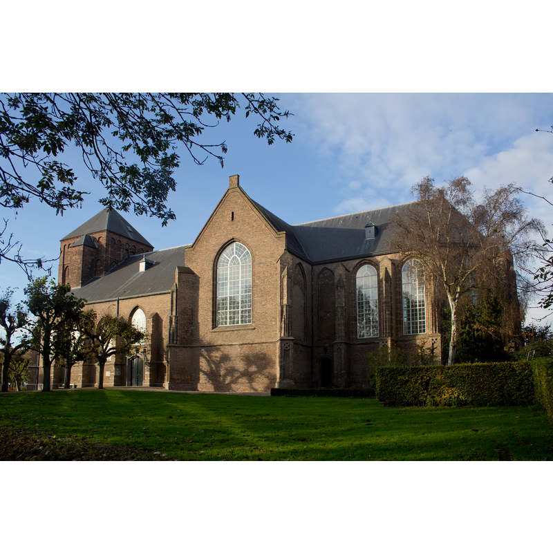
Image copyright © Johan Bakker, 2014
CC-BY-SA-4.0
Results: 3 records
view of church exterior - southeast view
Scene Description: Source caption: " Lambertuskerk, Raamsdonk"
Copyright Statement: Image copyright © Johan Bakker, 2014
Image Source: digital photograph 9 November 2014 by Johan Bakker [https://commons.wikimedia.org/wiki/File:32279_Lambertuskerk_Raamsdonk.jpg] [accessed 26 December 2021]
Copyright Instructions: CC-BY-SA-4.0
view of church interior - looking east
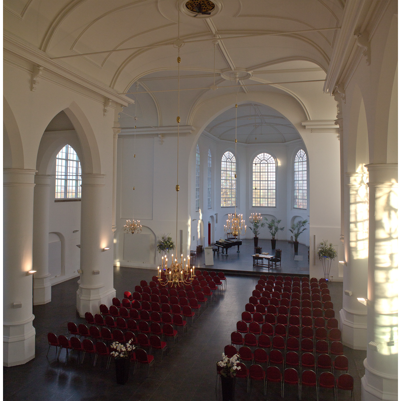
Scene Description: Source caption: "Lambertuskerk, Kerklaan 4, 4944 VB, Raamsdonk"
Copyright Statement: Image copyright © Johan Bakker, 2017
Image Source: digital photograph 26 November 2017 by Johan Bakker [https://commons.wikimedia.org/wiki/File:Raamsdonk_-_Interieur_Lambertuskerk.jpg] [accessed 26 December 2021]
Copyright Instructions: CC-BY-SA-4.0
view of base - lower base
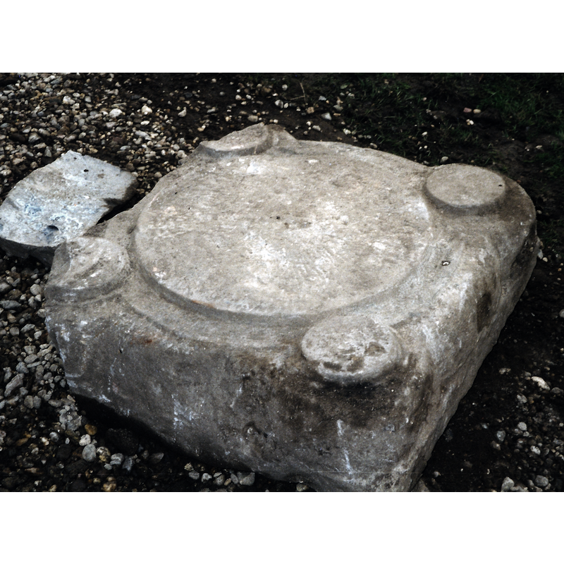
Copyright Statement: Image copyright © Jan van Gils, 2021
Image Source: digital photograph by Jan van Gils, voorzitter Lambertuskerk Raamsdonk [
Copyright Instructions: No known copyright restriction / Fair Dealing
INFORMATION
Font ID: 23627RAA
Object Type: Baptismal Font2, fragment
Font Century and Period/Style: 13th century (early?) [lower base only], Medieval [composite]
Church / Chapel Name: Hervormde Kerk Sint Lambertuskerk
Font Location in Church: [cf. FontNotes]
Church Patron Saint(s): St. Lambert of Maastricht[aka Lambaert, Lambertus, Lambrecht, Landebertus]
Church Notes: original church 1273 but there are claims of an earlier ca. 1150 church here; modified 1275-1300; tower added 1350; modified 15th, 16thC -- listed church [Rijksmonument no. 32279]
Church Address: Kerklaan 4, 4944 VD Raamsdonk, Netherlands -- Tel.: +31 162 515 286
Site Location: Noord-Brabant, Netherlands, Europe
Directions to Site: Located off (N) the A59, E of the A27, NE of Breda, SE of Dordrecht
Additional Comments: fragment of a font (only the lower base has survived)
Font Notes:
Click to view
A lower base of a baptismal font of Tournai or Mosan design survives here, reinforcing the claims of those who think a Romanesque church existed prior to 1273; the font that would fit this surviving base would consist of a broad pedestal base with four outer colonnettes supporting either a square basin or a round basin with four heads at 90-degree angles.
Credit and Acknowledgements: We are grateful to Pol Herman for bringing this font to our attention and for his help in documenting it
COORDINATES
UTM: 31U 631655 5728715
Latitude & Longitude (Decimal): 51.693928, 4.904881
Latitude & Longitude (DMS): 51° 41′ 38.14″ N, 4° 54′ 17.57″ E