Windesheim
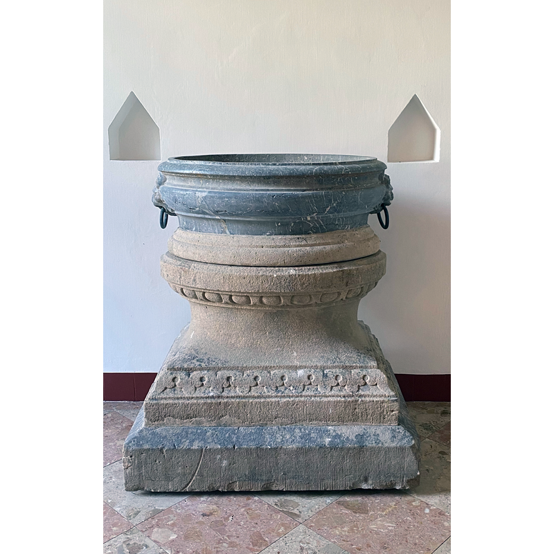
Image copyright © Landgoed Windesheim, 2021
No known copyright restriction / Fair Dealing
Results: 2 records
view of font
Scene Description: was it originally a font?
Copyright Statement: Image copyright © Landgoed Windesheim, 2021
Image Source: digital photograph in Landgoed Windesheim [https://landgoedwindesheim.nl/ontvangsten/] [accessed 26 December 2021]
Copyright Instructions: No known copyright restriction / Fair Dealing
view of context
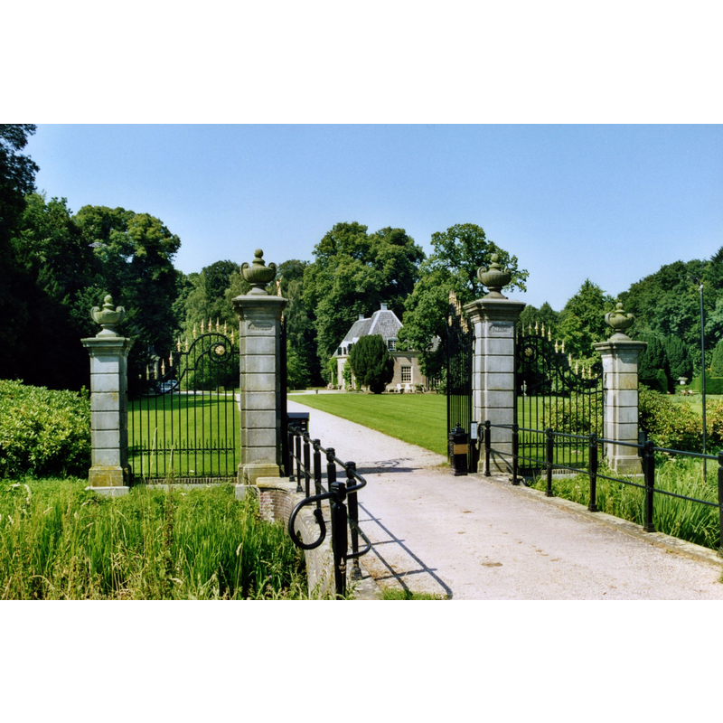
Scene Description: Source caption: " Het hek van 't huis te Windesheim."
Copyright Statement: Image copyright © Kasteelbeer, 2010
Image Source: digital photograph 15 October 2010 by Kasteelbeer [https://commons.wikimedia.org/wiki/File:Windesheim-hek.jpg] [accessed 26 December 2021]
Copyright Instructions: CC-BY-SA-3.0-NL
INFORMATION
Font ID: 23626WIN
Object Type: Baptismal Font1?
Church / Chapel Name: [unknown]
Font Location in Church: in the Windesheim estate [cf. FontNotes]
Church Notes: listed item [Rijksmonument no. 529125]
Church Address: [address & coordinates for the mansion housing the object] Windesheimerweg 2, 8015 PR Zwolle, Netherlands
Site Location: Overijssel, Netherlands, Europe
Directions to Site: The Windesheim estate is located W of the N337, 7-8 km S of Zwolle, just E of the county border with Gelderland
Font Notes:
Click to view
The entry for this item in Monumenten.nl [https://www.monumenten.nl/monument/529125] [accessed 26 December 2021] notes: baptismal font of oval shape made of veined marble in the 17th century, decorated with lion heads/masks with metal rings; used as planter and raised on a modern base or plinth. A communication to BSI (e-mail of 13 December 2021) from Pol Herman added: font in the Huis te Windesheim; the total surface area of the Windesheim estate today covers approximately 660 hectares, of which approximately 20% consists of forests and nature and the remaining cultivated land with farms is leased to farmers. Recently brought inside the eastern house (former carriage house) to prevent weather damage. [NB: it would be debatable that this obiect was originally made as a font].
Credit and Acknowledgements: We are grateful to Pol Herman for bringing this font to our attention and for his help in documenting it
COORDINATES
UTM: 32U 304657 5814555
Latitude & Longitude (Decimal): 52.446212, 6.125557
Latitude & Longitude (DMS): 52° 26′ 46.36″ N, 6° 7′ 32″ E