Reuver
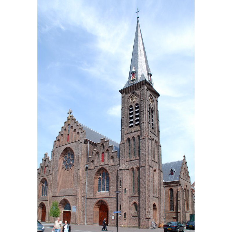
Image copyright © Joris, 2009
CC-BY-SA-3.0
Results: 3 records
view of church exterior - southwest view
Scene Description: Source caption: "Lambertuskerk - Reuver, the Netherlands"
Copyright Statement: Image copyright © Joris, 2009
Image Source: digital photograph 9 May 2009 by Joris [https://commons.wikimedia.org/wiki/File:Lambertuskerk_Reuver.JPG] [accessed 26 December 2021]
Copyright Instructions: CC-BY-SA-3.0
view of church interior - looking east
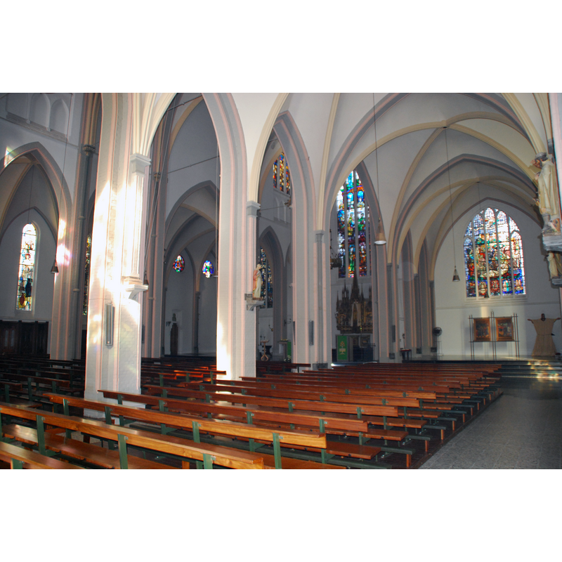
Scene Description: Source caption: "Sint-Lambertuskerk in Reuver, by Johannes Kayser."
Copyright Statement: Image copyright © Joris, 2010
Image Source: digital photograph 10 October 2010 by Joris [https://commons.wikimedia.org/wiki/File:Lambertuskerk_-_Reuver-2.JPG] [accessed 26 December 2021]
Copyright Instructions: GFDL / CC-BY-SA-3.0
view of font and cover in context

Copyright Statement: Image copyright © [s.n., s.d.]
Image Source: digital photograph [origin unknown] provided bt Pol Herman
Copyright Instructions: PERMISSION NOT AVAILABLE -- IMAGE NOT FOR PUBLIC USE
INFORMATION
Font ID: 23624REU
Object Type: Baptismal Font1
Font Century and Period/Style: 17th century
Church / Chapel Name: Rooms-katholieke Sint-Lambertuskerk
Font Location in Church: Inside the church
Church Patron Saint(s): St. Lambert of Maastricht[aka Lambaert, Lambertus, Lambrecht, Landebertus]
Church Notes: church of 1834 replaced an earlier chapel that collapsed in 1830; present church consecrated 1880; modified and extended 1907; restored 1923; bells stolen by German army; church bombed by Allied army; restored 1947-1957; restored 1997 -- listed church [Rijksmonument no. 8884]
Church Address: Karel Doormanlaan 2, 5953 LC Reuver, Netherlands
Site Location: Limburg, Netherlands, Europe
Directions to Site: Reuver is located between the A73 (E) and the river Maas (W), in the municipality of Beesel, between Roermond (S) and Venlo (N)
Font Notes:
Click to view
The entry for this church in the Rijksmonumenten [https://rijksmonumenten.nl/monument/8884/stlambertus/reuver/] [accessed 26 December 2021] reports a baptismal font made of blue limestone in the 17th century.
Credit and Acknowledgements: We are grateful to Pol Herman for bringing this font to our attention and for his help in documenting it
COORDINATES
UTM: 32U 296235 5685540
Latitude & Longitude (Decimal): 51.284689, 6.077911
Latitude & Longitude (DMS): 51° 17′ 4.88″ N, 6° 4′ 40.48″ E
MEDIUM AND MEASUREMENTS
Material: stone, limestone (black and blue) (Tournai marble)
Font Shape: round, mounted
Basin Interior Shape: round
Basin Exterior Shape: round
LID INFORMATION
Material: metal, brass
Apparatus: no