Rucphen
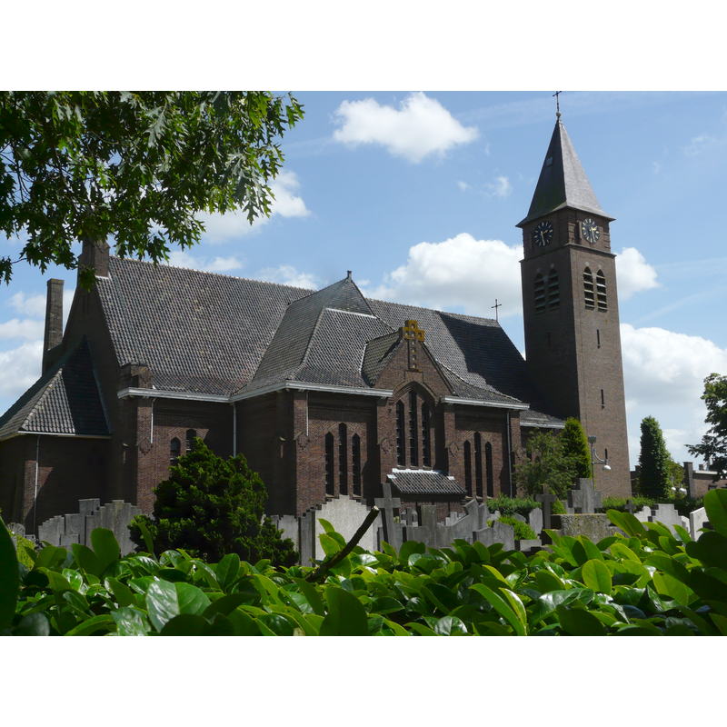
Image copyright © G. Lanting, 2011
GFDL / CC-BY-SA-3.0,2.5,2.0,1.0
Results: 2 records
view of church exterior - northeast view
Scene Description: Source caption: "Martinuskerk in Rucphen"
Copyright Statement: Image copyright © G. Lanting, 2011
Image Source: digital photograph 24 May 2011 by G. Lanting [https://commons.wikimedia.org/wiki/File:Martinuskerk_P1060918.JPG] [accessed 25 December 2021]
Copyright Instructions: GFDL / CC-BY-SA-3.0,2.5,2.0,1.0
view of church exterior - southwest end
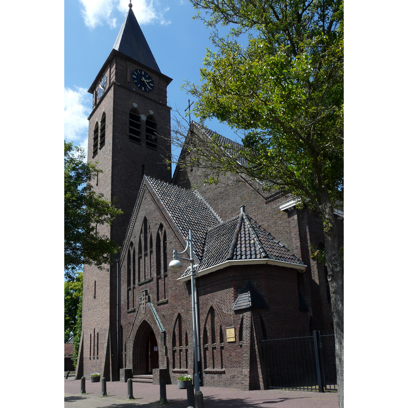
Scene Description: Source caption: "Martinuskerk in Rucphen"
Copyright Statement: Image copyright © G. Lanting, 2011
Image Source: digital photograph 24 May 2011 by G. Lanting [https://commons.wikimedia.org/wiki/File:Martinuskerk_P1060910.JPG] [accessed 25 December 2021]
Copyright Instructions: GFDL / CC-BY-SA-3.0,2.5,2.0,1.0
INFORMATION
Font ID: 23618RUC
Object Type: Baptismal Font1
Font Century and Period/Style: 16th century, Late Gothic? / Renaissance?
Church / Chapel Name: Rooms Katholieke Sint-Martinuskerk / H. Martinus Rucphen
Font Location in Church: [cf. FontNotes]
Church Patron Saint(s): St. Martin of Tours
Church Notes: first mention of a 'capella matutinalis' in Rucphen dates from 1432; became parochial 1442, "with a graveyard and baptismal font, and all other parochial rights and privileges"; re-buil larger in 1465; Lodewijkskerk was built in 1809; RC St. Martinuskerk was completed in 1933 but greatly damaged in WWII; restored with modifications -- listed church [Rijksmonument no. 517054]
Church Address: Raadhuisstraat 3, 4715 CB, Rucphen, Netherlands
Site Location: Noord-Brabant, Netherlands, Europe
Directions to Site: Located off the N638, S of the A58, 6 km E of Roosendaal, about 40 km NNE of Antwerp
Additional Comments: destroyed font? (in WWII [cf. ChurchNotes and FontNotes])
Font Notes:
Click to view
The Preliminary list of Dutch monuments of history and art. Volume X. The Province of North Brabant, Algemeene Landsdrukkerij, The Hague / A. Oosthoek, Utrecht 1931, reports a bluestone baptismal font (XV), the octagonal basin is decorated with four heads, but it cannot be found in the present church; it was probably destroyed during WWII, when the church was badly damaged.
Credit and Acknowledgements: We are grateful to Pol Herman for bringing this font to our attention and for his help in documenting it
COORDINATES
UTM: 31U 607996 5710228
Latitude & Longitude (Decimal): 51.53282, 4.55701
Latitude & Longitude (DMS): 51° 31′ 58.15″ N, 4° 33′ 25.24″ E
MEDIUM AND MEASUREMENTS
Material: stone, limestone (black and blue) (Tournai marble)
Font Shape: octagonal, mounted
Basin Interior Shape: round
Basin Exterior Shape: octagonal