Kesteren
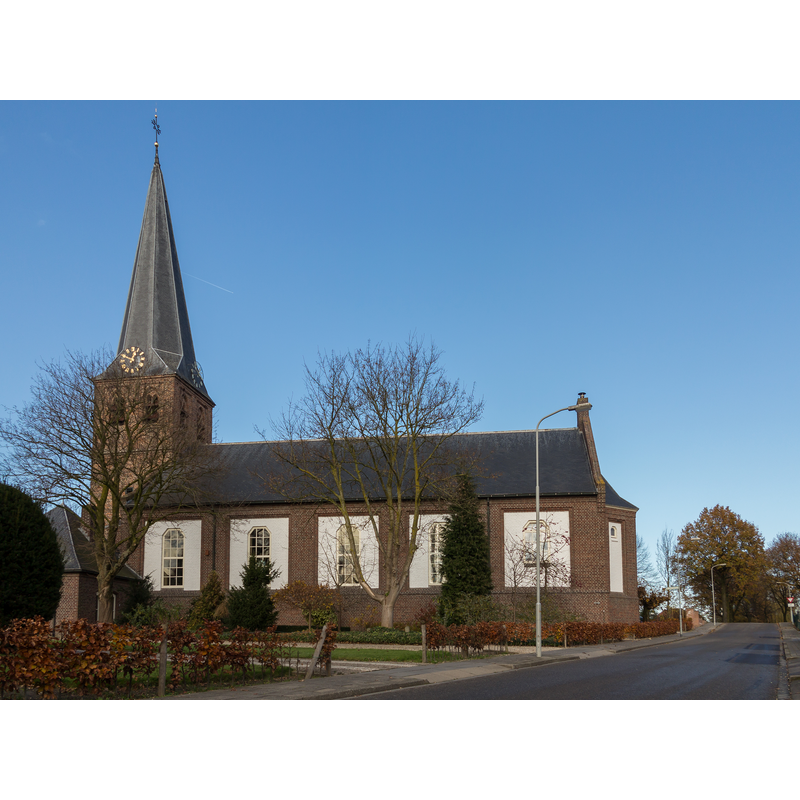
Image copyright © MichielverbeekNL, 2014
CC-BY-SA-3.0-NL
Results: 3 records
view of church exterior - south view
Scene Description: Source caption: "Kesteren, de Hervormde Kerk"
Copyright Statement: Image copyright © MichielverbeekNL, 2014
Image Source: digital photograph 24 November 2014 by MichielverbeekNL [https://commons.wikimedia.org/wiki/File:Kesteren,_de_Hervormde_Kerk_RM23651_foto4_2014-11-24_12.45.jpg] [accessed 5 December 2021]
Copyright Instructions: CC-BY-SA-3.0-NL
view of church exterior in context - southeast view
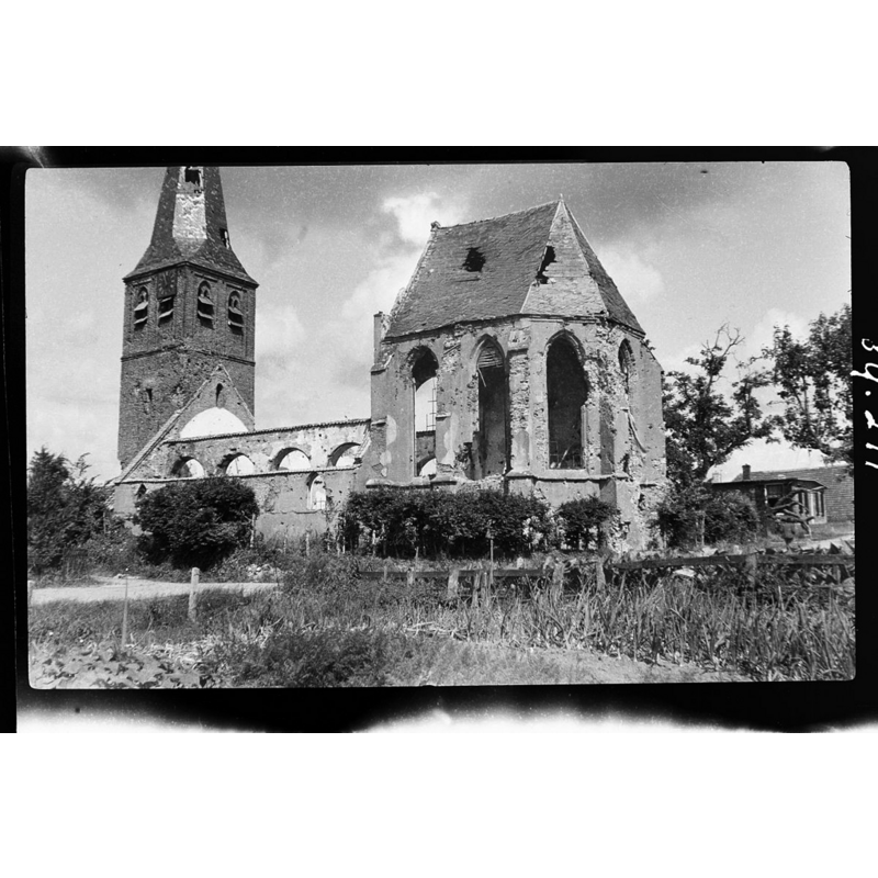
Scene Description: Source caption: "N.H.Kerk en Toren: exterieur" -- 14thC church destroyed in 1944 (WWII)
Copyright Statement: Image copyright © Rijksdienst voor het Cultureel Erfgoed, 2021
Image Source: digital image of an August 1946 B&W photograph in the Rijksdienst voor het Cultureel Erfgoed
[https://commons.wikimedia.org/wiki/File:Exterieur_-_Kesteren_-_20124957_-_RCE.jpg] [accessed 5 December 2021]
Copyright Instructions: CC-BY-SA-4.0
view of church interior - looking west
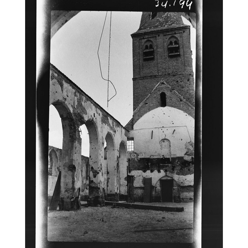
Scene Description: Source caption: "N.H.Kerk en Toren: interieur naar het noord-westen" -- 14thC church destroyed in 1944 (WWII)
Copyright Statement: Image copyright © Rijksdienst voor het Cultureel Erfgoed, 2021
Image Source: digital image of a 1955 B&W photograph by C.L. Temminck Groll, in the Rijksdienst voor het Cultureel Erfgoed
[https://commons.wikimedia.org/wiki/File:Interieur_naar_het_noord-westen_-_Kesteren_-_20124962_-_RCE.jpg] [accessed 5 December 2021]
Copyright Instructions: CC-BY-SA-4.0
INFORMATION
Font ID: 23579KES
Object Type: Baptismal Font1, fragment
Font Century and Period/Style: 14th century, Gothic
Church / Chapel Name: Hervormde Kerkelijke PKN Kesteren [new church]
Font Location in Church: [cf. FontNotes]
Church Notes: original church perhaps 13thC(?); 14thC church documented 1395 was destroyed in 1944 (WWII) -- listed [Rijksmonument 23652]
Church Address: Kerkstraat 4, 4041 XB Kesteren, Netherlands -- Tel.: +31 488 482 825
Site Location: Gelderland, Netherlands, Europe
Directions to Site: Located E of the N233, 8 km SW of Wageningen, in the municipality of Neder-Betuwe, 15 km NW of Nijmegen
Additional Comments: fragment of a font -- Pol Herman will try to get a photo of the survining head (5 Dec 2021)
Font Notes:
Click to view
The former head of a medieval (14th-century?) font was built into the wall above the north side entrance; it was later removed and is now in the tower [source: De Betuwe, R.F.P. de Beaufort en Herma M. van den Berg, Staatsuitgeverij, Den Haag 1968, page 300].
Credit and Acknowledgements: We are grateful to Pol Herman for his help in documenting this church and font
COORDINATES
UTM: 31U 676801 5756913
Latitude & Longitude (Decimal): 51.934811, 5.571842
Latitude & Longitude (DMS): 51° 56′ 5.32″ N, 5° 34′ 18.63″ E