Spijk / Spyke
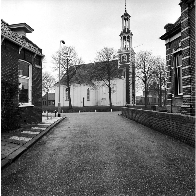
Image copyright © Rijksdienst voor het Cultureel Erfgoed, 2021
CC-BY-SA-4.0
Results: 6 records
view of church exterior in context - northwest view
Scene Description: Source caption: "Spaarbankweg/'t Loug"
Copyright Statement: Image copyright © Rijksdienst voor het Cultureel Erfgoed, 2021
Image Source: digital image of an April 1979 B&W photograph by A.J. van der Wal in the Rijksdienst voor het Cultureel Erfgoed [https://commons.wikimedia.org/wiki/File:'t_Loug_-_Spijk_-_20203206_-_RCE.jpg] [accessed 17 November 2021]
Copyright Instructions: CC-BY-SA-4.0
view of church exterior in context - south view
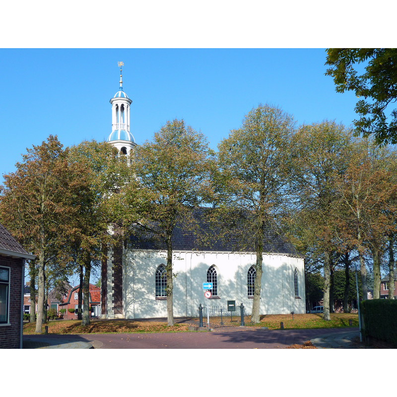
Scene Description: Source caption: "Hervormde kerk van het Groningse dorp Spijk uit 1676."
Copyright Statement: Image copyright © Hardscarf, 2010
Image Source: digital photograph 11 October 2010 by Hardscarf [https://commons.wikimedia.org/wiki/File:Spijk_-_kerk.jpg] [accessed 17 November 2021]
Copyright Instructions: CC-BY-SA-3.0
view of church interior - looking east
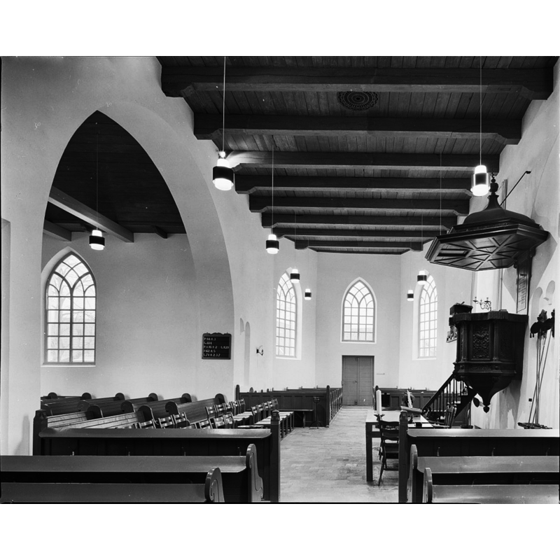
Scene Description: Source caption: "Nederlands Hervormde Kerk: interieur naar het oosten"
Copyright Statement: Image copyright © Rijksdienst voor het Cultureel Erfgoed, 2021
Image Source: digital image of an April 1979 B&W photograph by A.J. van der Wal in the Rijksdienst voor het Cultureel Erfgoed [https://commons.wikimedia.org/wiki/File:Interieur_naar_het_oosten_-_Spijk_-_20203230_-_RCE.jpg] [accessed 17 November 2021]
Copyright Instructions: CC-BY-SA-4.0
view of church interior - plan

Scene Description: the image at the top shows the location of the excavated plinth, just east of the waest tower
Copyright Statement: Image copyright © [Jakob B. Bronsema, 1996?]
Image Source: image supplied by Pol Herman [probably from Jakob B. Bronsema (1996)]
Copyright Instructions: PERMISSION NOT AVAILABLE -- IMAGE NOT FOR PUBLIC USE
view of plinth
Scene Description: the image at the bottom shows the excavated plinth
Copyright Statement: Image copyright © [Jakob B. Bronsema, 1996?]
Image Source: image supplied by Pol Herman [probably from Jakob B. Bronsema (1996)]
Copyright Instructions: PERMISSION NOT AVAILABLE -- IMAGE NOT FOR PUBLIC USE
view of plinth
Scene Description: the plinth excavated in the church restoraion in 1969-1970; it is suggested that it stood beneath a metal font [cf. FontNotes]
Copyright Statement: Image copyright © [Jakob B. Bronsema, 1996?]
Image Source: image supplied by Pol Herman [probably from Jakob B. Bronsema (1996)]
Copyright Instructions: PERMISSION NOT AVAILABLE -- IMAGE NOT FOR PUBLIC USE
INFORMATION
Font ID: 23546SPI
Object Type: Baptismal Font2, fragment
Cognate Fonts: similar plinth found at Feerwerd
Church / Chapel Name: Nederlands Hervormde Andreaskerk
Font Location in Church: [cf. FontNotes]
Church Patron Saint(s): St. Andrew
Church Notes: 13thC church; destroyed by fire and re-built late-17thC; restored 1969-1970 -- listed in Rijksmonumenten [Rijksmonument 9483]
Church Address: Andreaskerk, 't Loug 1, 9909 AA Spijk, Netherlands
Site Location: Groningen, Netherlands, Europe
Directions to Site: Located off (E) the N33 [aka Hogelandsterweg], in the municipality of Eemsdelta, about 10 km NNW of Delfzijl, about 30 km NE of Groningen
Additional Comments: disappeared font? (only the plinth of an earlier font was unearthed in the frounds of this church) -- disappeared font? (two: the one from the mid-13thC church and the later one of the 14th-15thC)
Font Notes:
Click to view
As was the case in the church at Feerwerd, a stone and brick plinth was unearthed in this church, as reported in Jakob B. Bronsema's De geschiedenis van de Nederlands Hervormde Andreaskerk te Spijk (Groningen) (1996) [NB: English-language text provided by Pol Herman]: "During the restoration in 1969-1970, various finds emerged that give a picture of the medieval church. Next to the foundations of the altar – equally distant from the north, south and west facades – a brick construction was found near the former entrances in both longitudinal facades. It is a remnant of a baptismal font plinth. The diameter of the structure is 2.20 m. It is partly still two bricks high, and is a bit messy. The recessed center is approx. 80 x 100 cm. Form and location characterize these types of finds as plinths for baptismal fonts. Such a find with an almost identical location was made in 1992 in the church of Feerwerd. Based on the height of the basement in relation to the floor heights, it can be noted that the pedestal does not date from the foundation time, plus minus 1225, of the church building. Partly in view of the level of the foundation of a side altar, the fourteenth or fifteenth century is considered a provisional date. The structures in the churches of Feerwerd and Spijk would not have carried a stone baptismal font, but a bronze one."
Credit and Acknowledgements: We are grateful to Pol Herman for bringing this font to our attention and for his help in documenting it
COORDINATES
UTM: 32U 356165 5917875
Latitude & Longitude (Decimal): 53.390347, 6.837039
Latitude & Longitude (DMS): 53° 23′ 25.25″ N, 6° 50′ 13.34″ E