Brouwershaven / Brouwesaeven
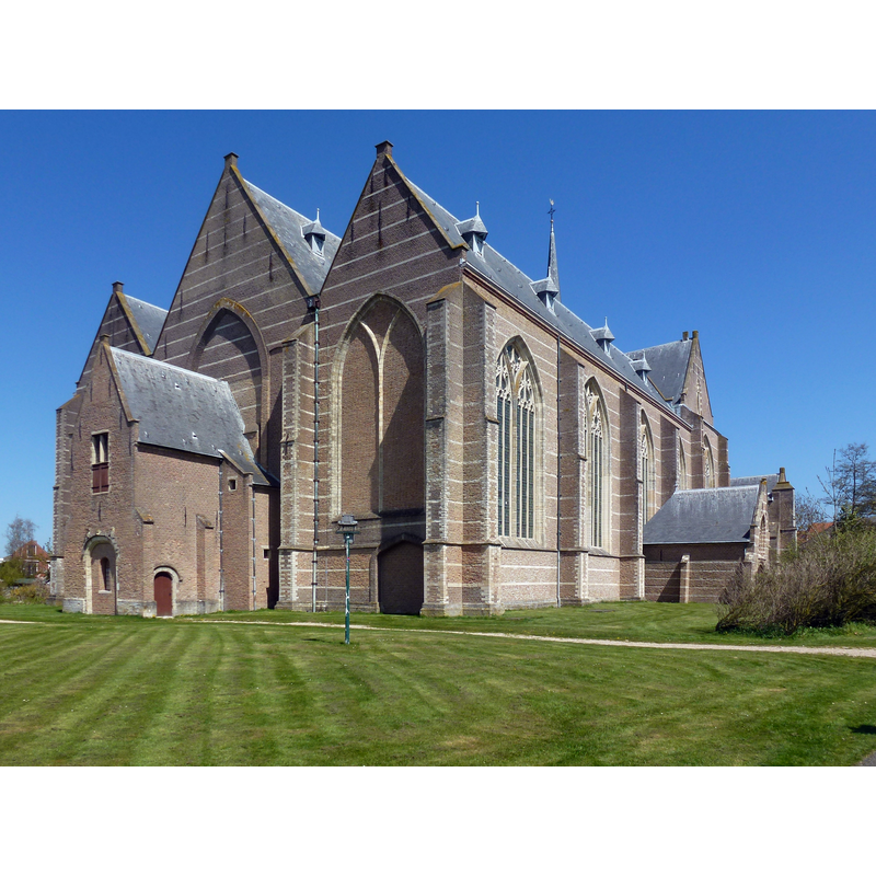
Image copyright © Rosemoon, 2013
CC-BY-SA-3.0
Results: 7 records
view of church exterior
Scene Description: Source caption: "Grote- of Sint-Nicolaaskerk, Brouwershaven"
Copyright Statement: Image copyright © Rosemoon, 2013
Image Source: digital photograph 4 May 2013 by Rosemoon [https://commons.wikimedia.org/wiki/File:RM11122_Grote-_of_Sint-Nicolaaskerk,_Brouwershaven_(4).JPG] [accessed 8 November 2021]
Copyright Instructions: CC-BY-SA-3.0
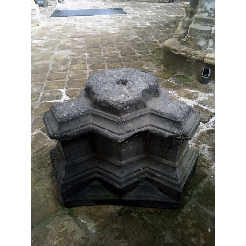
view of base in context
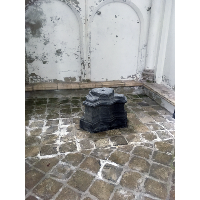
Copyright Statement: Image copyright © J.H. (Huib) Tieleman, 2022
Image Source: digital photograph 6 June 2022 by J.H. (Huib) Tieleman
Copyright Instructions: Image received from the author via Pol Herman (e-mail of 6 June 2022)
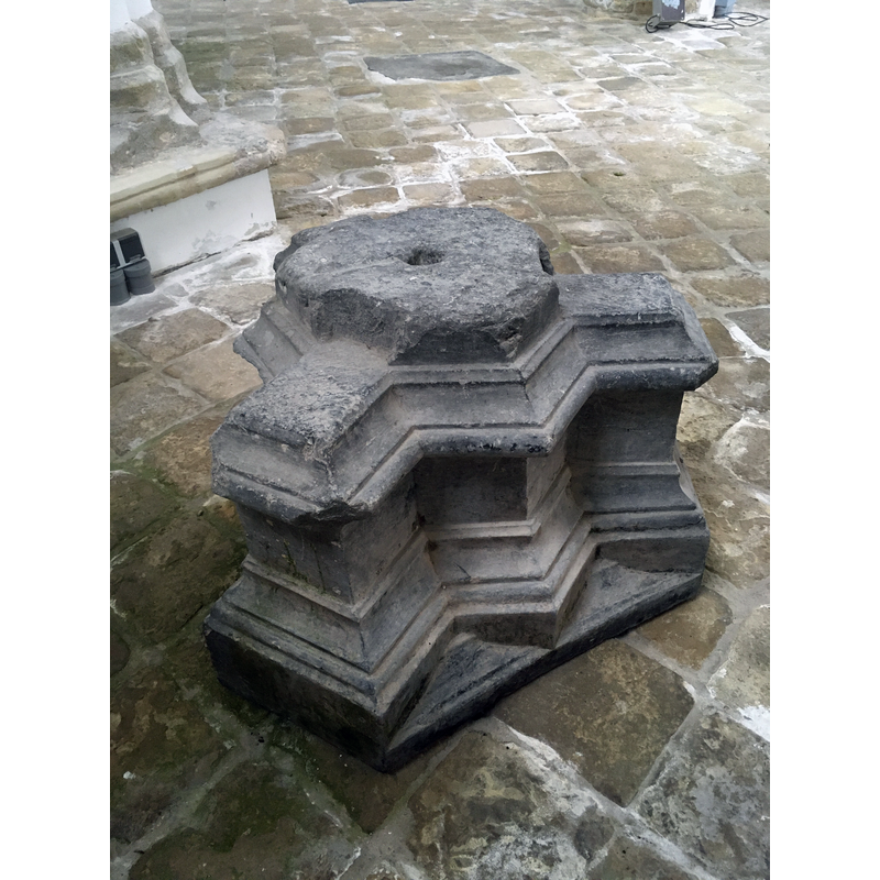
view of base
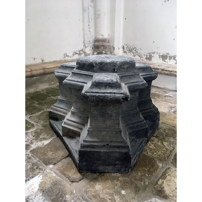
Copyright Statement: Image copyright © J.H. (Huib) Tieleman, 2022
Image Source: digital photograph 6 June 2022 by J.H. (Huib) Tieleman
Copyright Instructions: Image received from the author via Pol Herman (e-mail of 6 June 2022)
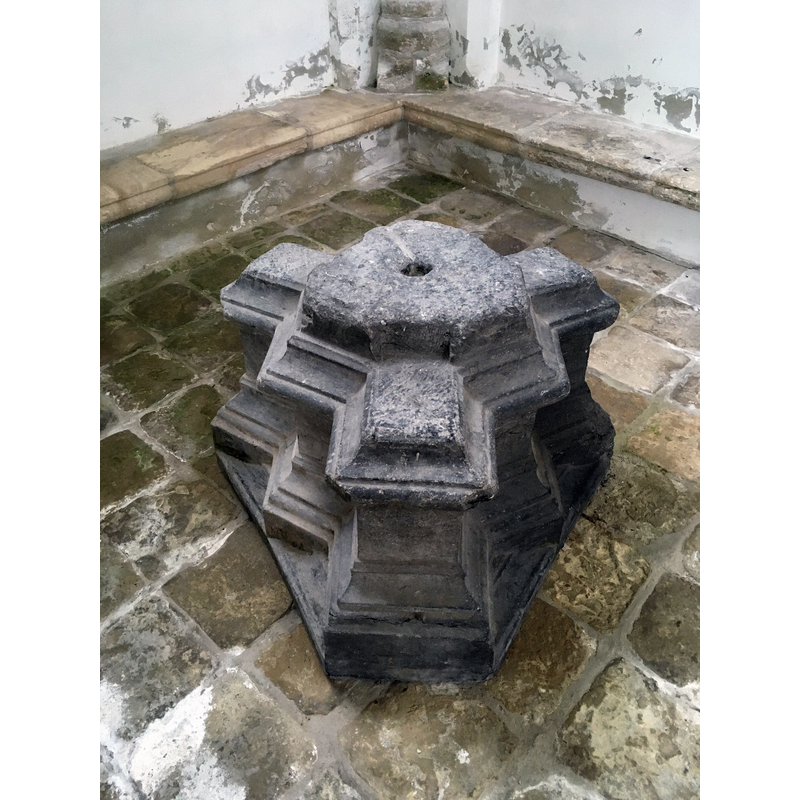
view of base
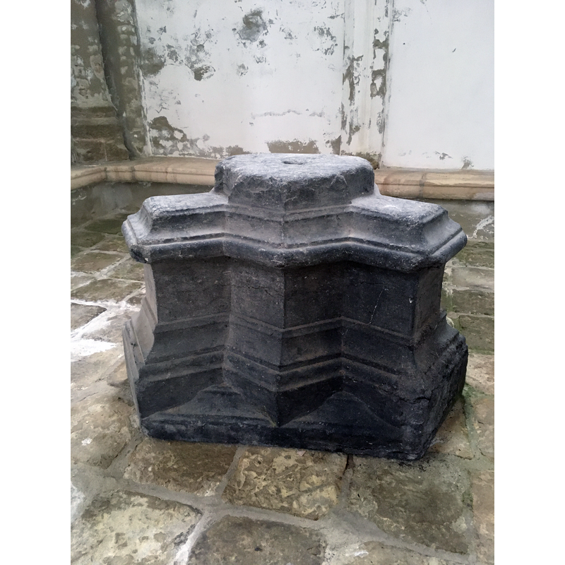
Copyright Statement: Image copyright © J.H. (Huib) Tieleman, 2022
Image Source: digital photograph 6 June 2022 by J.H. (Huib) Tieleman
Copyright Instructions: Image received from the author via Pol Herman (e-mail of 6 June 2022)
view of base
Copyright Statement: Image copyright © J.H. (Huib) Tieleman, 2022
Image Source: digital photograph 6 June 2022 by J.H. (Huib) Tieleman
Copyright Instructions: Image received from the author via Pol Herman (e-mail of 6 June 2022)
design element - motifs - moulding - graded
Copyright Statement: Image copyright © J.H. (Huib) Tieleman, 2022
Image Source: digital photograph 6 June 2022 by J.H. (Huib) Tieleman
Copyright Instructions: Image received from the author via Pol Herman (e-mail of 6 June 2022)
view of base
Copyright Statement: Image copyright © J.H. (Huib) Tieleman, 2022
Image Source: digital photograph 6 June 2022 by J.H. (Huib) Tieleman
Copyright Instructions: Image received from the author via Pol Herman (e-mail of 6 June 2022)
INFORMATION
Font ID: 23516BRO
Object Type: Baptismal Font1, base only
Font Century and Period/Style: 15th century [base only?] [composite font], Late Medieval
Church / Chapel Name: Hervormde Kerk Brouwershaven / Grote of Sint-Nicolaaskerk
Font Location in Church: Inside the church
Church Patron Saint(s): St. Nicholas of Myra
Church Notes: church listed in the Rijksmonumentenregister [Monumentnummer: 11122]
Church Address: Kerkplein 3, 4318 EB Brouwershaven, Netherlands
Site Location: Zeeland, Netherlands, Europe
Directions to Site: Located off the N653, in the municipality of Schouwen-Duiveland, on the island of Schowen, about 60 km NNW of Antwerp
Additional Comments: altered font? only the base remains now
Font Notes:
Click to view
The entry for this church in the Rijksmonumentenregister [https://monumentenregister.cultureelerfgoed.nl/monumenten/11122] [accessed 8 November 2021] reports "Voetstuk hardstenen doopvont XV a."
Credit and Acknowledgements: We are grateful to Pol Herman fo bringing this font to our attention and for his help documenting it. We are laso grateful to J.H. (Huib) Tieleman, Stichting Grote of St. Nicolaaskerk Brouwershaven, for his photographs of the font base
COORDINATES
UTM: 31U 562858 5730936
Latitude & Longitude (Decimal): 51.725825, 3.910081
Latitude & Longitude (DMS): 51° 43′ 32.97″ N, 3° 54′ 36.29″ E
MEDIUM AND MEASUREMENTS
Material: stone, limestone
Drainage System: centre hole in base