Kloosterzande / Klôôster / Zande
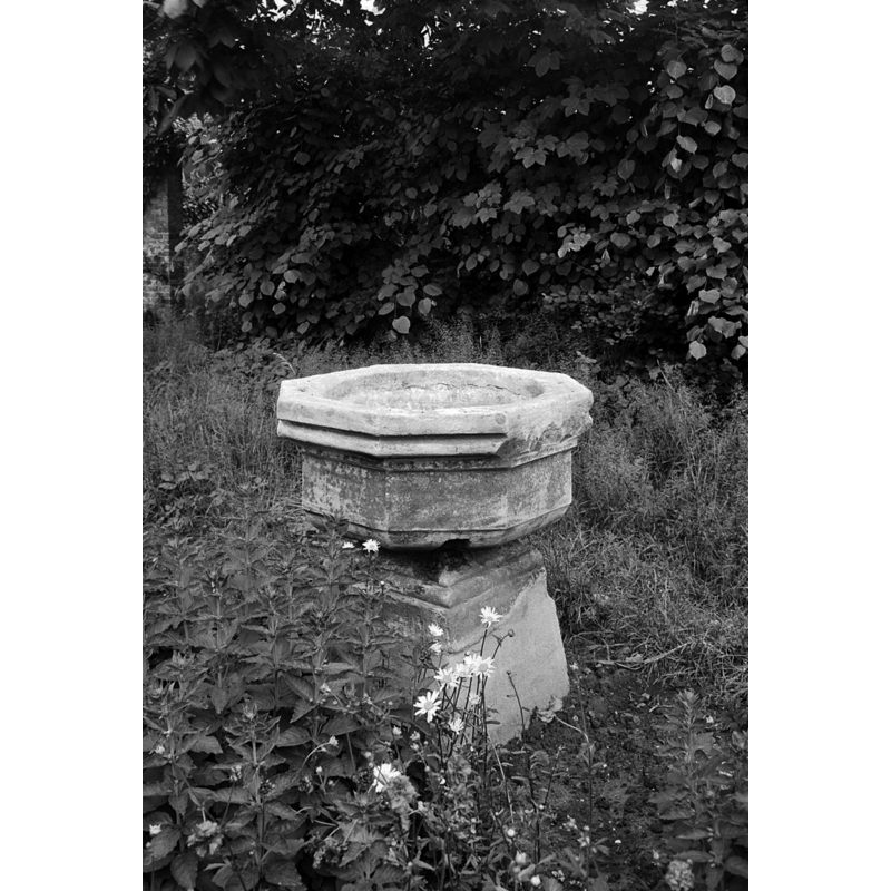
Image copyright © Rijksdienst voor het Cultureel Erfgoed, 2021
CC-BY-SA-4.0
Results: 2 records
view of font in context
Scene Description: the font in its present location at Hof Te Zandeplein 11, Kloosterzande
Copyright Statement: Image copyright © Rijksdienst voor het Cultureel Erfgoed, 2021
Image Source: digital image of a May 1967 B&W photograph by Gerard Drukker, in the Rijksdienst voor het Cultureel Erfgoed [Monumentnummer: 22221] [accessed 24 October 2021]
Copyright Instructions: CC-BY-SA-4.0
view of church exterior - southwest view
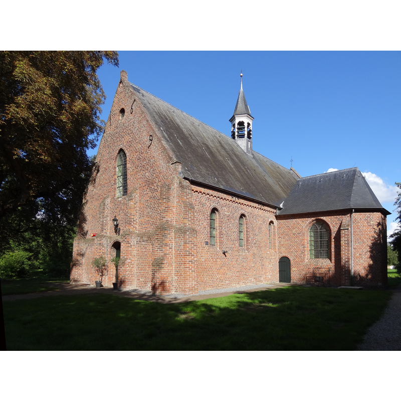
Scene Description: the former monastery chapel/church
Copyright Statement: Image copyright © D. Dieleman, 2017
Image Source: digital photograph 2 September 2017 by D. Dieleman [https://commons.wikimedia.org/wiki/File:22226_Hervormde_kerk_1.jpg] [accessed 24 October 2021]
Copyright Instructions: CC-BY-SA-4.0
INFORMATION
Font ID: 23487ZAN
Object Type: Baptismal Font1, basin only
Font Century and Period/Style: 16th century, Late Gothic? / Renaissance?
Church / Chapel Name: Hervormde Kerk, Kloosterzande
Font Location in Church: [cf. FontNotes]
Church Notes: probably from the 12th-13thC monastery church or chapel
Church Address: Willem de Zwijgerlaan 2, 4587 CJ Kloosterzande, Netherlands
Site Location: Zeeland, Netherlands, Europe
Directions to Site: Located off (W) the N689, in the municipality and about 12 km N of Hulst, about 20 km NW of Antwerp [NB: the actual address where the font is now [2021] located is: Hof Te Zandeplein 11, 4587 CK Kloosterzande, Netherlands]
Additional Comments: altered font / disused font (the basin may originally be from the nearby monastery, now in a garden [Monumentnummer: 22221])
Font Notes:
Click to view
Reported in oorloopige lijst der Nederlandsche monumenten van geschiedenis en kunst. Deel VI. De provincie Zeeland (1922), p. 74: Township Hontenisse - Village Kloosterzande: "In den tuin staat een achtkante kuip van een doopvont van het klooster te Zande (XVI A)." The font, shown in a May 1967 in a garden on Hof Te Zandeplein, Klosterzande, consists of an octagonal basin with moulded sides, raised on a square pedestal base; the basin is believed to be of 16th-century date and to have originated in the former monastery at Kloosterzande.
Credit and Acknowledgements: We are grateful to Pol Herman for bringing this font to our attention and for his help in documenting it
COORDINATES
UTM: 31U 570917 5690899
Latitude & Longitude (Decimal): 51.36492, 4.018681
Latitude & Longitude (DMS): 51° 21′ 53.71″ N, 4° 1′ 7.25″ E
MEDIUM AND MEASUREMENTS
Material: stone, limestone
Font Shape: octagonal, mounted
Basin Interior Shape: round
Basin Exterior Shape: octagonal