Askersund (Närke)
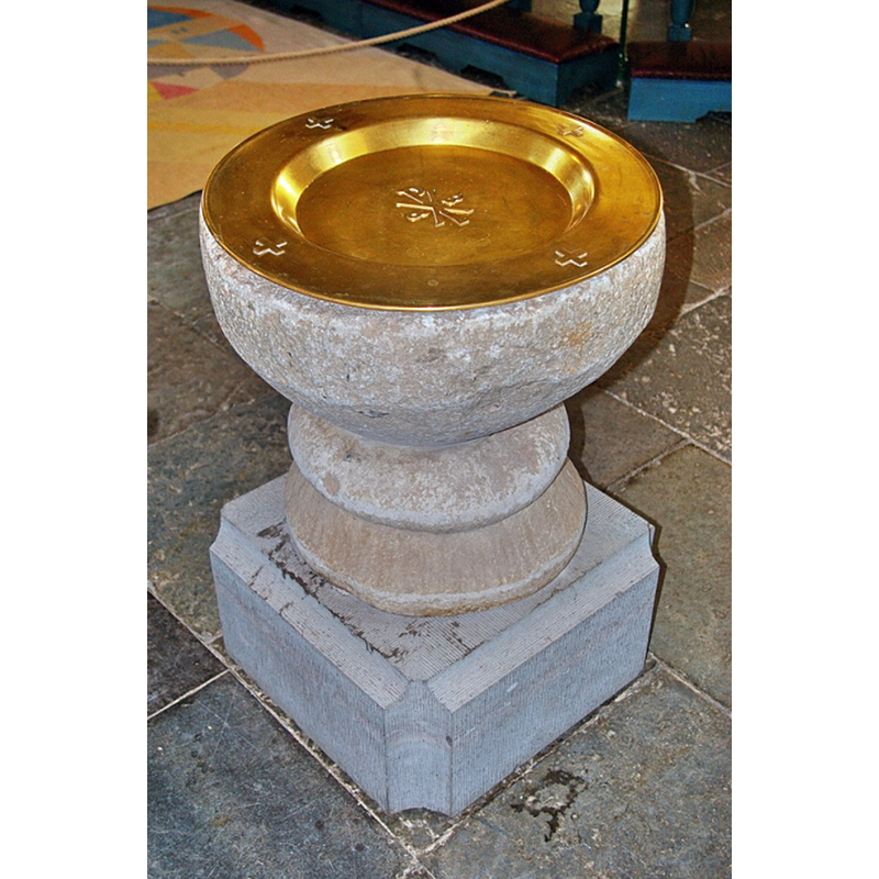
Image copyright © Janos Banan, 2021
No known copyright restriction / Fair Dealing
Results: 7 records
view of font and baptismal dish
Copyright Statement: Image copyright © Janos Banan, 2021
Image Source: digital photograph July 2012 by Janos Banan in Kyrkokartan [www.kyrkokartan.se/056707/Askersunds_kyrka] [accessed 18 June 2021]
Copyright Instructions: No known copyright restriction / Fair Dealing
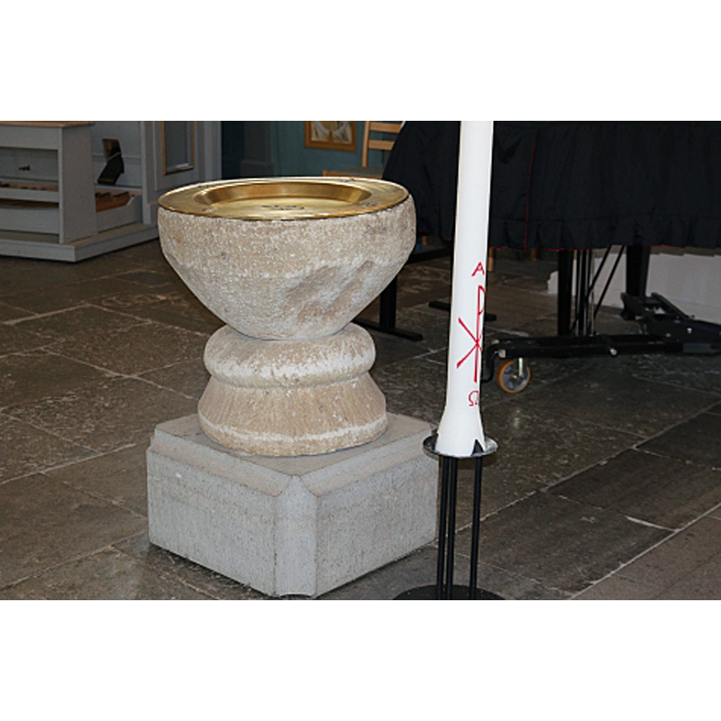
view of font and baptismal dish
Copyright Statement: Image copyright © Tom Wollecki, 2021
Image Source: digital photograph 23 August 2016 by Tom Wollecki in Kyrkokartan [www.kyrkokartan.se/056707/Askersunds_kyrka] [accessed 18 June 2021]
Copyright Instructions: No known copyright restriction / Fair Dealing
view of font
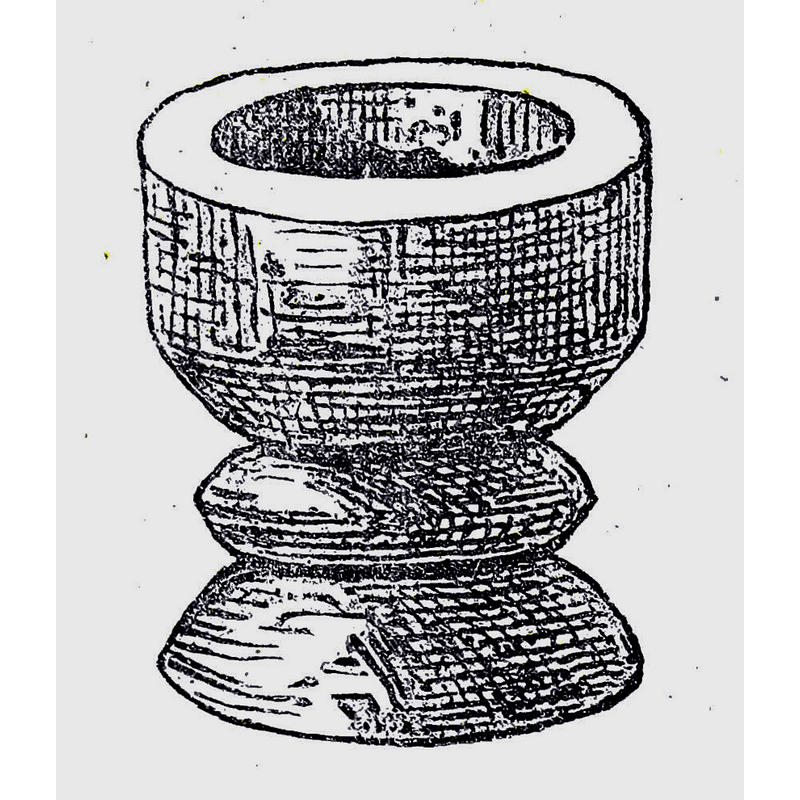
Scene Description: Source caption: "Dopfunt hos Askersunds landsförsamling."
Copyright Statement: Image copyright © [in the public domain]
Image Source: digital image from an illustration in Herman Hofberg's Nerikes gamla minnen (1868) [https://commons.wikimedia.org/wiki/File:Nerikes_gamla_minnen_151a.jpg] [accessed 18 June 2021]
Copyright Instructions: CC-PD-Mark / PD-old-70-expired
view of church exterior - east view
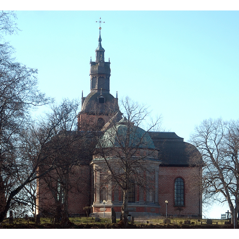
Scene Description: Source caption: "Askersunds landskyrka."
Copyright Statement: Image copyright © Janee, 2015
Image Source: digital photograph 14 March 2015 by Janee [https://commons.wikimedia.org/wiki/File:Askersunds_landskyrka25.JPG] [accessed 18 June 2021]
Copyright Instructions: CC-BY-SA-3.0
view of church exterior in context - northwest view
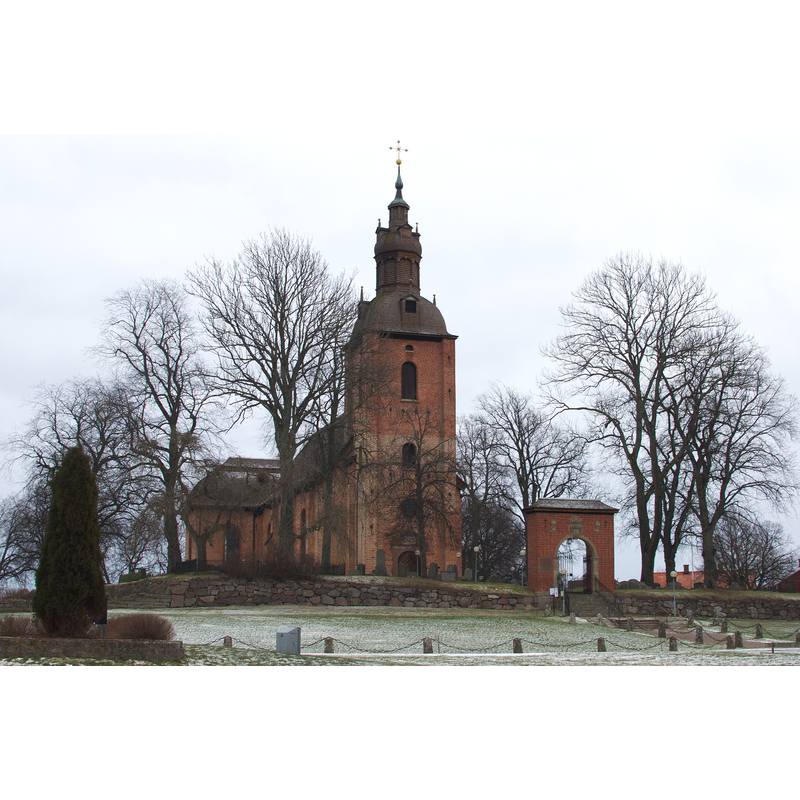
Scene Description: Source caption: "Askersunds landskyrka."
Copyright Statement: Image copyright © Magnus, 2012
Image Source: digital photograph 28 January 2012 by Magnus [https://commons.wikimedia.org/wiki/File:Askersunds_Landskyrka_2012.jpg] [accessed 18 June 2021]
Copyright Instructions: CC-BY-SA-2.0
view of church exterior in context - northeast view
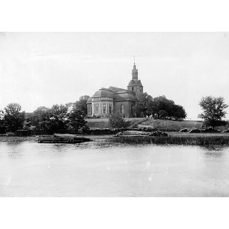
Scene Description: Source caption: "Askersunds landskyrka, i utkanten av Askersund vid sjön Alsen. Kyrkan, som byggdes 1664-1670, ritades av Jean de la Vallée, med bidrag av Erik Dahlberg."
Copyright Statement: Image copyright © [in the public domain]
Image Source: digital image of an undated [late-1800s] B&W photograph [silver gelatin print], in the Kulturmiljöbild, Riksantikvarieämbetet [https://commons.wikimedia.org/wiki/File:Askersund_Country_Church,_Närke,_Sweden.jpg] [accessed 18 June 2021]
Copyright Instructions: PD Sweden
view of font and baptismal dish in context
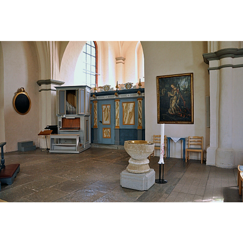
Copyright Statement: Image copyright © Barbro Thörn, 2021
Image Source: digital photograph 19 February 2009 by Barbro Thörn in Kyrkokartan [www.kyrkokartan.se/056707/Askersunds_kyrka] [accessed 18 June 2021]
Copyright Instructions: No known copyright restriction / Fair Dealing
INFORMATION
Font ID: 23347ASK
Object Type: Baptismal Font1
Font Century and Period/Style: 12th - 13th century, Romanesque
Church / Chapel Name: Askersunds landskyrka
Font Location in Church: Inside the church, at the E end
Church Notes: medieval wooden church destroyed by fire 1661; new church built of brick in 1664-1670;
Church Address: Lindbovägen 1, 696 30 Askersund, Sweden
Site Location: Närke, Örebro län, Sweden, Europe
Directions to Site: Located off (S) local road T907, between county road 50 (W) and lake Alsen (SE), about 50 km SSW of Örebro
Ecclesiastic Region: Strängnäs stift
Font Notes:
Click to view
Illustrated in Herman Hofberg's Nerikes gamla minnen (1868). Baptismal font of stone consisting of a round basin that has a short cylindrical ypper side with a tall tapering underbowl, all plain; raised on a round conical base topped with a broad roll moulding; the font is too short to stand on its own so it is now raised on a modern quadrangular block. No cover present. The metal baptismal dish appears modern.
COORDINATES
UTM: 33V 494079 6526470
Latitude & Longitude (Decimal): 58.877986, 14.897306
Latitude & Longitude (DMS): 58° 52′ 40.75″ N, 14° 53′ 50.3″ E
MEDIUM AND MEASUREMENTS
Material: stone
Font Shape: round, mounted
Basin Interior Shape: round
Basin Exterior Shape: round
Drainage Notes: no lining