Veitshochheim / Veitshöchheim
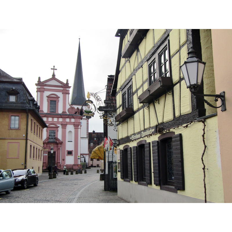
Image copyright © Colin Smith, 2020
Image and permission received from the author (e-mail of 13 Fberuary 2021)
Results: 3 records
view of church exterior in context - west view
Scene Description: the body of the tower remains from the original Tomanesque church re-built in the 1690s
Copyright Statement: Image copyright © Colin Smith, 2020
Image Source: digital photograph taken 14 January 2020 by Colin Smith
Copyright Instructions: Image and permission received from the author (e-mail of 13 Fberuary 2021)
view of church exterior in context - southwest end

Copyright Statement: Image copyright © Colin Smith, 2020
Image Source: digital photograph taken 14 January 2020 by Colin Smith
Copyright Instructions: Image and permission received from the author (e-mail of 13 Fberuary 2021)
view of church interior - looking east
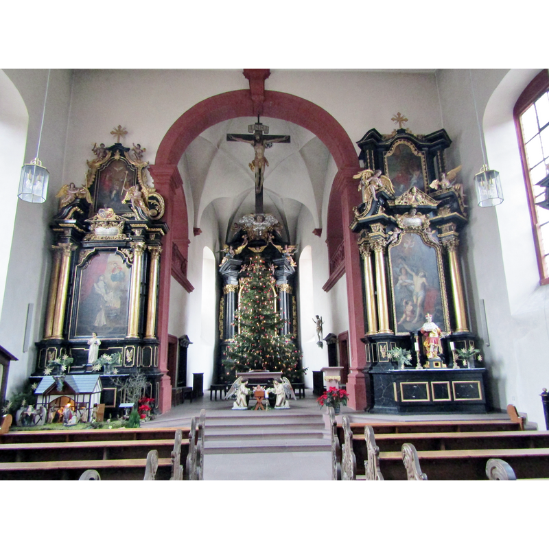
Scene Description: Baroque interior of the 1690s
Copyright Statement: Image copyright © Colin Smith, 2020
Image Source: digital photograph taken 14 January 2020 by Colin Smith
Copyright Instructions: Image and permission received from the author (e-mail of 13 Fberuary 2021)
INFORMATION
Font ID: 23159VEI
Object Type: Baptismal Font1
Font Date: ca. 1692?
Font Century and Period/Style: 17th century(late?), Baroque
Church / Chapel Name: Katholische Pfarrkirche St. Vitus
Font Location in Church: Inside the church
Church Patron Saint(s): St. Vitus
Church Notes: ca.1200 church; re-built late-17thC retaining the base of the old tower
Church Address: Kirchstraße 31, 97209 Veitshöchheim, Germany
Site Location: Würzburg, Bayern, Germany, Europe
Directions to Site: Located off road 27, 7-9 km NE of Würzburg, about half-way between Frankfurt (WNW) and Nuremberg (ESE)
Ecclesiastic Region: Diözese Würzburg
Additional Comments: disappeared font? (the one from the original ca.1200 church here)
Font Notes:
Click to view
The baptismal font of the Baroque is decorated with figures and probably dates from the 1690s date of the re-building. [NB: we have no information on the font of the Romanesque church here]
Credit and Acknowledgements: We are grateful to Colin Smith for his photographs of this church
COORDINATES
UTM: 32U 562751 5520315
Latitude & Longitude (Decimal): 49.831981, 9.872558
Latitude & Longitude (DMS): 49° 49′ 55.13″ N, 9° 52′ 21.21″ E