Hale-Tang No. 1 / Tang / Hale-Tang / Håle-Täng / Täng / Thäng
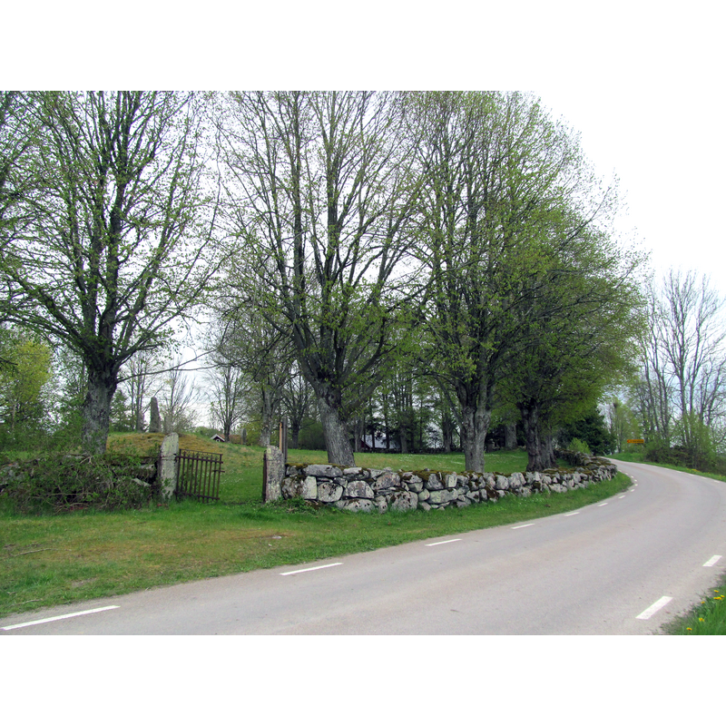
Image copyright © Joel Grafström, 2017
CC-BY-SA-4.0
Results: 5 records
view of church exterior in context
Scene Description: Source caption: The location of Håle old church seen from the north. In the old graveyard area, there are two Runic stones and also a memorial stone raised in memory of the old church.
Copyright Statement: Image copyright © Joel Grafström, 2017
Image Source: digital photograph taken 16 May 2017 by Joel Grafström [https://commons.wikimedia.org/wiki/File:Håle_ödekyrkogård_20170516.jpg] [accessed 9 July 2020]
Copyright Instructions: CC-BY-SA-4.0
view of church exterior
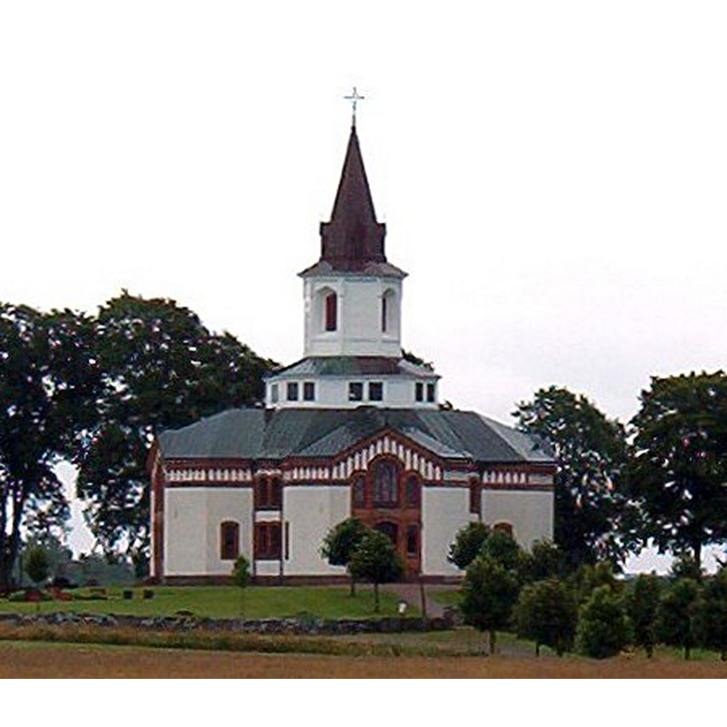
Scene Description: the new church of 1883 replaced the two demolished medieval churches of Håle and Täng
Copyright Statement: Image copyright © [s.n.], 2005
Image Source: digital image taken 2005 by unknown author [https://commons.wikimedia.org/wiki/File:Håle-Tängs_kyrka.jpg] [accessed 9 July 2020]
Copyright Instructions: CC-BY-SA-1.0
view of basin in context
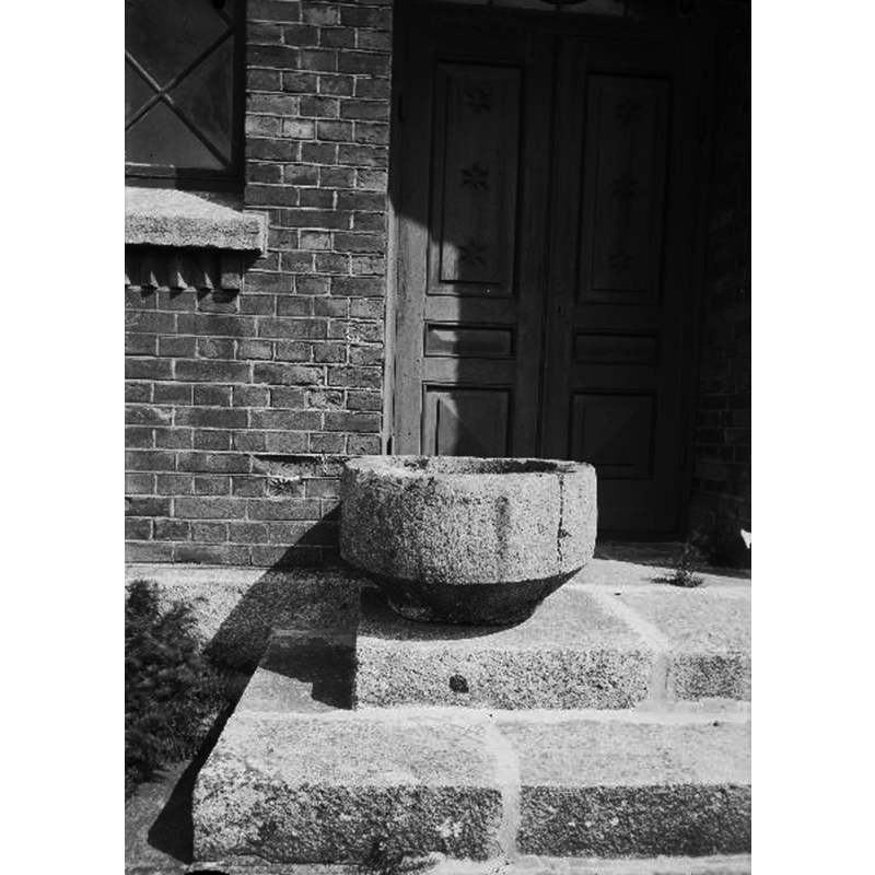
Scene Description: a basin believed to be from the demolished medieval church at Håle is seen here in the new parish church of Håle-Täng
Copyright Statement: Image copyright © [in the public domain]
Image Source: digital image [2748-007.tif] of an undated B&W photograph by Anders Roland, in the Kulturmiljöbild, Riksantikvarieämbetet [https://commons.wikimedia.org/wiki/File:Håle-Tängs_kyrka_-_KMB_-_16000200158887.jpg] [accessed 9 July 2020]
Copyright Instructions: PD Sweden
view of church exterior
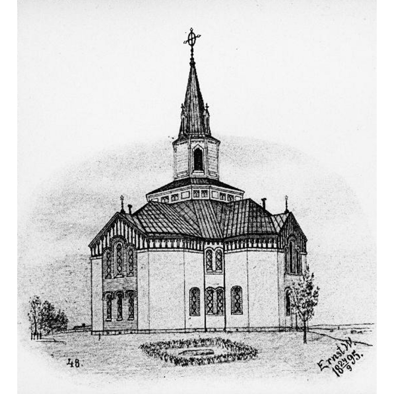
Scene Description: the new church of 1883 replaced the two demolished medieval churches of Håle and Täng
Copyright Statement: Image copyright © [in the public domain]
Image Source: digital image [2748-001.tif] of a 24 September 1895 drawing by Ernst Wennerblad, in the Kulturmiljöbild, Riksantikvarieämbetet [https://commons.wikimedia.org/wiki/File:Håle-Tängs_kyrka_-_KMB_-_16000200158879.jpg] [accessed 9 July 2020]
Copyright Instructions: PD Sweden
view of font in context
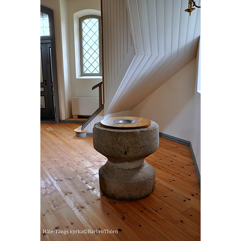
Scene Description: medieval baptismal font in the new parish church of Håle-Täng, said to be originally from the demolished medieval church at Håle
Copyright Statement: Image copyright © Barbro Thörn, 2020
Image Source: digital photograph by Barbro Thörn in Kyrkokartan [www.kyrkokartan.se/057558/images/57558_82460911] [accessed 9 July 2020]
Copyright Instructions: No known copyright restriction / Fair Dealing
INFORMATION
Font ID: 22791HAL
Object Type: Baptismal Font1
Font Century and Period/Style: 12th - 13th century, Medieval
Church / Chapel Name: Håle-Tängs kyrka [originally from the demolished Håle gamla kyrka?]
Font Location in Church: Inside Håle-Tängs kyrka [cf. FontNotes]
Church Notes: medieval [13thC?] church at Täng restored 1669; demolished ca. 1882; present 1883 church in Håle-Täng replaced the two demolished medieval churches of Håle and Täng; renovated 2011
Church Address: [NB: address and coordinates are for the new church] Håle Sjuberga 7, 467 91 Grästorp, Sweden -- Tel.: +46 514 585 60
Site Location: Västergötland, Västra Götalands län, Sweden, Europe
Directions to Site: The new church is located off local road O2584, just S of road 44, SW of Täng, NE of Håle, 12 km NE of Grästorp and in its municipality, about 25 km SW of Lidköping. The ruins of the old church of Håle are: 58° 22′ 48.72″ N / 12° 47′ 3.66″ E / 58.3802 / 12.78435 / 33V 370440 6473174
Ecclesiastic Region: Skara stift
Historical Region: Åse härad
Additional Comments: moved font (originally in the demolished church of Håle?) / composite font?
Font Notes:
Click to view
There are two medieval fonts in the present 1883 church in Håle-Täng, both of which are believed to be from the demolished medieval church of Håle and Täng. No entry found for either of these two churches in the SHM Medeltidens bildvärld. The font said to be originally from Håle consists of a roughly cylindrical basin raised on an equally shaped base, totally plain. The shape of the base is almost the same as that of the basin, which might suggest it is a former basin turned upside down. This font is located on one side of the stairs leadin to the upper gallery. [cf. BSI entry for Hale-Tang No. 1 for the second font in this church]
COORDINATES
UTM: 33V 371121 6474646
Latitude & Longitude (Decimal): 58.393614, 12.795164
Latitude & Longitude (DMS): 58° 23′ 37.01″ N, 12° 47′ 42.59″ E
MEDIUM AND MEASUREMENTS
Material: stone
Number of Pieces: two
Font Shape: cylindrical, mounted
Basin Interior Shape: round
Basin Exterior Shape: round