Solberga nr. Skurup
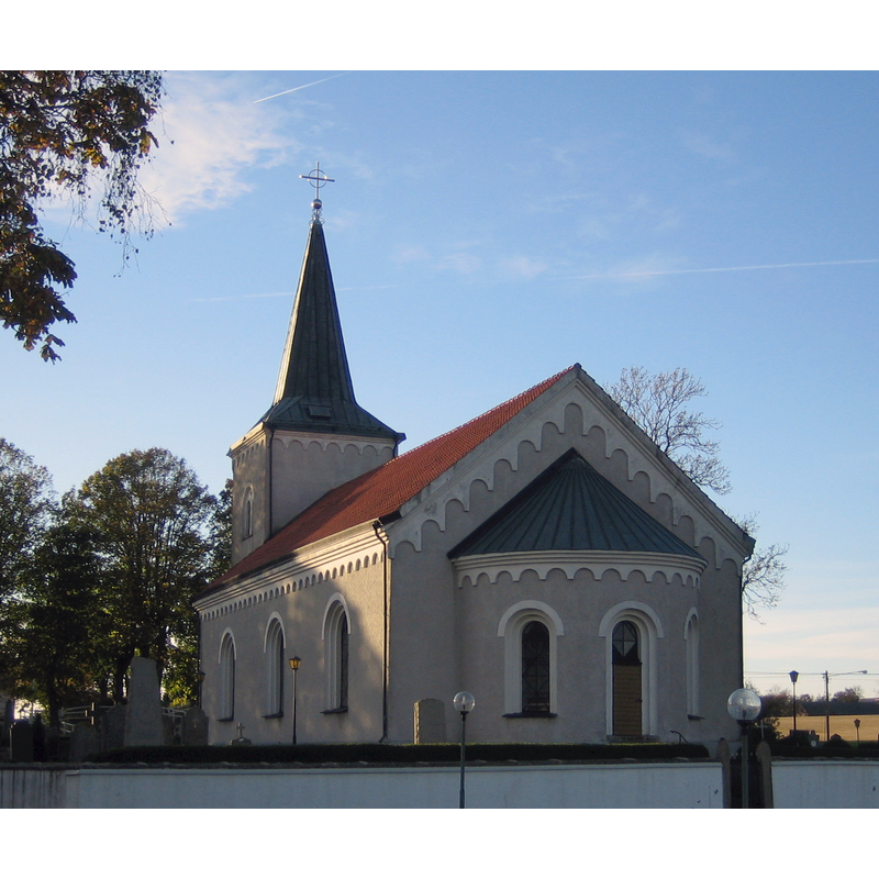
Image copyright © jorchr, 2007
GFDL / CC-BY-SA-3.0-migrated
Results: 2 records
view of church exterior - southeast view
Copyright Statement: Image copyright © jorchr, 2007
Image Source: digital photograph taken 13 October 2007 by jorchr [https://upload.wikimedia.org/wikipedia/commons/archive/7/73/20161219225516!Solberga_kyrka%2C_Skurup.jpg] [accessed 26 June 2020]
Copyright Instructions: GFDL / CC-BY-SA-3.0-migrated
view of church interior - looking east
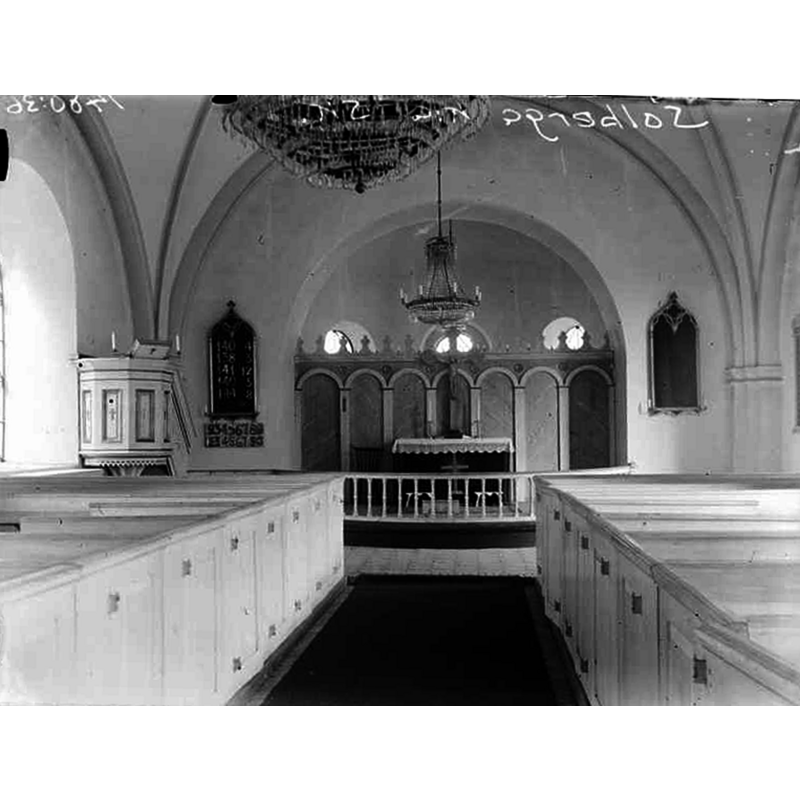
Copyright Statement: Image copyright © [in the public domain]
Image Source: edited detail of a digital image [1555-2.TIF] of a 1929 B&W photograph by Erik Andrén, in the Kulturmiljöbild, Riksantikvarieämbetet [https://commons.wikimedia.org/wiki/File:Solberga_kyrka_-_KMB_-_16000200062318.jpg] [accessed 26 June 2020]
Copyright Instructions: PD Sweden
INFORMATION
Font ID: 22763SOL
Object Type: Baptismal Font1
Font Century and Period/Style: Medieval
Church / Chapel Name: Solberga kyrka
Font Location in Church: Inside the new church
Church Notes: present church built 1865-1866 replacing demolished medieval building and using some of the old materials in its construction
Church Address: Solbergavägen, Solberga 221, 274 63 Rydsgård, Sweden
Site Location: Skåne, Skåne län, Sweden, Europe
Directions to Site: Located off local road M757, 3 km SSW of Rydsgård and the E65, in the municipality and about 5 km SW of Skurup
Ecclesiastic Region: Lunds Stift
Historical Region: Vemmenhögs härad
Additional Comments: re-cycled / moved font (originally from the demolished medieval church)
Font Notes:
Click to view
Kerstin Börjesson's Solberga kyrka – invändig renovering (Antikvarisk medverkan, 2011: 29) [http://www.regionmuseet.se/download/18.6e6896fd15f6bfe705038d6b/1510230421866/R2011_029.pdf] [accessed 26 June 2020] reports a stone font from the medieval church in the new church [="I kyrkan finns också en äldre troligtvis medeltida dopfunt"]. The old font is illustrated in a video [https://www.youtube.com/watch?v=W8FndWIVnT0] [accessed 26 June 2020]: it appears to be made of a dark stone, perhaps soapstone?, and consists of three parts: a roughly hemispherical basin with plain sides and a roll moulding at the bottom of the underbowll a cylindrical stem, also with a moulding, and a circular lower base; no cover present.
COORDINATES
UTM: 33U 409874 6145916
Latitude & Longitude (Decimal): 55.451111, 13.575
Latitude & Longitude (DMS): 55° 27′ 4″ N, 13° 34′ 30″ E
MEDIUM AND MEASUREMENTS
Material: stone, soapstone?
Number of Pieces: three?
Font Shape: hemispheric, mounted
Basin Interior Shape: round
Basin Exterior Shape: round
Drainage Notes: no lining