Skarv / Skärf / Skärv
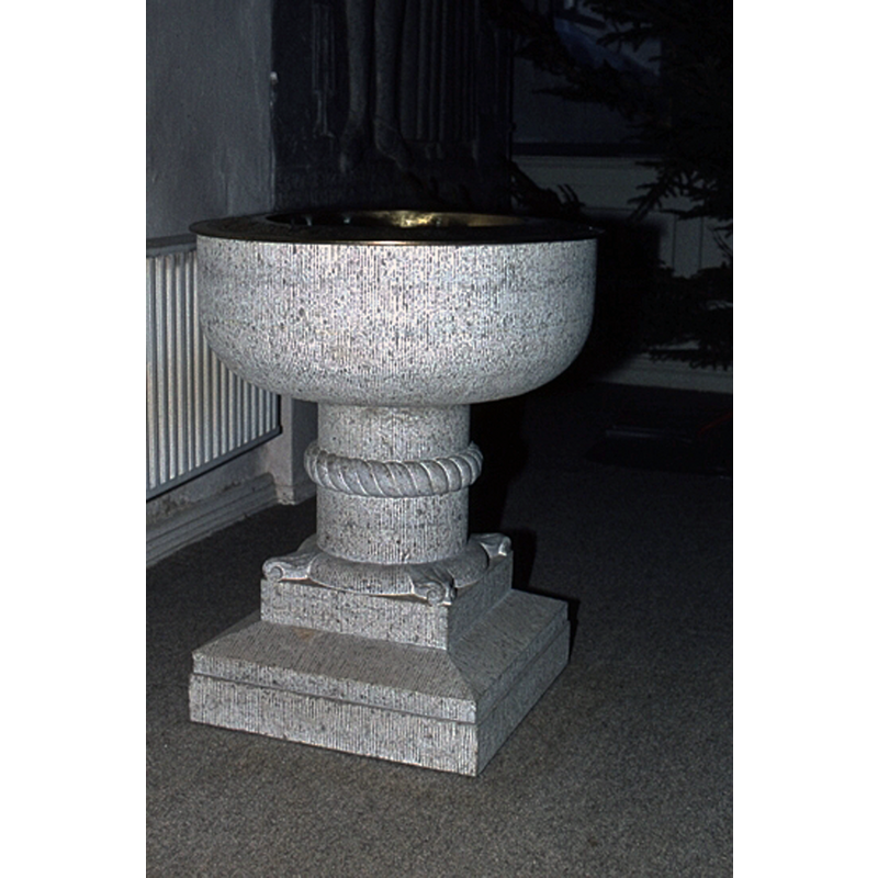
Image copyright © Lars Hasselberg / Västergötlands museum, 1978
CC-BY-NC-ND-4.0
Results: 4 records
view of font
Scene Description: the modern font in the church built 1791 to replace the demolished medieval building
Copyright Statement: Image copyright © Lars Hasselberg / Västergötlands museum, 1978
Image Source: digital image [1M16-D2743] of a 1978 B&W photograph by Lars Hasselberg, in the VGM Foro collection of the Västergötlands museum [https://digitaltmuseum.se/021017226211/1m16-d2743] [accessed 26 June 2020]
Copyright Instructions: CC-BY-NC-ND-4.0
view of church exterior - northeast view
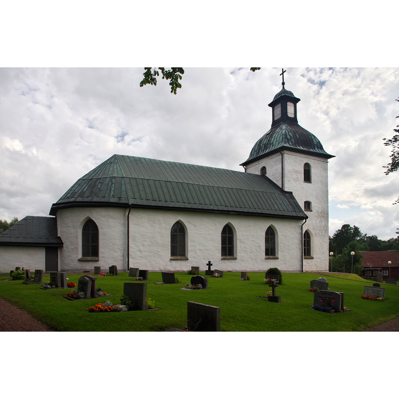
Scene Description: church built 1791 replaced demolished medieval building
Copyright Statement: Image copyright © Nasko, 2011
Image Source: digital photograph taken 7 August 2011 by Nasko [https://commons.wikimedia.org/wiki/File:Skärvs_kyrka_Sweden_03.jpg] [accessed 26 June 2020]
Copyright Instructions: CC-BY-SA-3.0
view of church exterior - southeast view
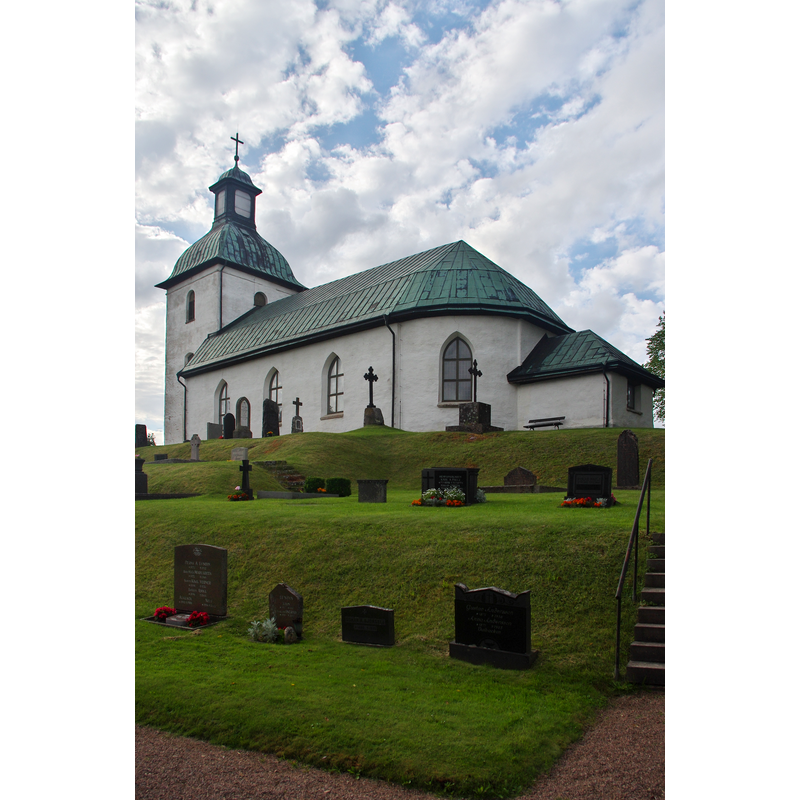
Scene Description: church built 1791 replaced demolished medieval building
Copyright Statement: Image copyright © Nasko, 2011
Image Source: digital photograph taken 7 August 2011 by Nasko [https://commons.wikimedia.org/wiki/File:Skärvs_kyrka_Sweden_02.jpg] [accessed 26 June 2020]
Copyright Instructions: CC-BY-SA-3.0
view of church exterior - southeast view
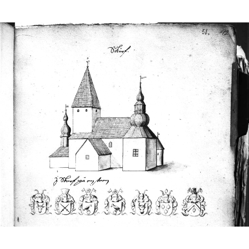
Scene Description: Source caption: "Den gamla kyrkan från sydöst, riven i slutet av 1700-talet. Foto efter teckning ur Peringskiölds Monumenta."
Copyright Statement: Image copyright © [in the public domain]
Image Source: digital image [2831-003.tif] of a late-17thC drawing in Peringskiöld's Monumenta, in the Kulturmiljöbild, Riksantikvarieämbetet [
Copyright Instructions: PD Sweden
INFORMATION
Font ID: 22761SKA
Object Type: Baptismal Font1?
Font Century and Period/Style: 12th century, Romanesque
Church / Chapel Name: Skärvs kyrka
Font Location in Church: [disappeared]
Church Notes: late-12thC church demolished; new church 1791
Church Address: Skärvs kyrby, Skärvavägen, 532 72 Axvall, Sweden
Site Location: Västergötland, Västra Götalands län, Sweden, Europe
Directions to Site: Located off local road O2747, N of road 49, in the municipality of Skara and about 10 km ENE of it and of highway E20
Ecclesiastic Region: Skara stift
Historical Region: Valle härad
Additional Comments: disappeared font? (the one from the 12thC demolished church)
Font Notes:
Click to view
The present font made of limestone in 1935 was Gustav Håård's gift. [NB: we have no information on the font of the 12th-century church here]
COORDINATES
UTM: 33V 418486 6474956
Latitude & Longitude (Decimal): 58.407778, 13.605
Latitude & Longitude (DMS): 58° 24′ 28″ N, 13° 36′ 18″ E