Sigtuna No. 5
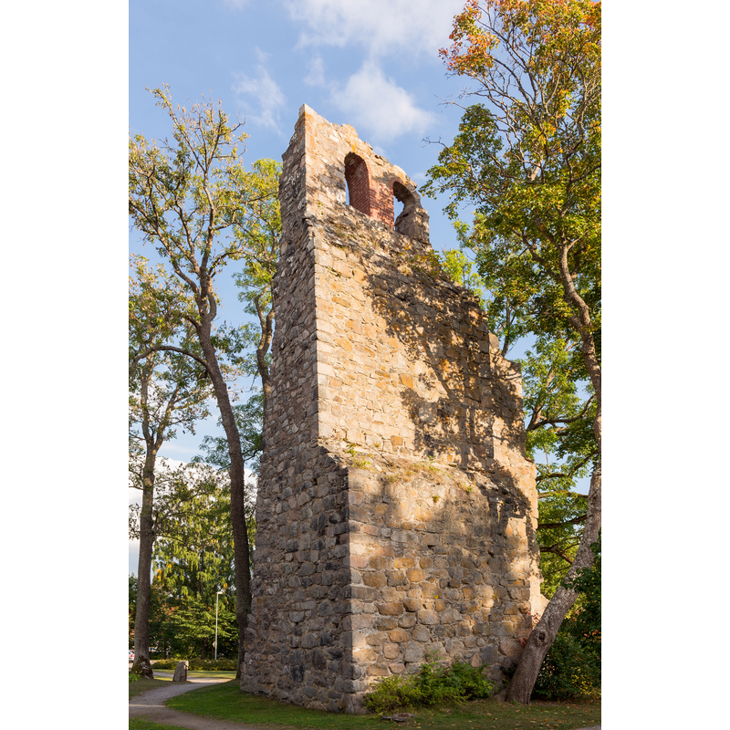
Image copyright © Arild Vågen, 2013
CC-BY-SA-3.0
Results: 2 records
view of church exterior - detail
Scene Description: in ruins since the mid-17thC
Copyright Statement: Image copyright © Arild Vågen, 2013
Image Source: digital photograph taken 12 September 2013 by Arild Vågen [https://commons.wikimedia.org/wiki/File:Sankt_Lars_kyrkoruin_September_2013_02.jpg] [accessed 17 May 2020]
Copyright Instructions: CC-BY-SA-3.0
view of church exterior - southwest view - detail
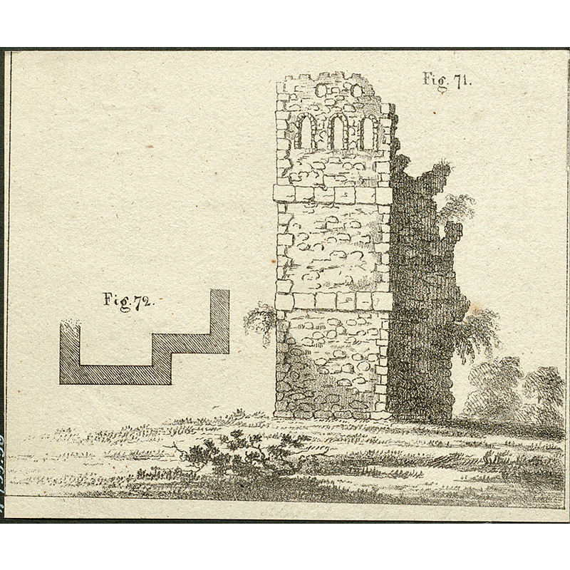
Scene Description: Source caption: "Raä-nr: Sigtuna 10:1. Kyrkoruinen från sydväst. Illustration från N. H. Sjöborgs "Samlingar för Nordens fornälskare", del 1, fig. 71 och 72, från 1822."
Copyright Statement: Image copyright © [in the public domain]
Image Source: digital photograph [htup252] taken 10 February 2017 by Lars Kennerstedt of a 1822 illustration in N. H. Sjöborg's "Samlingar för Nordens fornälskare", in the Kulturmiljöbild, Riksantikvarieämbetet [https://commons.wikimedia.org/wiki/File:Sankt_Olofs_kyrkoruin_-_KMB_-_16001000543841.jpg] [accessed 17 May 2020]
Copyright Instructions: PD Sweden
INFORMATION
Font ID: 22669SIG
Object Type: Baptismal Font1?
Font Century and Period/Style: 12th century, Romanesque
Church / Chapel Name: Sankt Lars kyrkoruin [church destroyed by fire in 1658]
Font Location in Church: [disappeared]
Church Notes: 12thC church; destroyed by fire in 1658; remained a ruin since
Church Address: Prästgatan / Fågelsångsvägen 1A, 193 30 Sigtuna, Sweden
Site Location: Uppland, Uppsala län, Sweden, Europe
Directions to Site: Sigtuna is located near the county border between Uppsala and Stockholm, between the E4 (E) and the E18 (W), 30 km S of Uppsala, 40-50 km N of Stockholm
Ecclesiastic Region: [Uppsala stift]
Additional Comments: disappeared font? (from the 12thC church here)
Font Notes:
Click to view
[NB: wer have no information on the font of the 12th-century church here, in ruins since the mid-17th century].
COORDINATES
UTM: 33V 653439 6611898
Latitude & Longitude (Decimal): 59.616972, 17.720028
Latitude & Longitude (DMS): 59° 37′ 1.1″ N, 17° 43′ 12.1″ E