Thornton in Lonsdale / Tornetun / Torntun
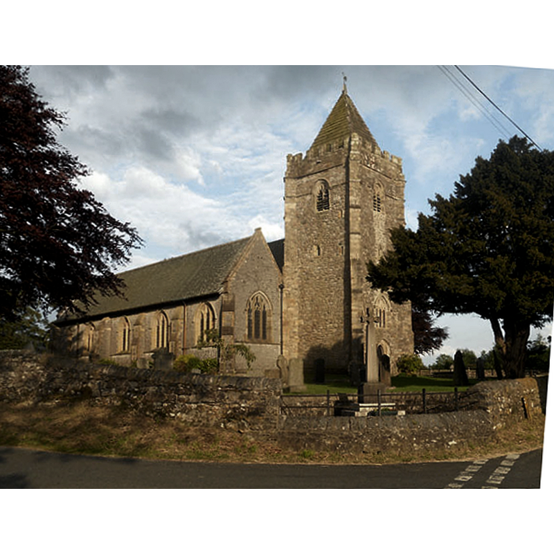
Image copyright © Row17, 2011
CC-BY-SA-2.0
Results: 2 records
view of church exterior - northwest view
Copyright Statement: Image copyright © Row17, 2011
Image Source: digital photograph taken 10 June 2011 by Row17 [www.geograph.org.uk/photo/2464553] [accessed 6 February 2020]
Copyright Instructions: CC-BY-SA-2.0
view of church exterior - southwest view
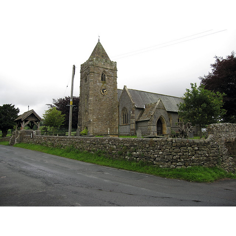
Copyright Statement: Image copyright © John S Turner, 2009
Image Source: digital photograph taken 29 July 2009 by John S Turner [www.geograph.org.uk/photo/1502821] [accessed 6 February 2020]
Copyright Instructions: CC-BY-SA-2.0
INFORMATION
Font ID: 22574THO
Object Type: Baptismal Font1?
Font Century and Period/Style: 12th century, Norman
Church / Chapel Name: Parish Church of St. Oswald
Font Location in Church: [disappeared]
Church Patron Saint(s): St. Oswald of Nothumbria
Church Notes: 15thC tower; re-built ca. 1870; damaged by fire 1933; re-built soon thereafter; restored 2019
Church Address: New Rd, Thornton, Carnforth LA6 3PB, UK
Site Location: North Yorkshire, Yorkshire and the Humber, England, United Kingdom
Directions to Site: Located N of the A65, 2 km N of Ingleton, 8 km SE of Kirkby Lonsdale, near the Cumbria and Lancs borders [the civil parish was partly in in Lancs but chiefly in NYrks]
Ecclesiastic Region: Diocese of Leeds
Historical Region: Hundred of Lonsdale [in part]
Additional Comments: disappeared font? (the one from the medieval church here)
Font Notes:
Click to view
There is a multiple-place entry for Thornton [in Lonsdale] in the Domesday survey [https://opendomesday.org/place/SD6773/thornton-in-lonsdale/] [accessed 6 February 2020] but it mentions neither cleric nor church in it. The entry for this parish in Whitaker (1823) identifies the earlier fabric of the church as early-Norman [he would have seen the church before the 19th-century re-building]; he mentions no font in it. The entry for this church in Historic England [Listing NGR: SD6857173618] mentions no font in it, either.
COORDINATES
UTM: 30U 533781 6001158
Latitude & Longitude (Decimal): 54.1574, -2.4827
Latitude & Longitude (DMS): 54° 9′ 26.64″ N, 2° 28′ 57.72″ W