Hardraw / Hardrow
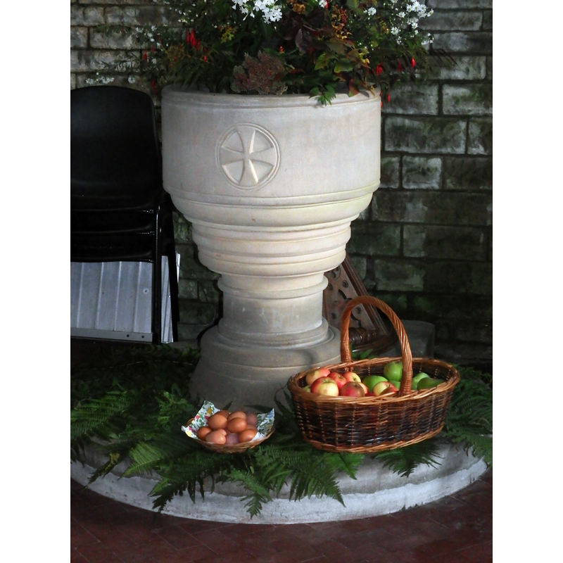
Image copyright © Colin Hinson, 2020
Image and permission received from the author (e-mail of 23 January 2020)
Results: 4 records
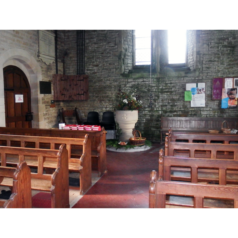
view of font and cover
Scene Description: the modern font and cover
Copyright Statement: Image copyright © Colin Hinson, 2020
Image Source: digital photograph taken 2 October 2016 by Colin Hinson [www.yorkshireCDbooks.com]
Copyright Instructions: Image and permission received from the author (e-mail of 23 January 2020)
view of church exterior in context - southwest view
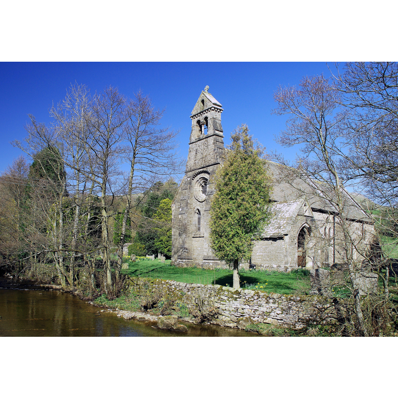
Copyright Statement: Image copyright © Gammock, 2011
Image Source: digital photograph taken 8 April 2011 by Gammock [https://commons.wikimedia.org/wiki/File:Hardrow_Church.jpg] [accessed 26 January 2020]
Copyright Instructions: CC-BY-SA-4.0
view of font and cover in context
Scene Description: the modern font and cover at the west end of the nave
Copyright Statement: Image copyright © Colin Hinson, 2020
Image Source: digital photograph taken 2 October 2016 by Colin Hinson [www.yorkshireCDbooks.com]
Copyright Instructions: Image and permission received from the author (e-mail of 23 January 2020)
view of church interior - looking east
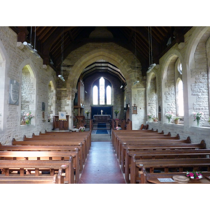
Copyright Statement: Image copyright © Wehha, 2012
Image Source: digital photograph taken 22 May 2012 by Wehha [https://commons.wikimedia.org/wiki/File:Interior_of_St_Mary_%26_St_John_Hardraw_Yorkshire.JPG] [accessed 26 January 2020]
Copyright Instructions: CC-BY-SA-3.0
INFORMATION
Font ID: 22570HAR
Object Type: Baptismal Font1?
Font Century and Period/Style: 17th century (?)
Church / Chapel Name: Parish Church of St. Mary and St. John
Font Location in Church: [disappeared]
Church Patron Saint(s): St. Mary the Virgin & St. John
Church Address: Hardraw, High Abbotside, Hawes, North Yorkshire, DL8 3LZ, UK
Site Location: North Yorkshire, Yorkshire and the Humber, England, United Kingdom
Directions to Site: Located NE of the A684-B6255 crossroads, on the E bank of the Hardraw beck, N of Hawes, WNW of Aysgarth, in the Yorkshire Dales National Park
Ecclesiastic Region: Diocese of Leeds
Additional Comments: disappeared font? (the one from the pre-1700 church here)
Font Notes:
Click to view
No individual entry found for Hardraw or Hardow in the Domesday survey. Speight (1897) writes: "Within the township of High Abbotside are comprised the chapelries of Hardraw and Lunds, which were formerly separate, but since 1858 have been united. They were severed from the large parish of Askrigg about the year 1747, and it was in 1748-9 that the former primitive little church at Hardraw was built. There must, however, have been some kind of chapel at Hardraw before this date, as among the parish records is a paper stating that William Broderick was licensed by the Bishop of Chester to perform the office of curate in the chapel of Hardraw, in the parish of Aysgarth, assigning him the full salary and other perquisites belonging to the said chapel. The writing is dated at Chester, September 26th, 1743." The entry for this church in Historic England [Listing NGR: SD8673591270] notes a building of 1879-1881; it mentions no font in it but describes interior vestry elements of the 17th and 18th centuries; it makes no reference to an earlier church here. The Hardraw Parish Church Registers at the National Archives [ref.: PR/HAD [MIC 3894] [https://discovery.nationalarchives.gov.uk/details/r/9e1af5b7-3e15-4e18-b60b-9b11ba1edd58] [accessed 26 January 2020] have an entry for an "extract relating to licensing of John Thompson as curate in 1686", which would indicate the existence of a church at Hardraw before 1700. The present font is modern.
Credit and Acknowledgements: We are grateful to Colin Hinson [www.yorkshireCDbooks.com], for his photographs of the modern font here
COORDINATES
UTM: 30U 551703 6019076
Latitude & Longitude (Decimal): 54.316933, -2.205186
Latitude & Longitude (DMS): 54° 19′ 0.96″ N, 2° 12′ 18.67″ W