Eglwys Fach / Eglwys-fach / Eglwys vach / Eglwysfach / Llanfihangel Capel Edwin / Llanvihangel Capel Edwin
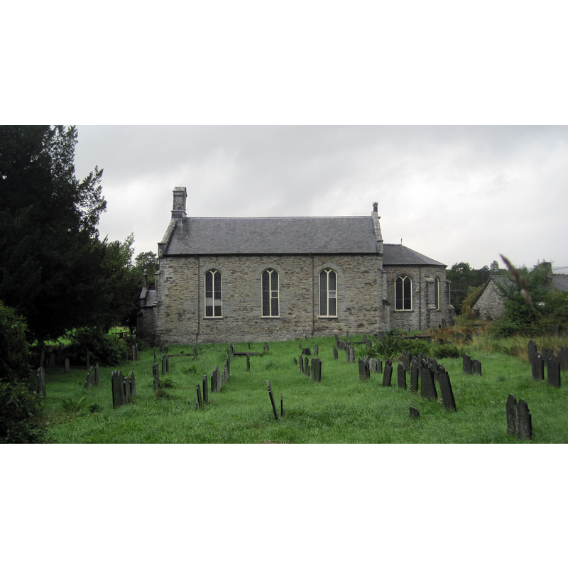
Image copyright © Llywelyn2000, 2013
CC-BY-SA-3.0
Results: 1 records
view of church exterior in context - south view
Scene Description: the 1830s church replaced an early-17thC church located about fifty yards from this site
Copyright Statement: Image copyright © Llywelyn2000, 2013
Image Source: digital photograph taken 7 September 2013 by Llywelyn2000 [https://commons.wikimedia.org/wiki/File:Eglwys_Ynys-hir_Machynlleth.JPG] [accessed 25 January 2020]
Copyright Instructions: CC-BY-SA-3.0
INFORMATION
Font ID: 22568FAC
Object Type: Baptismal Font1
Font Century and Period/Style: 17th century(early?)
Church / Chapel Name: Parish Church of St. Michael / Eglwys San Mihangel
Font Location in Church: Inside the later church
Church Patron Saint(s): St. Michael
Church Address: Brynheulog Ln, Eglwys Fach, Machynlleth SY20 8SY, UK
Site Location: Ceredigion, Wales, United Kingdom
Directions to Site: Located off (W) the A487, about 20 km NNE of Aberystwyth
Ecclesiastic Region: Diocese of St Davids
Historical Region: formerly Cardiganshire
Additional Comments: re-cycled font (from the old church and used in the new church)
Font Notes:
Click to view
Meyrick (1808) reports: "The font is a circular stone bason, supported on a square stone pillar." The entry for this church in COFLEIN [https://www.coflein.gov.uk/en/site/96028/details/st-michaels-church-eglwys-fach-ysgubor-y-coed] [accessed 25 January 2020] notes: "Throughout most of its history, the church has been a chapelry to Llanfihangel Genau'r Glyn parish. [...] The first church on the site was constructed [...] around 1623. [...] Nothing now remains of the structure, although the current church's seventeenth-century font is from the earlier church. It has a small, deep, circular bowl on a chamfered, square stem. A low earthwork in the eastern section of the churchyard may represent the site of the earlier church. The second church [...] was erected in 1833, some 50m west of the earlier site. [...] The church was restored in 1997-8."
COORDINATES
UTM: 30U 436290 5821707
Latitude & Longitude (Decimal): 52.54172, -3.93943
Latitude & Longitude (DMS): 52° 32′ 30.19″ N, 3° 56′ 21.95″ W
MEDIUM AND MEASUREMENTS
Material: stone
Font Shape: round, mounted
Basin Interior Shape: round
Basin Exterior Shape: round
REFERENCES
- Meyrick, Samuel Rush, The History and Antiquities of the County of Cardigan [...], London: Longman, Hurst, Rees, and Orme, 1808, p. 462