Llangynfelyn / Llancynfelin / Llancynvelyn / Llangynfelin / Llangynvelin
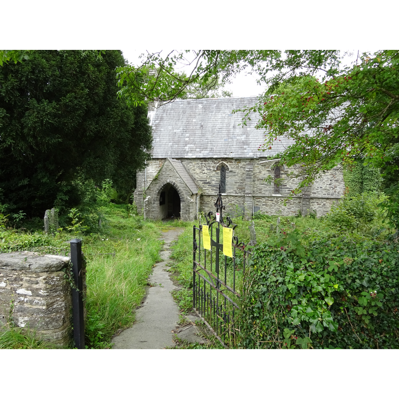
Image copyright © Llywelyn2000, 2017
CC-BY-SA-2.0
Results: 1 records
view of church exterior in context - south view
Scene Description: 19thC re-building of a medieval church
Copyright Statement: Image copyright © Llywelyn2000, 2017
Image Source: digital photograph taken 6 August 2017 by Llywelyn2000 [https://commons.wikimedia.org/wiki/File:Llangynfelyn,_St_Cynfelyn's_Church,_Ceredigion,_Wales_18.jpg] [accessed 14 January 2020]
Copyright Instructions: CC-BY-SA-2.0
INFORMATION
Font ID: 22550LLA
Object Type: Baptismal Font1
Font Century and Period/Style: 13th century, Early English
Church / Chapel Name: Parish Church of St. Cynvelyn / Eglwys Sant Cynfelyn
Font Location in Church: Inside the church
Church Patron Saint(s): St. Cynvelin [aka Cynfelin / Cynfelyn / Cynvelyn]
Church Notes: said to have existed 6thC; reported in Lewis (1833) as "a very ancient structure, and in a very dilapidated condition" and about to be re-built; re-built / restored 1845 and 1878; appears disused September 2019
Church Address: Llangyfelyn, Machynlleth SY20 8PU, UK
Site Location: Ceredigion, Wales, United Kingdom
Directions to Site: Located off the A4353, W of the A487, 15 km NNE of Aberystwith
Ecclesiastic Region: Diocese of St Davids
Historical Region: Hundred of Geneu'r-Glyn -- formerly Cardiganshire
Additional Comments: altered font? (the stem of the base is missing)
Font Notes:
Click to view
Meyrick (1808) reports: "THe font is octagonal, and stands on two steps." The entry in Evans (1914) mentions no font in it. The entry for this church in COFLEIN [https://coflein.gov.uk/en/site/400469/details/st-cynfelyns-church-llancynfelyn] [accessed 14 January 2020] notes: "During the medieval period the church was a chapelry [...] By 1833 the church had become a parish church [...] The nave and chancel may possibly be medieval in origin. The oolite font with octagonal bowl and base (but no stem) dates to the thirteenth-fourteenth century."
COORDINATES
UTM: 30U 432345 5818309
Latitude & Longitude (Decimal): 52.5107, -3.9969
Latitude & Longitude (DMS): 52° 30′ 38.52″ N, 3° 59′ 48.84″ W
MEDIUM AND MEASUREMENTS
Material: stone, oolite (Barnack stone)
Font Shape: octagonal, mounted
Basin Interior Shape: round
Basin Exterior Shape: octagonal
REFERENCES
- Meyrick, Samuel Rush, The History and Antiquities of the County of Cardigan [...], London: Longman, Hurst, Rees, and Orme, 1808, p. 466