Llangeitho
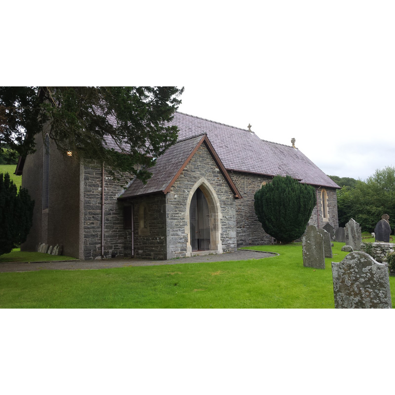
Image copyright © Peter Mackenzie, 2017
CC-BY-SA-2.0
Results: 2 records
view of church exterior - southwest view
Scene Description: the present church of St Ceitho's after the 1899 modifications
Copyright Statement: Image copyright © Peter Mackenzie, 2017
Image Source: digital photograph taken 16 August 2017 by Pater Mackenzie [www.geograph.org.uk/photo/5502975] [accessed 12 January 2020]
Copyright Instructions: CC-BY-SA-2.0
view of church exterior in context - west view
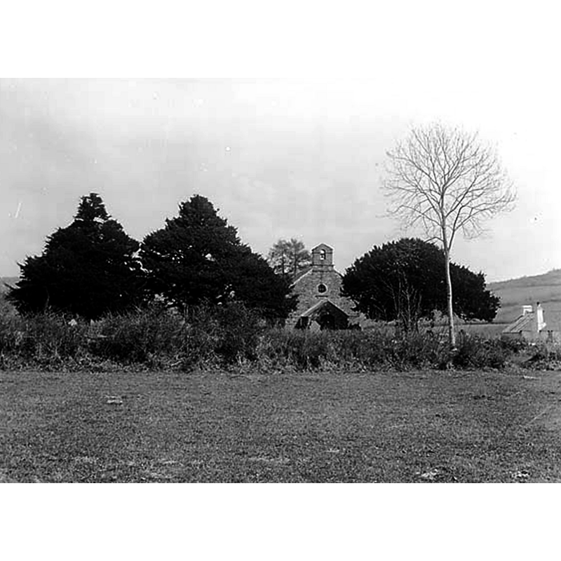
Scene Description: St Ceitho's after the 1821 re-building of the medieval church, before the 1899 modifications
Copyright Statement: Image copyright © [in the public domain]
Image Source: edited detail of a an image of a B&W photograph [1 negative : glass, dry plate, b&w ; 12 x 16.5 cm.] taken ca. 1885 by John Thomas in a The National Library of Wales [3363416], collection [(WlAbNL)003381774] https://commons.wikimedia.org/wiki/File:The_church,_Llangeitho_NLW3363416.jpg] [accessed 12 January 2020]
Copyright Instructions: CC-PD-Mark
INFORMATION
Font ID: 22547LLA
Object Type: Baptismal Font1?
Font Century and Period/Style: Medieval
Church / Chapel Name: Parish Church of St. Ceitho
Font Location in Church: [disappeared]
Church Wikidata: https://www.wikidata.org/wiki/Q114457961
Church Patron Saint(s): St. Ceitho [aka Geitho]
Church Address: Llangeitho, Tregaron SY25 6TW, UK
Site Location: Ceredigion, Wales, United Kingdom
Directions to Site: Located off the B4342, 6 km W of Tregaron, 11 km N of Lampeter. The church is located across the river N of the village
Ecclesiastic Region: Diocese of St Davids
Historical Region: Hundred of Penarth -- formerly Cardiganshire
Additional Comments: disappeared font? (the one from the medieval church here)
Font Notes:
Click to view
The church of Llangeitho but not its font, is mentioned in Meyrick (1808). The entry for this church in Lewis (1833) and in the National Gazetteer of 1868 note that the church is a 1821 re-building of an earlier one. The entry for this church in Evans (1914) reports a new font in it. The entry in COFLEIN [https://www.coflein.gov.uk/en/site/400475/details/st-ceithos-church-llangeitho] [accessed 12 January 2020] notes: "During the medieval period the church was a chapelry belonging to the Deanery of Ultra-Aeron. [...] The medieval church had a timber double rood screen [...] The church was entirely rebuilt in 1821 on the same site and in the same location as its predecessor, but retaining nothing from its earlier fabric. [...] The church was again restored and enlarged in 1899"; no font mentioned in it.
COORDINATES
Latitude & Longitude (Decimal): 52.2256, -4.0009
Latitude & Longitude (DMS): 52° 13' 32" N, 4° 0' 3" W
REFERENCES
- Evans, J.T., The Church Plate of Cardiganshire, Stow-in-the-Wold: James H. Halden, 1914, p. 56