Cilcennin / Cil-Cenin / Cilcennyn / Kilkennin
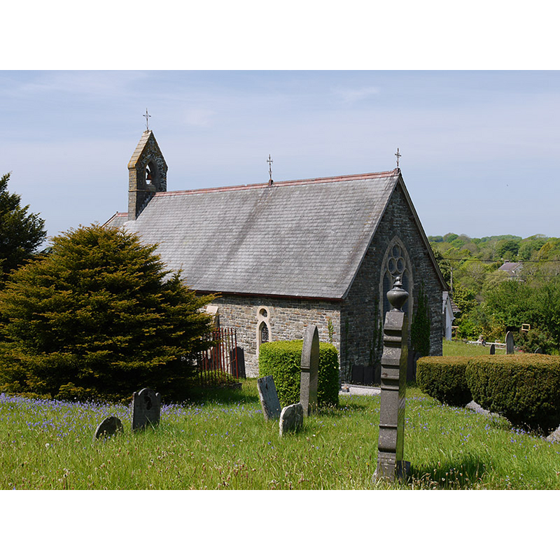
Image copyright © Nigel Brown, 2010
CC-BY-SA-2.0
Results: 1 records
view of church exterior in context - southeast view
Scene Description: present church is a lete-19thC re-building of a pre-1833 re-building of an earlier church [cf. FontNotes]
Copyright Statement: Image copyright © Nigel Brown, 2010
Image Source: digital photograph taken 25 May 2010 by Nigel Brown [www.geograph.org.uk/photo/1877941] [accessed 5 January 2020]
Copyright Instructions: CC-BY-SA-2.0
INFORMATION
Font ID: 22537CIL
Object Type: Baptismal Font1
Font Century and Period/Style: [composite]
Church / Chapel Name: Parish Church of the Holy Trinity / Eglwys Cilcennin
Font Location in Church: [reported in the porch ca. 1906 and 1914]
Church Patron Saint(s): The Holy Trinity
Church Notes: earlier church may have been dedicated to St. Cennin [aka St. Cenwyn / Cannen]
Church Address: Cilcennin, Lampeter SA48 8RF, UK
Site Location: Ceredigion, Wales, United Kingdom
Directions to Site: Located 4-5 km ESE of Aberaeron, 10 km NNW of Newcastle, about 30 km NE of Cardigan
Ecclesiastic Region: Diocese of St. Davids
Historical Region: Hundred of Ilar -- formerly Cardiganshire
Additional Comments: disused font? / disappeared font? (reported in the porch ca. 1906 and 1914)
Font Notes:
Click to view
Evans (1914) notes a modern font in this church, but reports that "the square bowl of the ancient one rests in the porch." The entry for this church in COFLEIN [www.coflein.gov.uk/en/site/400416/details/holy-trinity-church-cilcennin] [accessed 5 January 2020] notes: "The church is known to have existed in 1684 [...] a single-celled stucture with a plain, square-headed doorway, two plain windows and a west single bellcote [...] entirely rebuilt in the early nineteenth century (before 1833) on the same site and in the same location as its predecessor, but retaining nothing from the earlier fabric. [...] again substantially rebuilt in 1889-1891 [...] A possible medieval font bowl was noted, lying loose in the porch, in 1906."
COORDINATES
UTM: 30U 420266 5786154
Latitude & Longitude (Decimal): 52.22004, -4.1672
Latitude & Longitude (DMS): 52° 13′ 12.14″ N, 4° 10′ 1.92″ W
MEDIUM AND MEASUREMENTS
Material: stone
Font Shape: square
Basin Exterior Shape: square
REFERENCES
- Evans, J.T., The Church Plate of Cardiganshire, Stow-in-the-Wold: James H. Halden, 1914, p. 20