Marienthal in Ostritz

Image copyright © Peter Seifert, 2019
GFDL / CC-BY-3.0
Results: 3 records
view of church exterior
Scene Description: the Baroque church
Copyright Statement: Image copyright © Peter Seifert, 2019
Image Source: digital photograph taken 25 May 2019 by Peter Seifert [https://commons.wikimedia.org/wiki/File:Kloster_st_marienthal_ostritz_DE.jpg] [accessed 4 January 2020]
Copyright Instructions: GFDL / CC-BY-3.0
view of church exterior in context
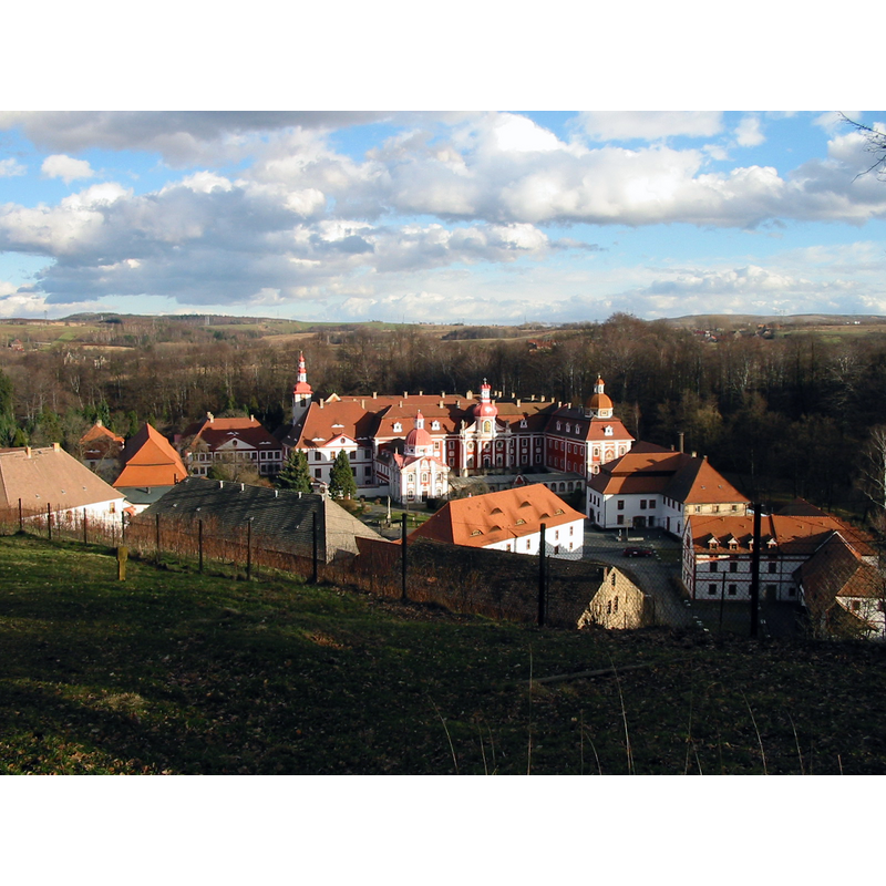
Scene Description: the abbey complex
Copyright Statement: Image copyright © [in the public domain]
Image Source: digital photograph taken 27 February 2002 by Wurzelgnohm [https://commons.wikimedia.org/wiki/File:St._Marienthal_Abbey.jpg] [accessed 4 January 2020]
Copyright Instructions: CC-Zero
view of church interior - detail
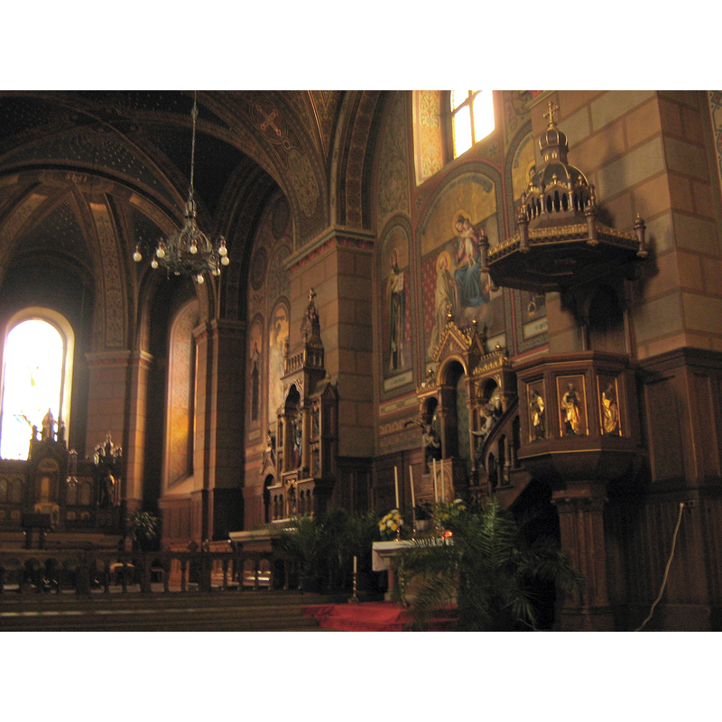
Scene Description: the interior of the Baroque church
Copyright Statement: Image copyright © [in the public domain]
Image Source: digital photograph taken 6 April 2007 by Botaurus [https://commons.wikimedia.org/wiki/File:Kloster-St.-Marienthal-06.IV.07-0183.jpg] [accessed 4 January 2020]
Copyright Instructions: PD-user
INFORMATION
Font ID: 22534MAR
Object Type: Baptismal Font1?
Font Date: ca. 1234?
Font Century and Period/Style: 13th century, Medieval
Church / Chapel Name: Zisterzienserinnenabtei Klosterstift St. Marienthal
Font Location in Church: [disappeared]
Church Notes: abbey founded 1234; Cistercian by 1235; destroyed 1427; re-built 1452; damaged by fires and floods several times; re-built 1685; repaired and restored 19th and 20thC
Church Address: Klosterstraße, Marienthal, 02899 Ostritz, Germany
Site Location: Görlitz, Sachsen, Germany, Europe
Directions to Site: Located between Bundestrasse 90 (W) and the Lusatian Neisse, which is the German-Polish border, about 1 km SSW of Ostritz, about 20 km S of Görlitz
Historical Region: Oberlausitz / Łužica / Łużyce Górne
Additional Comments: disappeared font? (the one from the 13thC abbey church here)
Font Notes:
Click to view
[NB: we have no information on the font from the medieval abbey church here]
COORDINATES
UTM: 33U 494712 5649602
Latitude & Longitude (Decimal): 50.997971, 14.924648
Latitude & Longitude (DMS): 50° 59′ 52.7″ N, 14° 55′ 28.73″ E