Warthill / Wradille / Wardhilla / Wartheill / Warthull / Wathell / Wharthell
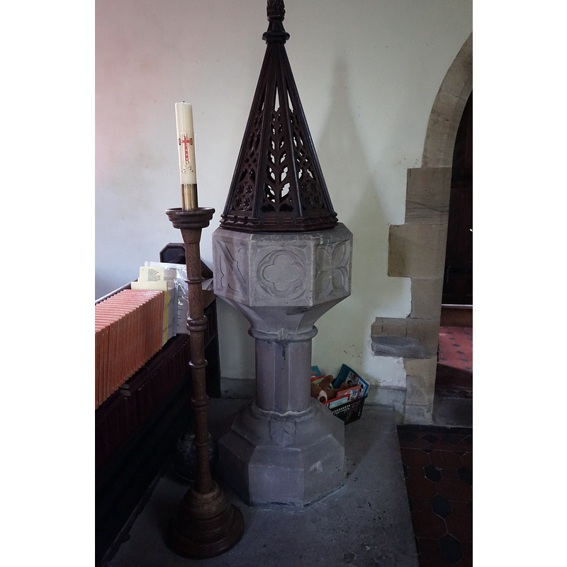
Image copyright © Ian S, 2017
CC-BY-SA-2.0
Results: 4 records
view of font and cover
Scene Description: the modern font by the entranceway
Copyright Statement: Image copyright © Ian S, 2017
Image Source: digital photograph taken 10 August 2017 by Ian S [www.geograph.org.uk/photo/5495389] [accessed 16 December 2019]
Copyright Instructions: CC-BY-SA-2.0
view of church exterior in context - southeast view
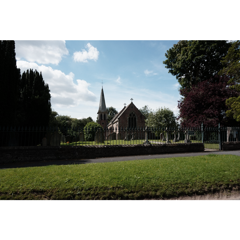
Scene Description: the 19thC church
Copyright Statement: Image copyright © Ian S, 2017
Image Source: digital photograph taken 10 August 2017 by Ian S [www.geograph.org.uk/photo/5495377] [accessed 16 December 2019]
Copyright Instructions: CC-BY-SA-2.0
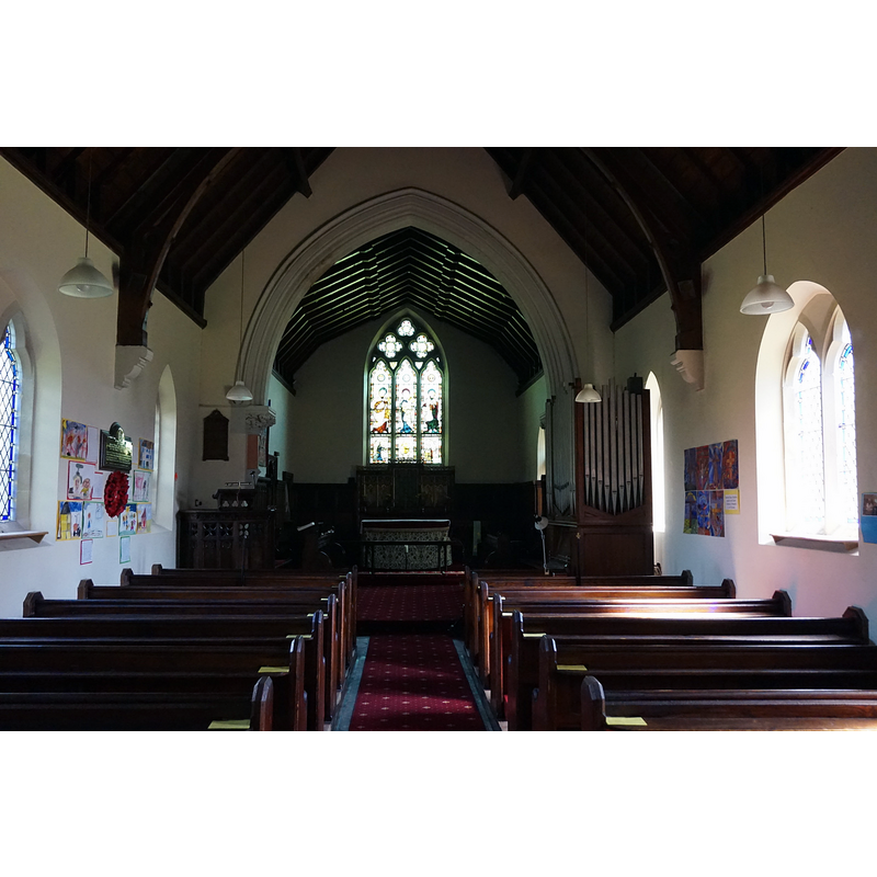
view of church interior - looking west
![the modern font and its cover is visible at the far [west] end, left [south] side by the entranceway](/static-50478a99ec6f36a15d6234548c59f63da52304e5/compressed/1191219015_compressed.png)
Scene Description: the modern font and its cover is visible at the far [west] end, left [south] side by the entranceway
Copyright Statement: Image copyright © Ian S, 2017
Image Source: digital photograph taken 10 August 2017 by Ian S [www.geograph.org.uk/photo/5495793] [accessed 16 December 2019]
Copyright Instructions: CC-BY-SA-2.0
view of church interior - looking east
Copyright Statement: Image copyright © Ian S, 2017
Image Source: digital photograph taken 10 August 2017 by Ian S [www.geograph.org.uk/photo/5495394] [accessed 16 December 2019]
Copyright Instructions: CC-BY-SA-2.0
INFORMATION
Font ID: 22480WAR
Object Type: Baptismal Font1?
Font Century and Period/Style: 13th - 14th century, Medieval
Church / Chapel Name: Parish Church of St. Mary
Font Location in Church: [disappeared]
Church Patron Saint(s): St. Mary the Virgin
Church Address: 2 Woodlands, Warthill, York YO19 5XN, UK -- Tel.: +44 1904 489349
Site Location: North Yorkshire, Yorkshire and the Humber, England, United Kingdom
Directions to Site: Located N of the A166, 10 km NE of York, 23 km SW of Malton
Ecclesiastic Region: Diocese of York
Historical Region: Hundred of Bulford
Additional Comments: disappeared font? (the one from the pre-1330 church here; the present font is modern)
Font Notes:
Click to view
There are two entries for Warthill [variant spellings] in the Domesday survey [https://opendomesday.org/place/SE6755/warthill/] [accessed 16 December 2019] neither of which mentions cleric or church in it. The entry for this parish in George Lawton's Collectio rerun eclesiasticarum de Dioecesi Eboracensi (London: J.G. and F. Rivington, 1842: 471) quotes Torre: "Torre says The Prebendary is Rector, and hath the tithes, for which he shall find a Chaplain. No endowment. There have been Vicars earlier than 1330." The entry for this parish in the Victoria County History (York North Riding, vol. 2, 1923) notes: "At what date the vicarage was ordained is not known, [...] but it was valued at 60s. 8d. in 1535 [...] The church of ST. MARY is a small modern building consisting of a chancel, nave and tower on the south side, forming a porch. The ancient church was pulled down in 1787 and a brick building substituted by Robert Bowes. The present structure was begun in 1873".
COORDINATES
UTM: 30U 633027 5984192
Latitude & Longitude (Decimal): 53.9889, -0.971
Latitude & Longitude (DMS): 53° 59′ 20.04″ N, 0° 58′ 15.6″ W
REFERENCES
- Victoria County History [online], University of London, 1993-. URL: https://www.british-history.ac.uk.