Terrington / Teurinctine / Teurinctun / Teurinctune / Teurinton / Teurintone / Tyverington
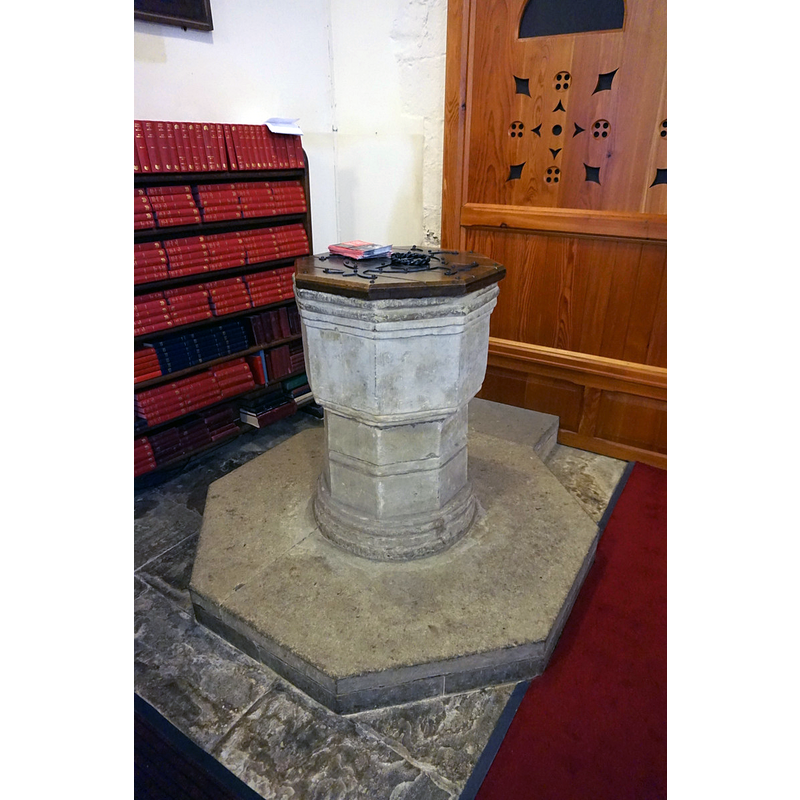
Image copyright © Ian S, 2017
CC-BY-SA-2.0
Results: 3 records
view of font and cover in context
Scene Description: the 15thC font cleaned up and moved here in the 1860s restoration; the plinth and the font cover are probably of that date
Copyright Statement: Image copyright © Ian S, 2017
Image Source: digital photograph taken 26 May 2017 by Ian S [www.geograph.org.uk/photo/5420000] [accessed 16 December 2019]
Copyright Instructions: CC-BY-SA-2.0
view of church exterior - southwest view
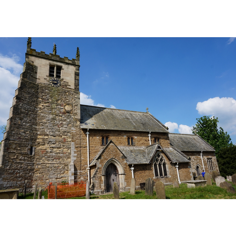
Copyright Statement: Image copyright © Ian S, 2017
Image Source: digital photograph taken 26 May 2017 by Ian S [www.geograph.org.uk/photo/5419965] [accessed 16 December 2019]
Copyright Instructions: CC-BY-SA-2.0
view of church interior - looking east
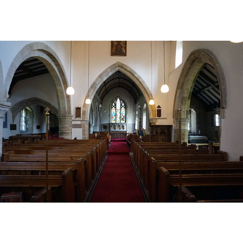
Copyright Statement: Image copyright © Ian S, 2017
Image Source: digital photograph taken 26 May 2017 by Ian S [www.geograph.org.uk/photo/5419966] [accessed 16 December 2019]
Copyright Instructions: CC-BY-SA-2.0
INFORMATION
Font ID: 22478TER
Object Type: Baptismal Font1
Font Century and Period/Style: 15th century, Perpendicular
Church / Chapel Name: Parish Church of All Saints
Font Location in Church: Inside the church [in its present location since 1860s]
Church Patron Saint(s): All Saints
Church Address: Church Ln, Terrington, York YO60 6PS, UK
Site Location: North Yorkshire, Yorkshire and the Humber, England, United Kingdom
Directions to Site: Located N of the A64, 7 km W of Malton, about 20 km NE of York city centre
Ecclesiastic Region: Diocese of York
Historical Region: Hundred of Bulford
Additional Comments: disappeared font? (the one from the Domesday-time church here)
Font Notes:
Click to view
There are four entries [two are multiple-place] for this Terrington [variant spellings] in the Domesday survey [https://opendomesday.org/place/SE6770/terrington/] [accessed 16 December 2019] one of which reports a church in it. The entry for this parish in the Victoria County History (York North Riding, vol. 2, 1923) notes: "The earliest remaining work in the church is the western portion of the south nave wall, which may be pre-Conquest and cannot be later than the 11th century. Late in the 12th century the nave was mostly rebuilt [...] The font dates from the 15th century and is octagonal [...] The church of All Saints lies off the road, east of the village". There is no mention of a font in it in the entry for this church in Historic England [Listing NGR: SE6719370769].
COORDINATES
UTM: 30U 632478 5999610
Latitude & Longitude (Decimal): 54.127529, -0.97263
Latitude & Longitude (DMS): 54° 7′ 39.1″ N, 0° 58′ 21.47″ W
MEDIUM AND MEASUREMENTS
Material: stone
Font Shape: octagonal, mounted
Basin Interior Shape: round
Basin Exterior Shape: octagonal
LID INFORMATION
Date: modern
Material: wood, oak?
Apparatus: no
Notes: octagonal and flat, with metal decoration and ring handle
REFERENCES
- Victoria County History [online], University of London, 1993-. URL: https://www.british-history.ac.uk.