Strenshall / Stranessale / Strencham / Strencile / Strenshale / Streonaeshalch / Trencham
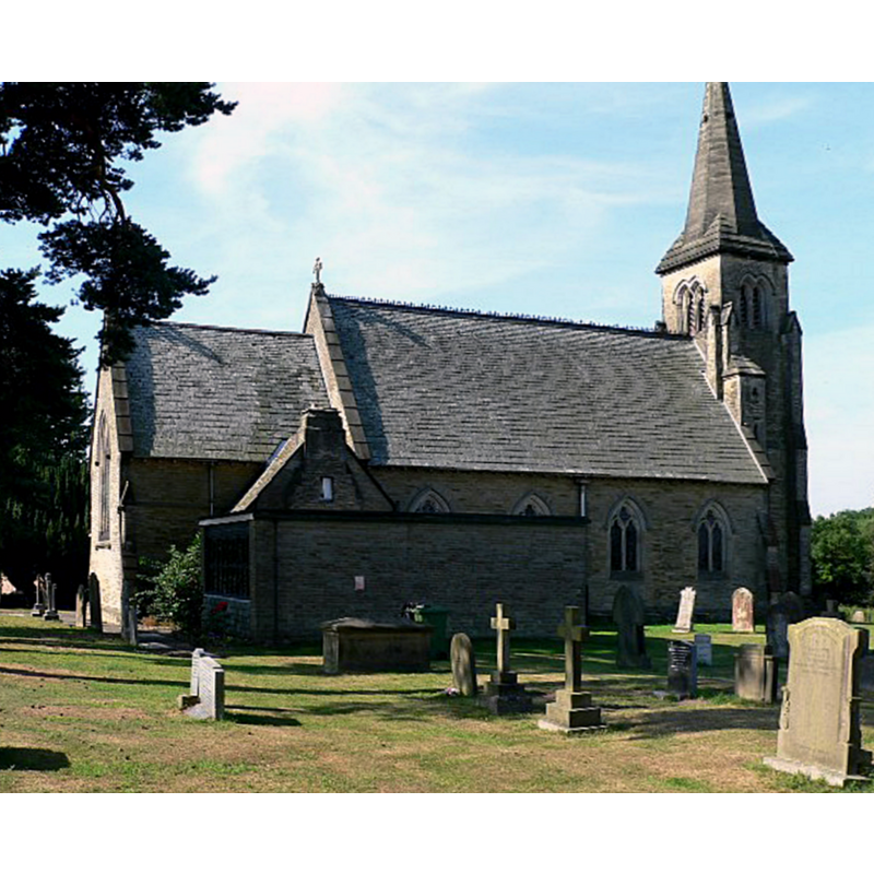
Image copyright © Gilbertson, 2006
CC-BY-SA-2.0
Results: 2 records
view of church exterior - northeast view
Copyright Statement: Image copyright © Gilbertson, 2006
Image Source: edited detail of a digital photograph taken 25 July 2006 by Roger Gilbertson [www.geograph.org.uk/photo/208924] [accessed 12 December 2019]
Copyright Instructions: CC-BY-SA-2.0
view of church exterior - southeast view
!["The ancient church was destroyed about 1798 or 1800, when a brick building was erected on its site, which in turn gave place to the present structure" [cf. VCH in FootNotes]](/static-50478a99ec6f36a15d6234548c59f63da52304e5/compressed/1191220003_compressed.png)
Scene Description: "The ancient church was destroyed about 1798 or 1800, when a brick building was erected on its site, which in turn gave place to the present structure" [cf. VCH in FootNotes]
Copyright Statement: Image copyright © Gordon Hatton, 2009
Image Source: digital photograph taken 21 January 2009 by Gordon Hatton [www.geograph.org.uk/photo/1130345] [accessed 16 December 2019]
Copyright Instructions: CC-BY-SA-2.0
INFORMATION
Font ID: 22477STR
Object Type: Baptismal Font1?
Font Century and Period/Style: 14th century (early?), Decorated
Church / Chapel Name: Parish Church of St. Mary [formerly St James']
Font Location in Church: [disappeared]
Church Patron Saint(s): St. Mary the Virgin [earlier dedication St. James]
Church Address: Church Ln, Strensall, York YO32 5XU, UK -- Tel.: +44 1904 490683
Site Location: North Yorkshire, Yorkshire and the Humber, England, United Kingdom
Directions to Site: Located N of the A1237 [York Ring Rd], 12-14 km NNE of York city centre
Ecclesiastic Region: Diocese of York
Historical Region: Hundred of Bulford
Additional Comments: disappeared font? (the one from the church here documented in 1314)
Font Notes:
Click to view
There is an entry for Strenshall [variant spelling] in the Domesday survey [https://opendomesday.org/place/SE6360/strensall/] [accessed 16 December 2019] but it mentions neither cleric nor church in it. The entry for this parish in the Victoria County History (York North Riding, vol. 2, 1923) notes; "The church is said to have been appropriated to the prebend in 1314, when a vicarage was ordained [...] The church of ST. MARY is a modern building consisting of an aisleless nave and chancel, with a western tower and south porch. The ancient church was destroyed about 1798 or 1800, when a brick building was erected on its site, which in turn gave place to the present structure"; no font mentioned in it. There is no mention of a font either in the entry for this church in Historic England [Listing NGR: SE6299460754].
COORDINATES
Latitude & Longitude (DMS): 54° 2′ 20″ N, 1° 2′ 20″ W
REFERENCES
- Victoria County History [online], University of London, 1993-. URL: https://www.british-history.ac.uk.