South Otterington / Ostrinctune / Otrintona / Otterinctune / South Ottrington / Southottryngton
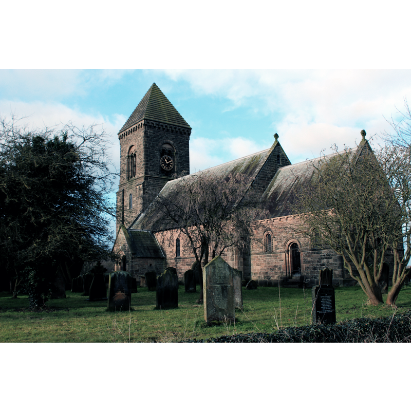
Image copyright © Chris Heaton, 2018
CC-BY-SA-2.0
Results: 2 records
view of church exterior - southeast view
Scene Description: Source caption: "St. Andrew's Church, South Otterington. Rather unattractive Early Victorian Church"
Copyright Statement: Image copyright © Chris Heaton, 2018
Image Source: digital photograph taken 1 January 2018 by Chris Heaton [www.geograph.org.uk/photo/5642753] [accessed 5 December 2019]
Copyright Instructions: CC-BY-SA-2.0
view of church exterior - northeast view
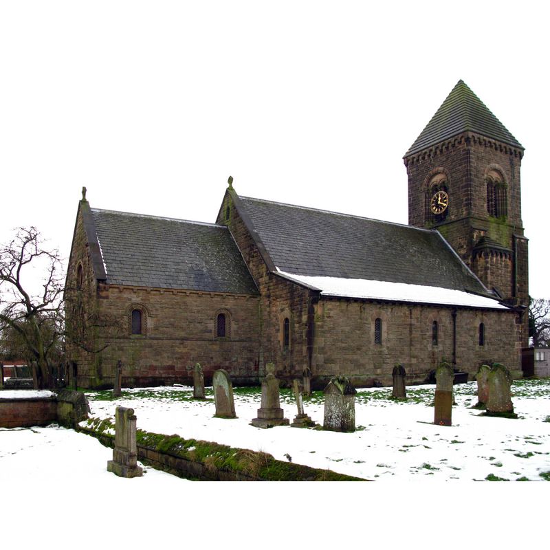
Scene Description: Source caption: "St Andrews Parish Church. Rebuilt in 1846 on the site of a late Norman structure."
Copyright Statement: Image copyright © David Rogers, 2010
Image Source: digital photograph taken 11 January 2010 by David Rogers [www.geograph.org.uk/photo/1660505] [accessed 5 December 2019]
Copyright Instructions: CC-BY-SA-2.0
INFORMATION
Font ID: 22458OTT
Object Type: Baptismal Font1
Church / Chapel Name: Parish Church of St. Andrew
Font Location in Church: [moved to North Otterington]
Church Notes: Norman or pre-Conquest church; modified 17thC; re-built mid-19thC
Church Address: Newby Wiske Rd, South Otterington, Northallerton DL7 9HD, UK -- Tel.: +44 1609 773758
Site Location: North Yorkshire, Yorkshire and the Humber, England, United Kingdom
Directions to Site: Located off the A167, 8 km S of Northallerton, on the E bank of the Wiske river
Ecclesiastic Region: Diocese of York
Historical Region: Hundred of Allerton
Additional Comments: moved font [cf. BSI entry for North Otterington]
Font Notes:
Click to view
[cf. BSI entry for North Otterington where the font from South Otterington was moved] There is an entry for [South] Otterington [variant spelling] in the Domesday survey [https://opendomesday.org/place/SE3787/south-otterington/] [accessed 5 December 2019] but it mentions neither cleric nor church in it. The entry for this parish in the Victoria County History (York North Riding, vol. 2, 1923) notes: "The church of ST. ANDREW [...] is an entirely modern building of stone in the Norman style and was erected in 1846"; it does not mention a previous church here. The entry for the modern church in Historic England [Listing NGR: SE3713287569] notes: "Church. 1847"; no font mentioned in it. The entry for this church in the Church of England A Church Near You [www.achurchnearyou.com/church/19398/find-us/] [accessed 5 December 2019] notes; "This church is the third church on the site. In the 19th Century the church was a plain Norman structure with the tower being constructed from the stones of an earlier church. The main features of the early church were its unmoulded round tower and chancel arches. The nave walls were thought to have been rebuilt in the reign of King Charles II. The earliest register was recorded from 1689. [...] In 1844 with the church in a “dangerous and ruinous state” and wholly inadequate to accommodate the increasing population, permission was given to pull down, rebuild and enlarge the existing building. [...] The current building was built in 1846 in the Norman style".
COORDINATES
UTM: 30U 602140 6016056
Latitude & Longitude (Decimal): 54.2822, -1.4311
Latitude & Longitude (DMS): 54° 16′ 55.92″ N, 1° 25′ 51.96″ W
REFERENCES
- Victoria County History [online], University of London, 1993-. URL: https://www.british-history.ac.uk.