Normanby / Normanby in Pickering Lythe / Normanebi / Normanton / Northmanby
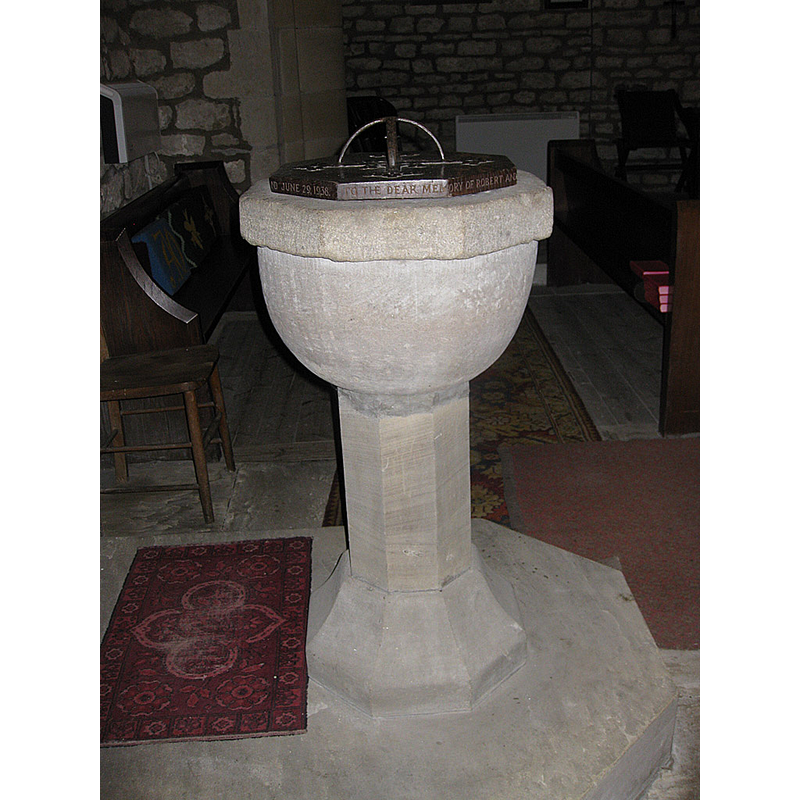
Image copyright © Pauline E, 2011
CC-BY-SA-2.0
Results: 6 records
view of font and cover - south side
Scene Description: Source caption: "Font, St Andrew's Church, Normanby. An eight-sided stone font, which is thought to date from the 1894 restoration, stands on a modern pedestal." [NB: the VCH entry describes the basin as old, and Historic England as 17thC [cf. FontNotes]]
Copyright Statement: Image copyright © Pauline E, 2011
Image Source: digital photograph taken 18 January 2011 by Pauline E [www.geograph.org.uk/photo/2240372] [accessed 3 December 2019]
Copyright Instructions: CC-BY-SA-2.0
design element - motifs - flat moulding
Copyright Statement: Image copyright © Pauline E, 2011
Image Source: digital photograph taken 18 January 2011 by Pauline E [www.geograph.org.uk/photo/2240372] [accessed 3 December 2019]
Copyright Instructions: CC-BY-SA-2.0
view of church exterior - south portal
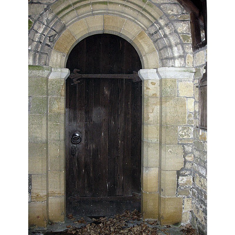
Scene Description: Source caption: "Norman style doorway, St Andrew's. Showing much restoration."
Copyright Statement: Image copyright © Pauline E, 2011
Image Source: digital photograph taken 18 January 2011 by Pauline E [www.geograph.org.uk/photo/2240381] [accessed 3 December 2019]
Copyright Instructions: CC-BY-SA-2.0
view of church exterior - northwest view
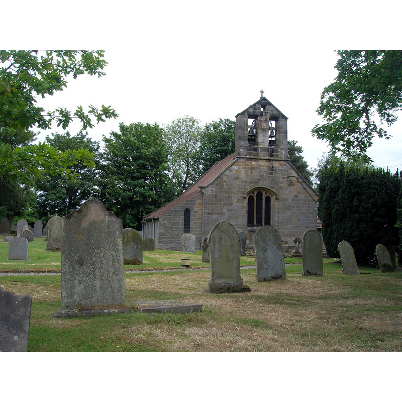
Copyright Statement: Image copyright © JThomas, 2011
Image Source: digital photograph taken 10 June 2011 by JThomas [www.geograph.org.uk/photo/2453460] [accessed 3 December 2019]
Copyright Instructions: CC-BY-SA-2.0
view of church exterior - southeast view
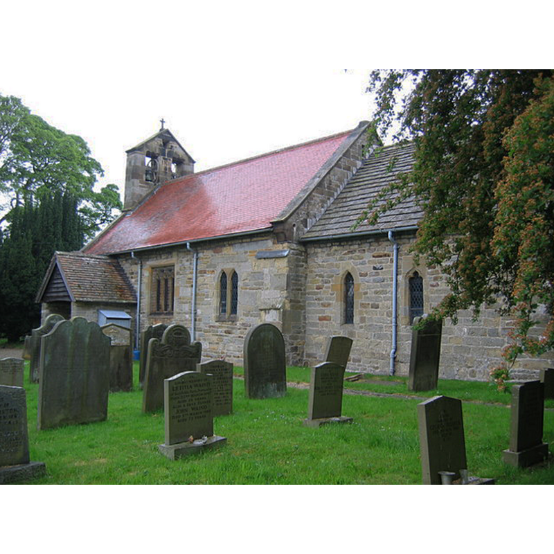
Copyright Statement: Image copyright © Stephen Horncastle, 2006
Image Source: digital photograph taken 12 June 2006 by Stephen Horncastle [www.geograph.org.uk/photo/185991] [accessed 3 December 2019]
Copyright Instructions: CC-BY-SA-2.0
view of church interior - looking east
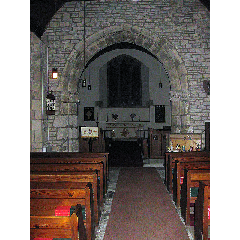
Scene Description: Source caption: "Chancel arch, St Andrew's, Normanby. Rebuilt in 1894 and off centre with the nave. The nave dates from the 12th century."
Copyright Statement: Image copyright © Pauline E, 2011
Image Source: digital photograph taken 18 January 2011 by Pauline E [www.geograph.org.uk/photo/2240349] [accessed 3 December 2019]
Copyright Instructions: CC-BY-SA-2.0
INFORMATION
Font ID: 22455NOR
Object Type: Baptismal Font1
Font Century and Period/Style: 17th century[basin only] [composite font], Baroque [composite]
Church / Chapel Name: Parish Church of St. Andrew
Font Location in Church: Inside the church
Church Patron Saint(s): St. Andrew
Church Address: Malton Rd, Normanby, York YO62 6RH, UK -- Tel.: +44 1751 476686
Site Location: North Yorkshire, Yorkshire and the Humber, England, United Kingdom
Directions to Site: Located S of the A170, 8-10 SW of Pickering, 30-35 km W of Scarborough
Ecclesiastic Region: Diocese of York
Historical Region: Hundred of Maneshou
Additional Comments: altered font (17thC(?) basin on a on a modern base) / re-cycled font from a poorbox [cf. FontNotes] -- disappeared font? (the one from the 12thC church here)
Font Notes:
Click to view
There are two entries [one is multiple-place] for this Normanby [variant spelling] in the Domesday survey [https://opendomesday.org/place/SE7381/normanby/] [accessed 3 December 2019] neither of which mentions cleric or church in it. The entry for this parish in the Victoria County History (York North Riding, vol. 1, 1914) notes: "The whole church, which is built of coursed rubble with tiled roofs, has been much restored, and is said to have been rebuilt in 1718, but the plan of the nave probably dates from the 12th century, and the chancel may be in part of the same date, but was widened to the north late in the 14th century. [...] At the west end of the nave is an old stone basin on a modern stem, now used as a font. Near the south door is a turned wooden baluster, now used as a poor-box. The head of this is hollow and lined with lead, and it was used until recently as a font." The entry for this church in Historic England [Listing NGR: SE7348181656] notes: "Church. Mid C12 arcade; chancel arch c1300, partly rebuilt 1894; rebuilt 1718; restoration, and chancel rebuilt, 1893-95 [...] C17 octagonal font on C19 pedestal. "
COORDINATES
UTM: 30U 638581 6010691
Latitude & Longitude (Decimal): 54.22544, -0.8742
Latitude & Longitude (DMS): 54° 13′ 31.58″ N, 0° 52′ 27.12″ W
MEDIUM AND MEASUREMENTS
Material: stone, limestone?
Font Shape: octagonal, mounted
Basin Interior Shape: round
Basin Exterior Shape: octagonal
LID INFORMATION
Date: modern
Material: wood, oak?
Apparatus: no
Notes: octagonal and flat, with metal decoration and handle/finial; inscription around the sides; modern
REFERENCES
- Victoria County History [online], University of London, 1993-. URL: https://www.british-history.ac.uk.