Barton nr. Richmond / Bartun
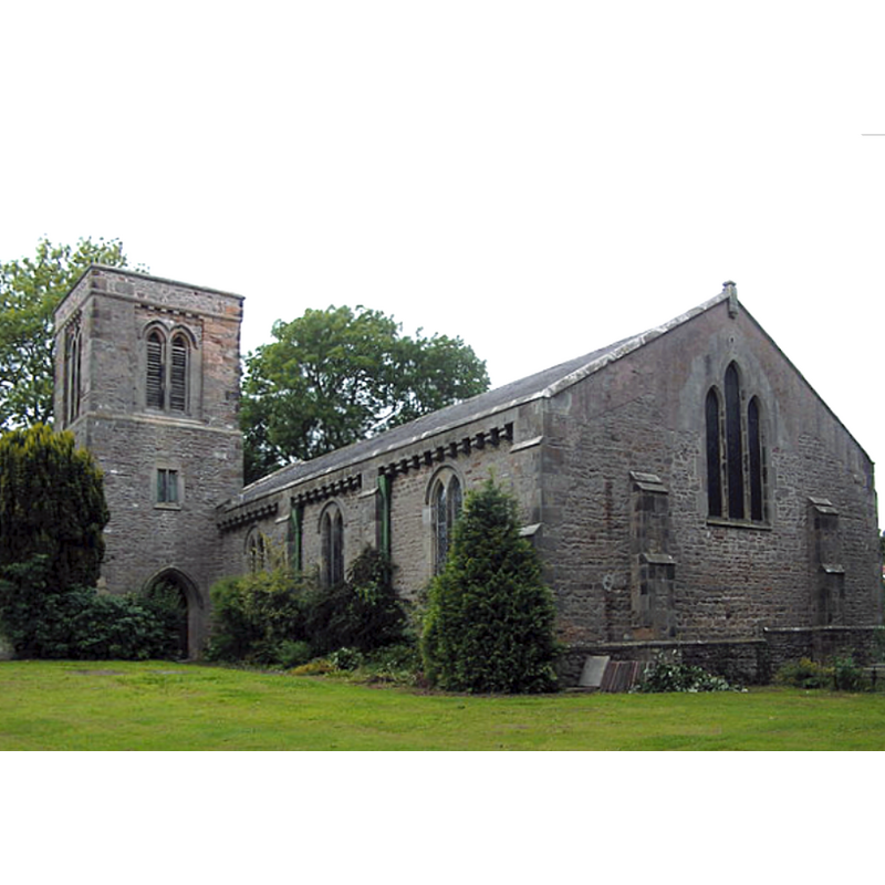
Image copyright © Hugh Mortimer, 2006
CC-BY-SA-2.0
Results: 1 records
view of church exterior - southeast view
Copyright Statement: Image copyright © Hugh Mortimer, 2006
Image Source: edited detail of a digital photograph taken14 August 2006 by Hugh Mortimer [www.geograph.org.uk/photo/219182] [accessed 13 November 2019]
Copyright Instructions: CC-BY-SA-2.0
INFORMATION
Font ID: 22442BAR
Object Type: Baptismal Font1
Church / Chapel Name: Parish Church of St. Cuthbert and St. Mary [originally from the ruins St. Mary's]
Font Location in Church: [disappeared]
Church Patron Saint(s): St. Cuthbert [aka Cubertus] & St. Mary
Church Notes: originally two separate medieval chapels dedicated correspondingly to each May and Cuthbert [cf. FontNotes]
Church Address: Church Ln, Barton, Richmond DL10, UK -- Tel.: +44 1325 377918
Site Location: North Yorkshire, Yorkshire and the Humber, England, United Kingdom
Directions to Site: Located off the A6055, just E of the A1(M), 10 km SW of Darlington, 11-12 km NE of Richmond, near the county border with Durham
Ecclesiastic Region: Diocese of Leeds
Historical Region: Hundred of Land of Count Alan
Additional Comments: re-cycled font (originally from St Mary's old chapel, moved to the re-built church)
Font Notes:
Click to view
There is a multiple-plece entry for this Barton [variant spelling] in the Domesday survey [https://opendomesday.org/place/NZ2308/barton/] [accessed 13 November 2019]; it reports two churches in it. The entry for this parish in the Victoria County History (York North Riding, vol. 1, 1914) notes; "In the 13th century there were two chapels in Barton; that of St. Mary was dependent on the mother church of Gilling and as such was confirmed to the abbey of St. Mary, York, in 1396; the chapel of St. Cuthbert was attached to the church of Stanwick St. John, which until 1228 was in the possession of St. Agatha's Abbey. [...] Of the two chapels St. Mary's was the first to fall into decay, its condition being such by the time of Bishop Pearson (1673—86) [...] that it ceased to be used for divine service. [...] St. Cuthbert's was in decay in the early 19th century and a church unde[r] the double invocation was built in 1840. [...] The church of ST. CUTHBERT [...] was built in 1840 to replace an older one, which had a chancel, nave with south porch and west tower. Architecturally it is of no interest [...] A plain circular font, on a round stem, mediaeval but of uncertain date, has recently been recovered near the ruined church of St. Mary and set up here at the west end of the nave, the modern font formerly in the church being at present in the churchyard near the entrance doorway. [...] The church of ST. MARY before 1840 had a chancel, nave and south porch, but in that year all except the chancel was pulled down and a small west porch added to it with the intention of using it as a mortuary chapel; it is now [i.e., ca. 1914] ruinous and overgrown with ivy". The entry for this church in Historic England [Listing NGR: NZ2305608964] notes: "Church. Rebuilt 1840-1 [...] Font: Romanesque; squat circular bowl, on short stem on chamfered
base, brought from the site of St Mary's Church."
base, brought from the site of St Mary's Church."
COORDINATES
UTM: 30U 587790 6037166
Latitude & Longitude (Decimal): 54.4755, -1.6457
Latitude & Longitude (DMS): 54° 28' 31" N, 1° 38' 44" W
MEDIUM AND MEASUREMENTS
Material: stone
Font Shape: cauldron-shaped, mounted
Basin Interior Shape: round
Basin Exterior Shape: round
REFERENCES
- Victoria County History [online], University of London, 1993-. URL: https://www.british-history.ac.uk.