Koln-Rheinkassel / Köln-Rheinkassel / Rheinkassel [disappeared?]
![Main image for Koln-Rheinkassel / Köln-Rheinkassel / Rheinkassel [disappeared?]](/static-50478a99ec6f36a15d6234548c59f63da52304e5/compressed/1191110017_compressed.png)
Image copyright © Elke Wetzig (Elya), 2009
GFDL / CC-BY-SA-3.0,2.5,2.0,1.0
Results: 5 records
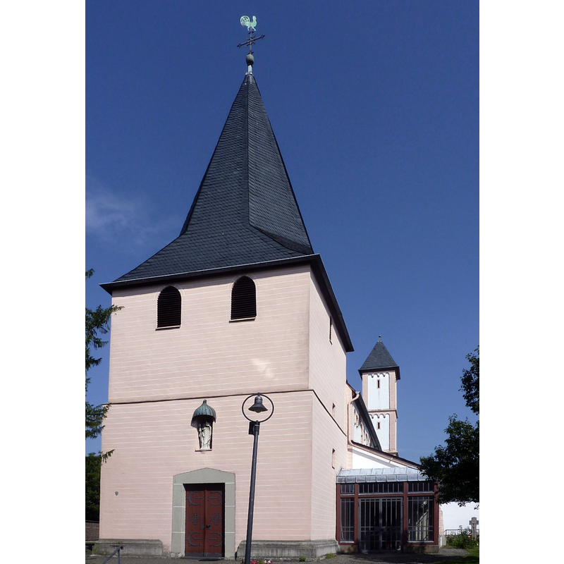
view of church exterior in context - southwest view
Scene Description: Source caption: "Köln-Rheinkassel Dorfplatz, Mitte St.-Amandus-Kirche, rechts und Links Teile der Amandus-Siedlung von Gottfried Böhm"
Copyright Statement: Image copyright © Elke Wetzig (Elya), 2009
Image Source: digital photograph taken 15 February 2009 by Elke Wetzig (Elya)
Copyright Instructions: GFDL / CC-BY-SA-3.0,2.5,2.0,1.0
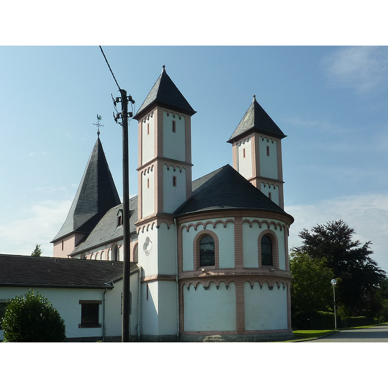
view of church exterior - southwest view
Copyright Statement: Image copyright © [in the public domain]
Image Source: edited detail of a digital photograph taken 10 September 2015 by Chris06 [https://commons.wikimedia.org/wiki/File:St._Amandus_(Köln-Rheinkassel)_(4).JPG] [accessed 10 November 2019]
Copyright Instructions: CC-Zero
view of church exterior - southeast view
Copyright Statement: Image copyright © [in the public domain]
Image Source: digital photograph taken 10 September 2015 by Chris06 [https://commons.wikimedia.org/wiki/File:St._Amandus_(Köln-Rheinkassel)_(9).JPG] [accessed 10 November 2019]
Copyright Instructions: CC-Zero
view of church exterior in context - northeast view
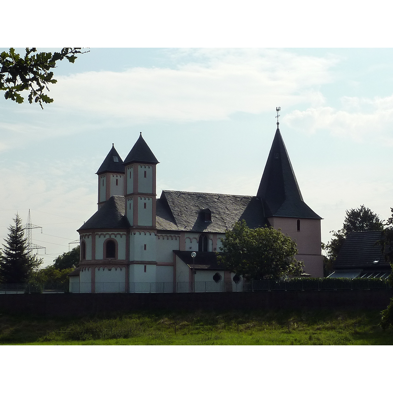
Copyright Statement: Image copyright © [in the public domain]
Image Source: digital photograph taken 10 September 2015 by Chris06 [https://commons.wikimedia.org/wiki/File:St._Amandus_(Köln-Rheinkassel)_(3).JPG] [accessed 10 November 2019]
Copyright Instructions: CC-Zero
view of church interior - looking east
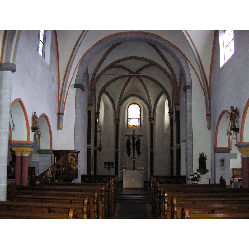
Copyright Statement: Image copyright © [in the public domain]
Image Source: digital photograph taken in September 2008 by Chris06 [https://commons.wikimedia.org/wiki/File:Rheinkassel_Amandus1.JPG] [accessed 10 November 2019]
Copyright Instructions: PD-self
INFORMATION
Font ID: 22438RHE
Object Type: Baptismal Font1?
Font Century and Period/Style: 11th - 12th century, Romanesque
Church / Chapel Name: Römisch-katholische Pfarrkirche St. Amandus von Köln-Rheinkassel
Font Location in Church: [disappeared]
Church Patron Saint(s): St. Amand [aka Amandus]
Church Notes: wooden church probably 10thC; re-built in stone 11thC; first documented 1156; modified 12thC; tower ca. 1200, shortened ca. 1700; church modified 13thC; again 17thC; new baptistery late-1920s; restored 1980s
Church Address: Amandusstraße 2, Köln-Rheinkassel, 50769 Köln, Germany -- Tel.: +49 221 782322
Site Location: Köln, Nordrhein-Westfalen, Germany, Europe
Directions to Site: Located off (W) the Kasselberge Weg, on the W bank of the Rhein, just N of the Leberkusener bridge, in the N suburbs of Cologne
Ecclesiastic Region: Erzbistum Köln
Additional Comments: disappeared font? (the one from the 11th-12thC church here)
Font Notes:
Click to view
[NB: we have no information on the font of the medieval church here].
COORDINATES
UTM: 32U 355312 5656400
Latitude & Longitude (Decimal): 51.040905, 6.936123
Latitude & Longitude (DMS): 51° 2′ 27.26″ N, 6° 56′ 10.04″ E