Barningham / Bernincheham / Beringham / Berningham
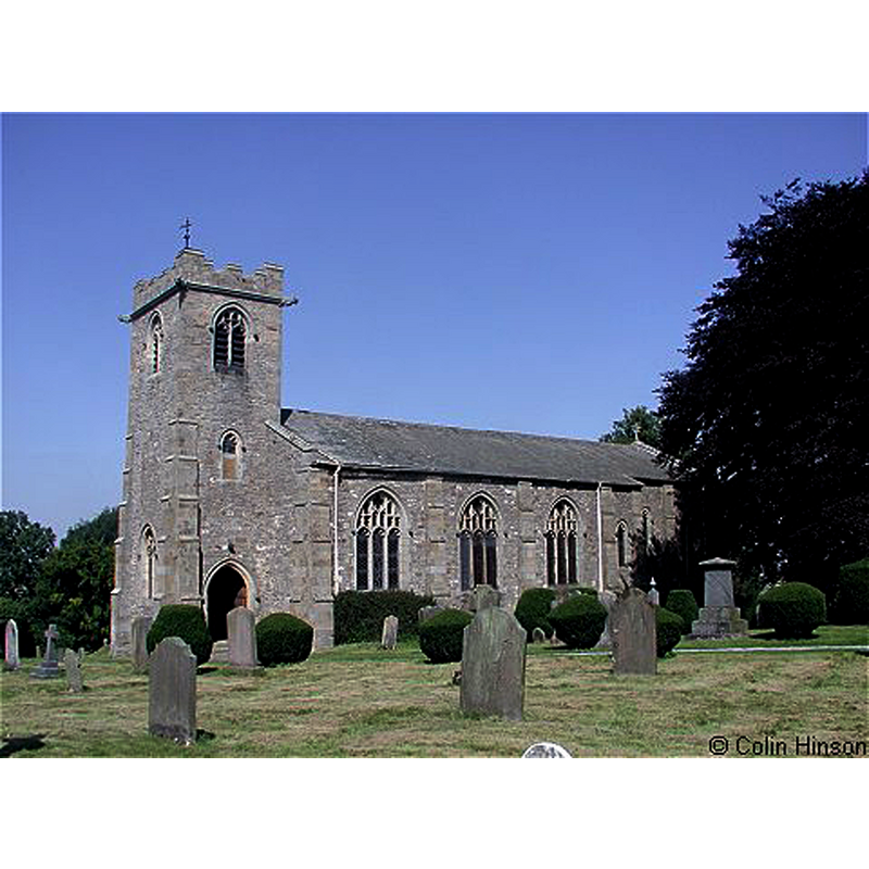
Image copyright © Colin Hinson, 2019
Standing permission
Results: 1 records
view of church exterior - southwest view
Scene Description: the modern church that replaced its 12thC predecessor
Copyright Statement: Image copyright © Colin Hinson, 2019
Image Source: digital photograph taken by Colin Hinson [www.genuki.org.uk/big/eng/YKS/NRY/Barningham/PhotoFrames/BarninghamStMichaelAndAA_1] [accessed 8 November 2019]
Copyright Instructions: Standing permission
INFORMATION
Font ID: 22436BAR
Object Type: Baptismal Font1?
Font Century and Period/Style: 12th century, Late Norman
Church / Chapel Name: Parish Church of St. Michael and All Angels [original church demolished]
Font Location in Church: [disappeared]
Church Patron Saint(s): St. Michael & All Angels
Church Address: Church View, Barningham, Richmond DL11 7DP, UK -- Tel.: +44 1833 621259
Site Location: Durham, North East, England, United Kingdom
Directions to Site: Located off (W) the A66, 4 km SSE of Barnard Castle, 8-10 km NNW of Richmond
Ecclesiastic Region: Diocese of Leeds
Historical Region: Hundred of Land of Count Allan -- formerly York North Riding
Additional Comments: disappeared font? (the one from the disappeared 12thC church documented ca. 1213)
Font Notes:
Click to view
There are two entries -one of them multiple-place- for this Barningham [variant spelling] in the Domesday survey [https://opendomesday.org/place/NZ0810/barningham/] [accessed 8 November 2019] one of which reports two churches in it. The entry for this parish in The Victoria County History (York North Riding, vol. 1, 1914) notes; "In 1213 Hugh Bardolf claimed the advowson of Barningham Church against the Prior of Malton [...] The [present] building is entirely modern [...] The font is of marble and quite modern, the only ancient fitting in the church being the scalloped capital of a 12th century pillar piscina, set in the chancel." The entry for this church in Historic England [Listing NGR: NZ0853110448] notes; "Parish Church. 1816 on medieval site, remodelled 1891 [...] Re-set C12 pillar piscina from previous church"; no font mentioned.
COORDINATES
UTM: 30U 573235 6038584
Latitude & Longitude (Decimal): 54.48959, -1.86942
Latitude & Longitude (DMS): 54° 29′ 22.52″ N, 1° 52′ 9.91″ W
REFERENCES
- Victoria County History [online], University of London, 1993-. URL: https://www.british-history.ac.uk.