Rise / Rison / Risun
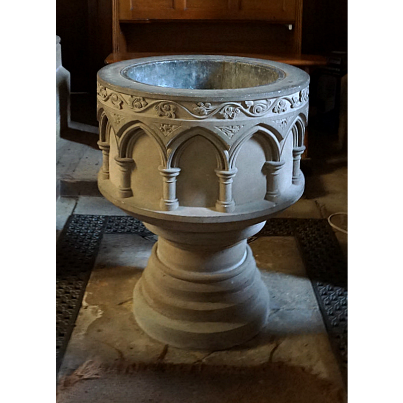
Image copyright © Ian S, 2017
CC-BY-SA-2.0
Results: 4 records
view of font
Scene Description: the modern font
Copyright Statement: Image copyright © Ian S, 2017
Image Source: edited detail of a digital photograph taken 11 December 2017 by Ian S [www.geograph.org.uk/photo/5629390] [accessed 6 November 2019]
Copyright Instructions: CC-BY-SA-2.0
view of church exterior - southeast view
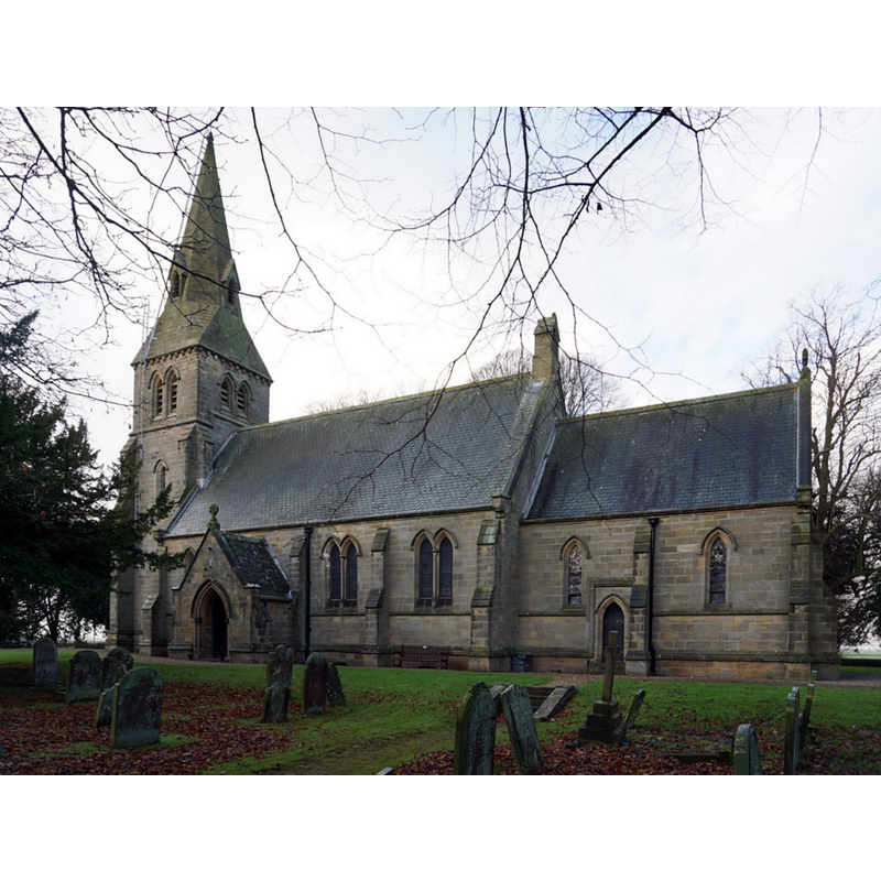
Copyright Statement: Image copyright © Ian S, 2017
Image Source: digital photograph taken 11 December 2017 by Ian S [www.geograph.org.uk/photo/5629408] [accessed 6 November 2019]
Copyright Instructions: CC-BY-SA-2.0
view of font in context
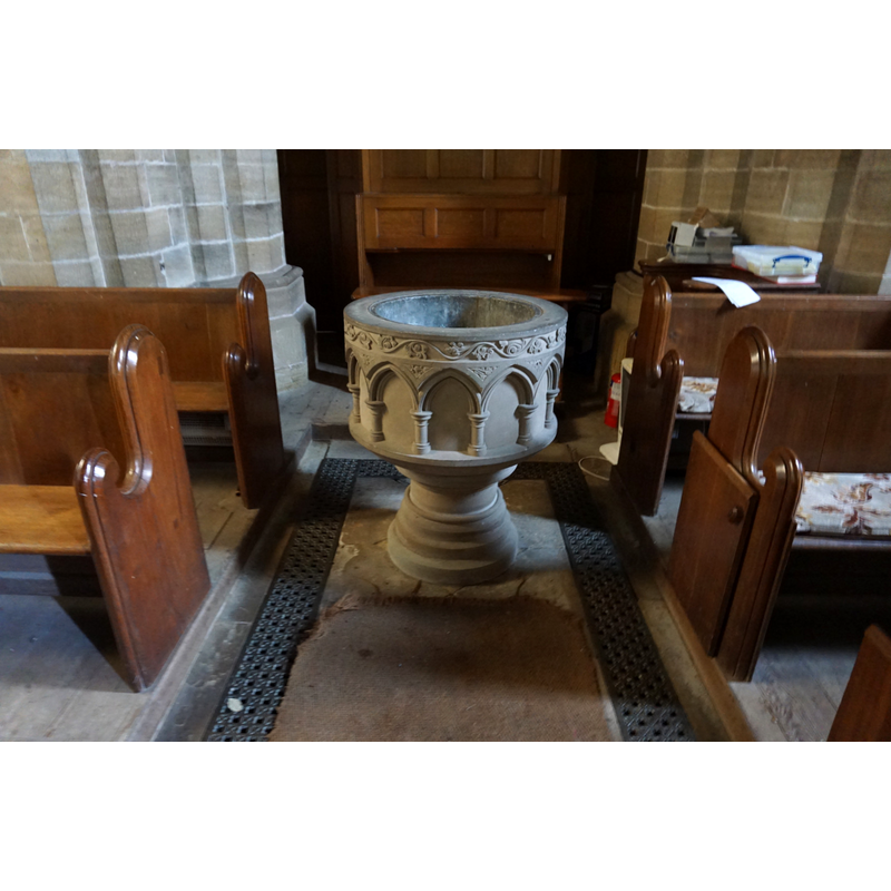
Scene Description: the modern font
Copyright Statement: Image copyright © Ian S, 2017
Image Source: digital photograph taken 11 December 2017 by Ian S [www.geograph.org.uk/photo/5629390] [accessed 6 November 2019]
Copyright Instructions: CC-BY-SA-2.0
view of font in context
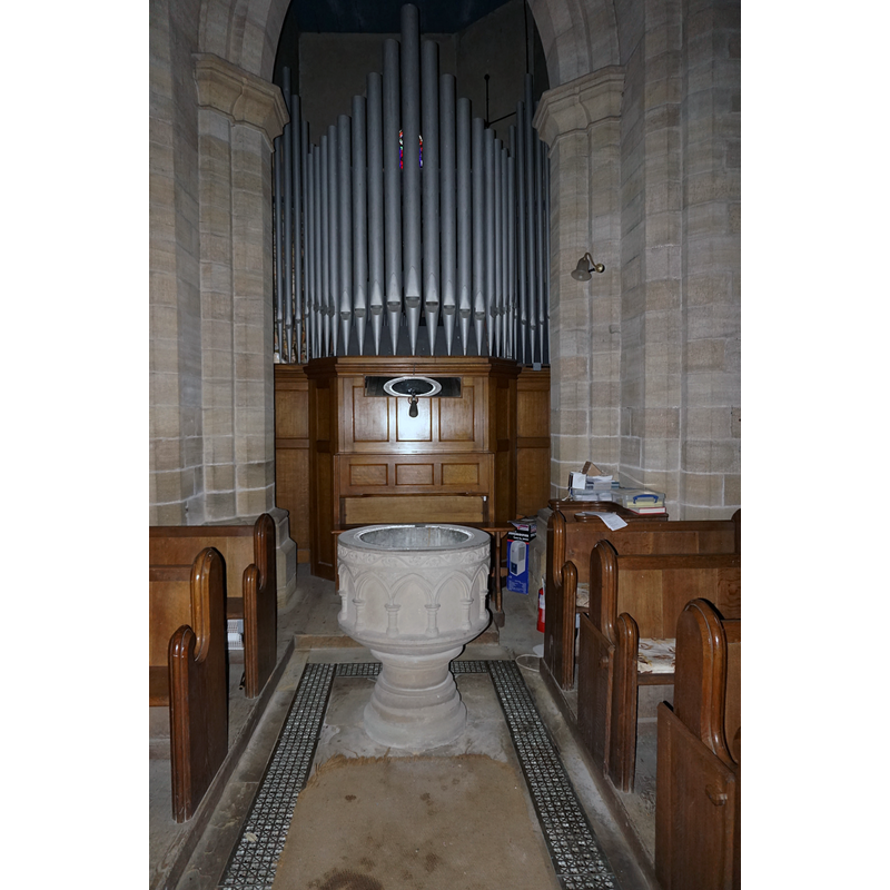
Scene Description: the modern font
Copyright Statement: Image copyright © Ian S, 2017
Image Source: digital photograph taken 11 December 2017 by Ian S [www.geograph.org.uk/photo/5629393] [accessed 6 November 2019]
Copyright Instructions: CC-BY-SA-2.0
INFORMATION
Font ID: 22433RIS
Object Type: Baptismal Font1?
Font Date: ca. 1200?
Font Century and Period/Style: 12th - 13th century, Transitional
Church / Chapel Name: Parish Church of Sll Saints [formerly St Mary's]
Font Location in Church: [disappeared]
Church Patron Saint(s): All Saints [formerly St. Mary]
Church Address: Rise Rd, Rise, Hull HU11 5BJ, UK -- Tel.: +44 1964 564634 / +44 1964 562241
Site Location: East Riding of Yorkshire, Yorkshire and the Humber, England, United Kingdom
Directions to Site: Located off (S) the B1243, 7 km SW of Hornsea, 11 km E of Beverley and Ne of Hull
Ecclesiastic Region: Diocese of York
Historical Region: Hundred of Holderness [North Hundred]
Additional Comments: disappeared font? (the one from the demolished medieval church here)
Font Notes:
Click to view
There are two entries for Rise [variant spellings] in the Domesday survey [https://opendomesday.org/place/TA1441/rise/] [accessed 6 November 2019] neither of which mentions cleric or church in it. The enry for this parish in the Victoria County History (Yorks East Riding, vol. 7, 2002) notes: "A chapel at Rise was mentioned c. 1200, before the first known record of the church [...] Rise church existed by 1221 [...] The medieval church comprised a chancel and a nave with south porch and western bell turret. A blocked, round-headed doorway in the north side of the nave suggests that it was of 12thcentury origin although most of the features were said to be 14th-century. [...] The old church was demolished and a new one built in 1844–5 [...] Some 13th-century stonework was reused in the chancel arch"; there is no mention of a font in the VCH entry. The entry for this church in Historic England [Listing NGR: TA1497041942] notes: "Church. 1844-5, reusing some medieval fragments. [...] C19 arcaded cylindrical font on columnar plinth."
COORDINATES
UTM: 30U 680624 5971544
Latitude & Longitude (Decimal): 53.86091, -0.2533
Latitude & Longitude (DMS): 53° 51′ 39.28″ N, 0° 15′ 11.88″ W
REFERENCES
- Victoria County History [online], University of London, 1993-. URL: https://www.british-history.ac.uk.