Koln-Esch / Köln-Esch
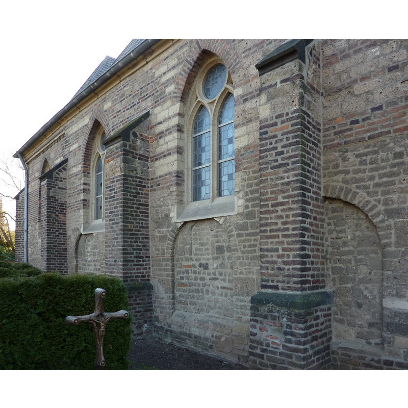
Image copyright © Chris06, 2014
CC-BY-SA-3.0
Results: 3 records
view of church exterior - north side - detail
Scene Description: showing the modifications made to the earlier fabric
Copyright Statement: Image copyright © Chris06, 2014
Image Source: digital photograph taken 31 January 2014 by Chris06 [https://commons.wikimedia.org/wiki/File:Esch_Martinus9.JPG] [accessed 3 November 2019]
Copyright Instructions: CC-BY-SA-3.0
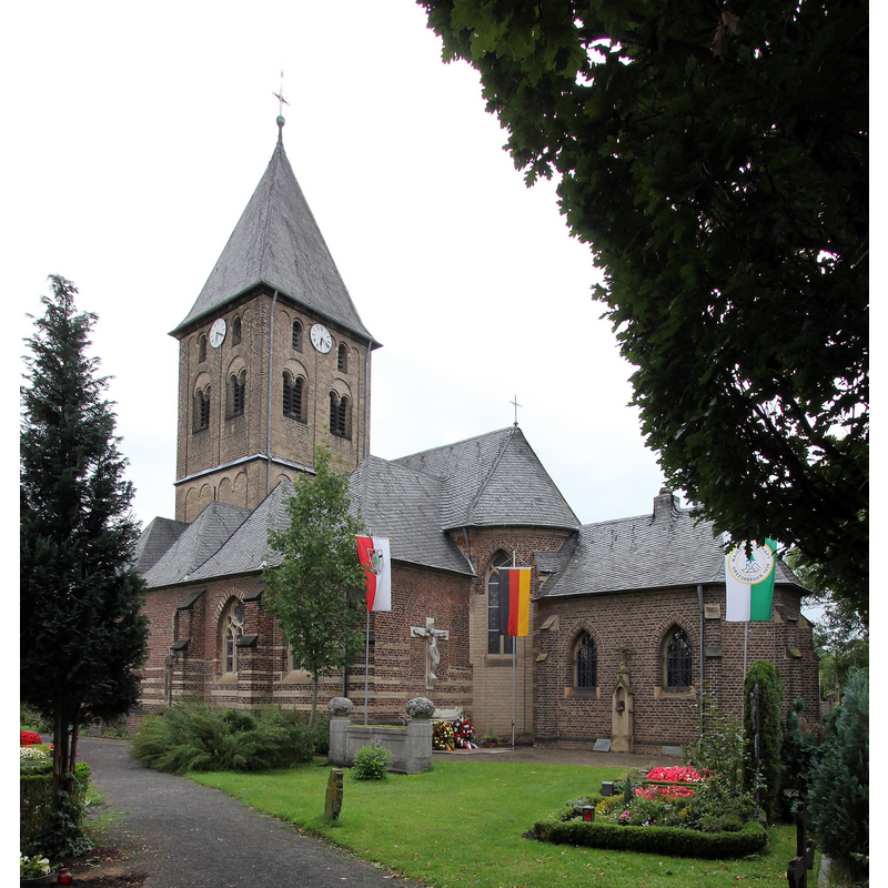
view of church exterior - southeast view
Copyright Statement: Image copyright © Elke Wetzig, 2011
Image Source: digital photograph taken 17 September 2011 by Elke Wetzig [User:Elya] [https://commons.wikimedia.org/wiki/File:Köln_Esch_Kirche_St._Martinus(919).jpg] [accessed 3 November 2019]
Copyright Instructions: CC-BY-SA-3.0
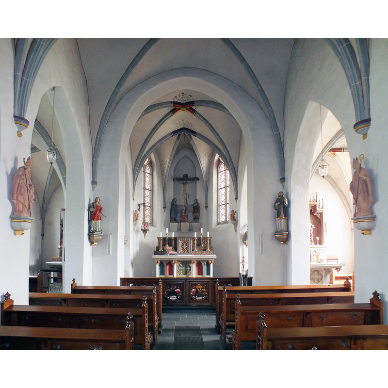
view of church interior - looking east
Copyright Statement: Image copyright © Pappnaas666, 2012
Image Source: digital photograph taken 1 September 2012 by Pappnaas666 [https://commons.wikimedia.org/wiki/File:Koeln_Esch_St_Martinus_Innenansicht.JPG] [accessed 3 November 2019]
Copyright Instructions: CC-BY-SA-3.0
INFORMATION
Font ID: 22424ESC
Object Type: Baptismal Font1
Font Century and Period/Style: 14th - 15th century / 19th century, Gothic? / Neo-Gothic?
Church / Chapel Name: Römisch-katholische Pfarrkirche St. Martinus des Kölner Ortsteils Esch
Font Location in Church: Inside the new church, in the chancel, N side
Church Patron Saint(s): St. Martin of Tours
Church Notes: the church probably existed by 1091, but is first documented ca. 1300 in a 'liber valoris'; extended ca. 1200; tower added 13thC; repaired and extended early 16thC; new church built 1960s dedicated to St Mary
Church Address: Am Kirchberg, Köln-Esch, 50765 Köln, Germany
Site Location: Köln, Nordhein-Westfalen, Germany, Europe
Directions to Site: Originally a separate village, Esch is located off (W) highway 57, between Pulheim (W) and the Rhine river (E), NNW of Gologne city centre
Ecclesiastic Region: Erzbistum Köln
Font Notes:
Click to view
The Seelsorgebereich Erftmühlenbach site [www.erftmuehlenbach.de/kirche/dom_esch/] [accessed 3 November 2019] reports: "Taufbecken, Becken und Basis gotisch, Schaft und Deckel um 1980 hinzugefügt", and shows the location of the font in the chancel;, north side. The site for the new church [www.kreuz-koeln-nord.de/kkn_kirchen/esch_maria.html] [accessed 3 November 2019], bowever, identifies the font from Old St. Martin's as neo-Gothic: "Links von Altar und Ambo befindet sich die kleine, runde, zum Gemeinderaum offene Taufkapelle. In ihr steht der neugotische Taufstein aus der alten St. Martinuskirche."
COORDINATES
UTM: 32U 349745 5653794
Latitude & Longitude (Decimal): 51.01605, 6.857845
Latitude & Longitude (DMS): 51° 0′ 57.78″ N, 6° 51′ 28.24″ E
LID INFORMATION
Date: 20th century / modern
Notes: [cf. FontNotes]