Barmby Moor / Barmby-on-the-Moor / Barnebi / Bernebi
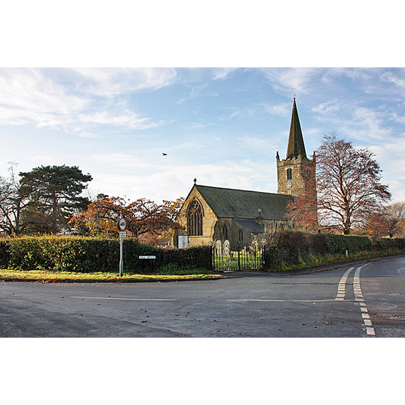
Image copyright © Peter Church, 2008
CC-BY-SA-2.0
Results: 3 records
view of church exterior in context - northeast view
Copyright Statement: Image copyright © Peter Church, 2008
Image Source: digital photograph taken 19 November 2008 by Peter Church [www.geograph.org.uk/photo/1051471] [accessed 24 October 2019]
Copyright Instructions: CC-BY-SA-2.0
view of church exterior - southwest view
![EXT SW CNTXT digital photograph taken 12 October 2007 by Keith Laverack [www.geograph.org.uk/photo/743194] [accessed 24 October 2019]
EXT NE CNTXT digital photograph taken 19 November 2008 by Peter Church [www.geograph.org.uk/photo/1051471] [accessed 24 October 2019]
INT E digital photograph taken 12 October 2007 by Keith Laverack [www.geograph.org.uk/photo/743203] [accessed 24 October 2019]](/static-50478a99ec6f36a15d6234548c59f63da52304e5/compressed/1191027001_compressed.png)
Scene Description: EXT SW CNTXT digital photograph taken 12 October 2007 by Keith Laverack [www.geograph.org.uk/photo/743194] [accessed 24 October 2019]
EXT NE CNTXT digital photograph taken 19 November 2008 by Peter Church [www.geograph.org.uk/photo/1051471] [accessed 24 October 2019]
INT E digital photograph taken 12 October 2007 by Keith Laverack [www.geograph.org.uk/photo/743203] [accessed 24 October 2019]
Copyright Statement: Image copyright © Keith Laverack, 2008
Image Source: digital photograph taken 12 October 2007 by Keith Laverack [www.geograph.org.uk/photo/743194] [accessed 24 October 2019]
Copyright Instructions: CC-BY-SA-2.0
view of church interior - looking east
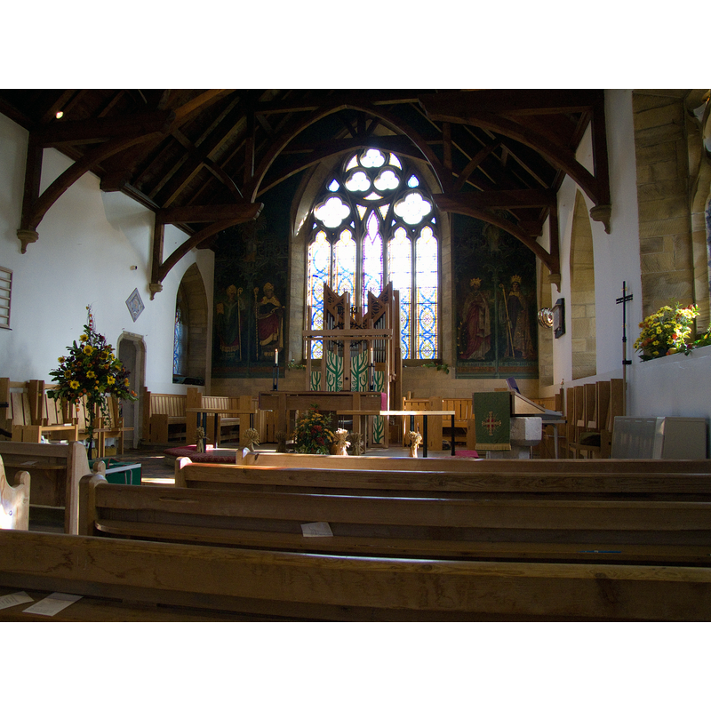
Copyright Statement: Image copyright © Keith Laverack, 2008
Image Source: digital photograph taken 12 October 2007 by Keith Laverack [www.geograph.org.uk/photo/743203] [accessed 24 October 2019]
Copyright Instructions: CC-BY-SA-2.0
INFORMATION
Font ID: 22412BAR
Object Type: Baptismal Font1
Font Date: ca. 1100-1108?
Font Century and Period/Style: 12th century, Norman
Church / Chapel Name: Parish Church of St. Catherine
Font Location in Church: [disappeared]
Church Patron Saint(s): St. Catherine of Alexandria [aka Katherine]
Church Address: Main St, Barmby Moor, York YO42 4EF , UK -- Tel.: +44 759307490 / +44 759307490
Site Location: East Riding of Yorkshire, Yorkshire and the Humber, England, United Kingdom
Directions to Site: Located off (S) the B1246 [aka Main St], 2-3 km W of Pocklington
Ecclesiastic Region: Diocese of York
Historical Region: Hundred of Pocklington
Additional Comments: disappeared font? (the one from the early-12thC church here) -- e-mailed vicar req'g update on present font situation (24 Oct 2019)
Font Notes:
Click to view
There is are two multiple-place entries for Barmby [Moor] in the Domesday survey [https://opendomesday.org/place/SE7748/barmby-moor/] [accessed 23 October 2019] one of which reports a priest and a church in it. The entry for this parish in Bulmer's county directory of 1892 [www.genuki.org.uk/big/eng/YKS/ERY/BarmbyMoor/BarmbyMoor92] [accessed 24 October 2019] reports two fonts in this church; a modern one, "The font is a beautiful piece of work in Caen stone, the gift of the Hon. Mrs. A. Duncombe, of Kilnwick Percy", and an earlier one relegated to the vicarage garden at the time, "There was a church here in Saxon times, which was probably erected by one of the early Danish owners of the place; and the ancient font, now standing in the vicarage garden, is said by good authority to belong to that period." The entry for this parish in the Victoria County History (York East Riding, vol. 3, 1976) notes: "Although not named, Barmby Moor, like Fangfoss, was one of the chapels given by the king between 1100 and 1108, along with their mother-church of Pocklington, to the archbishop of York and York minster. They were apparently assigned by the archbishop to the dean, and between c. 1119 and 1129 the king confirmed the assignment. [...] The church was largely rebuilt in 1850-2 [...] The old tower, with its stone spire, was, however, retained; it has a 15th-century upper stage and west window, but the unbuttressed lower stage is probably earlier. [...] The fittings include an octagonal stone font given by Delia Duncombe in 1852. [...] A stoup in the tower stood near the south door until c. 1840 and later in the Vicarage garden." The entry for this church in Historic England [Listing NGR: SE7764648942] notes: "Church. C15 west tower and spire, nave and chancel rebuilt 1851 [...] C14 octagonal font on octagonal base with pyramidal stops."
COORDINATES
UTM: 30U 643196 5978028
Latitude & Longitude (Decimal): 53.93082, -0.8189
Latitude & Longitude (DMS): 53° 55′ 50.95″ N, 0° 49′ 8.04″ W
REFERENCES
- Victoria County History [online], University of London, 1993-. URL: https://www.british-history.ac.uk.