Hull No. 7 / Marfleet / Mereflet / Kings-town upon Hull / Kingston-upon-Hull / Kingston upon Hull / Wyke on Hull
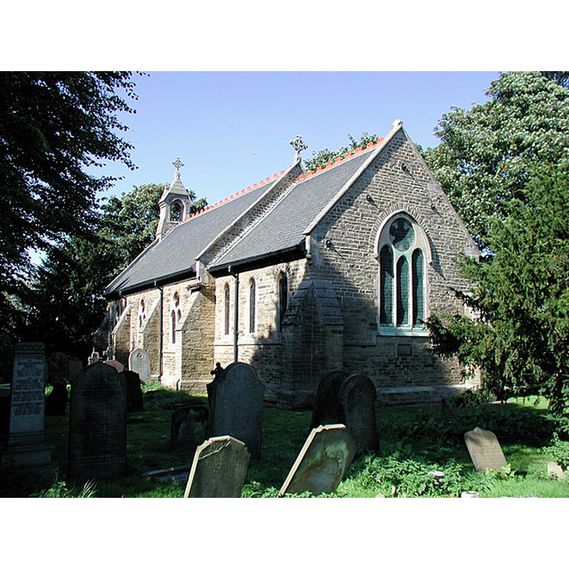
Image copyright © Paul Glazzard, 2006
CC-BY-SA-2.0
Results: 2 records
view of church exterior - southeast view
Scene Description: Source caption: "St. Giles' Church, Marfleet. Built in 1883-4 on this site where a church has stood since 1217, St. Giles' previously served the local farming community before the Marfleet area of Hull became very much industrialised."
Copyright Statement: Image copyright © Paul Glazzard, 2006
Image Source: digital photograph taken 23 September 2006 by Paul Glazzard [www.geograph.org.uk/photo/247247] [accessed 17 October 2019]
Copyright Instructions: CC-BY-SA-2.0
view of church exterior - southwest view
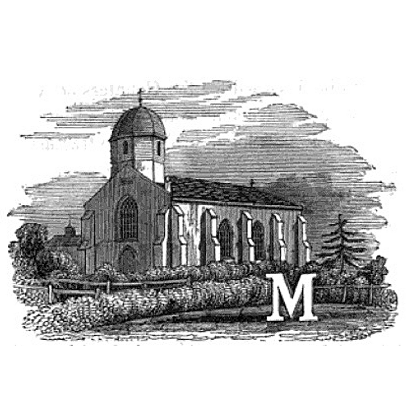
Scene Description: Source caption: "Initial "M" illustrated by Marfleet church, East Riding of Yorkshire, in about 1840"
Copyright Statement: Image copyright © [in the public domain]
Image Source: digital image of an illustration in George Poulson's The history and antiquities of the seigniory of Holderness (1840) [https://commons.wikimedia.org/wiki/File:Illustated_initial_of_Marfleet_church_c.1840_(Poulson).jpg] [accessed 17 October 2019]
Copyright Instructions: PD US
INFORMATION
Font ID: 22404MAR
Object Type: Baptismal Font1?
Font Century and Period/Style: 13th century (early?), Early English
Church / Chapel Name: Parish Church of St. Giles
Font Location in Church: [disappeared]
Church Patron Saint(s): St. Giles [aka Aegidus, Egidus, Gilles]
Church Notes: original church 13thC; re-built 1793; repaired 1875; re-built again 1880s
Church Address: Church Ln, off Marfleet Ln, Marfleet, Hull HU9 5RL, UK -- Tel.: +44 1482 783690
Site Location: East Riding of Yorkshire, Yorkshire and the Humber, England, United Kingdom
Directions to Site: Formerly a separate village, Marfleet is off (N) the A1033, near the King George Dock, now in the E area pf Hull
Ecclesiastic Region: [Diocese of York]
Historical Region: Hundred of Holderness
Additional Comments: disappeared font? (the one from the medieval church documented ca. 1217)
Font Notes:
Click to view
No individual entry found for Marfleet in the Domesday survey. The entry for this parish in the Victoria County History (York East Riding, vol. 1. 1969) notes: "The church is first mentioned c. 1217 [...] Anciently it was a chapelry of Paull, a church which was given in 1115 by Stephen, Earl of Aumale, along with other Holderness churches, to the abbey of St. Martin D'Auchy, Aumale (SeineInférieure) [...] No representation of the medieval church has been found. In 1793 application was made to rebuild the church [...] The present church, reopened and re-dedicated in 1884, [...] is the third on the site [...] The font, dated 1864 and erected as a memorial to the Revd. J. H. Robinson". The entry for this church in Historic England [Listing NGR: TA1435229497] notes: "Parish church. 1884. By JT Webster. [...] Fittings include octagonal ashlar font dated 1864, benches with shaped ends, C19, and stalls c1920."
COORDINATES
UTM: 30U 680417 5959316
Latitude & Longitude (Decimal): 53.7493, -0.2673
Latitude & Longitude (DMS): 53° 44' 57" N, 0° 16' 2" W
REFERENCES
- Victoria County History [online], University of London, 1993-. URL: https://www.british-history.ac.uk.