Easby No. 3 / Asebi / Easeby / Esebi / Essebi
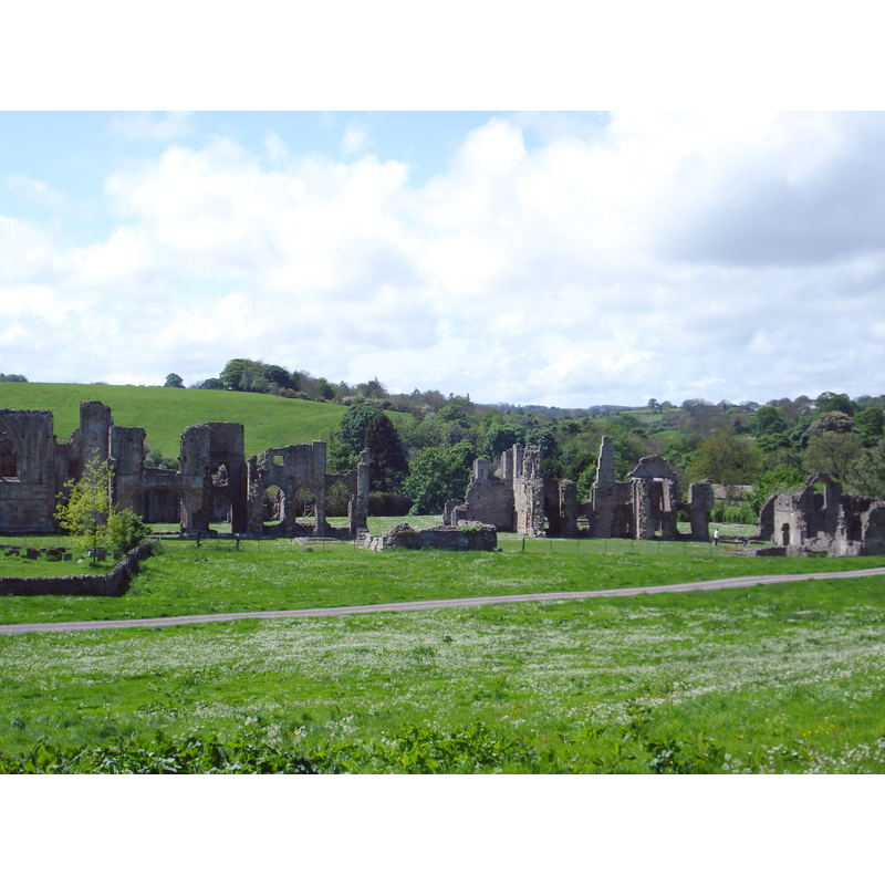
Image copyright © [in the public domain]
CC-Zero
Results: 3 records
view of church exterior in context
Scene Description: Source caption: "View of Easby Abbey, Yorkshire from the northeast"
Copyright Statement: Image copyright © [in the public domain]
Image Source: digital photograph taken 19 May 2007 by Greenjettaguy [https://commons.wikimedia.org/wiki/File:Easby_abbey_wideview.JPG] [accessed 9 October 2019]
Copyright Instructions: CC-Zero
view of church interior in context - plan
![the abbey church in the context of the abbey building compound [letters I+M+N identify the interior of the church]](/static-50478a99ec6f36a15d6234548c59f63da52304e5/compressed/0191012035_compressed.png)
Scene Description: the abbey church in the context of the abbey building compound [letters I+M+N identify the interior of the church]
Copyright Statement: Image copyright © [in the public domain]
Image Source: edited detail of a digital image from Walcott, Mackenzie E. C. (Mackenzie Edward Charles), 1821-1880, Church and conventual arrangement. With copious references, a complete glossary, and an index. And illustrated by a series of ground-plans and plates of the arrangements of churches in different countries and at successive periods, and of the conventual plans adopted by the various orders (London: Atchley and Co., 1861) [www.flickr.com/photos/internetarchivebookimages/14597137018/] [accessed 9 October 2019]
Copyright Instructions: CC-BY-2.0
view of context
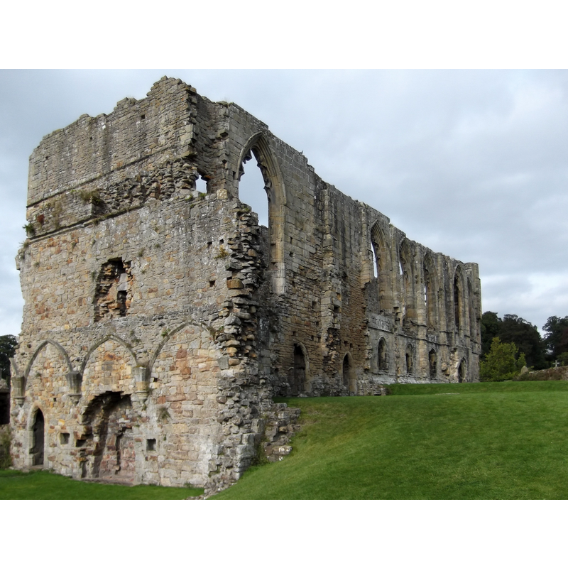
Scene Description: Source caption: "Photograph of the remains of the refectory of Easby Abbey, North Yorkshire, England"
Copyright Statement: Image copyright © John Armagh, 2014
Image Source: digital photograph taken 8 September 2014 by John Armagh [https://commons.wikimedia.org/wiki/File:EasbyAbbey_Refectory.jpg] [accessed 9 October 2019]
Copyright Instructions: CC-BY-SA-4.0
INFORMATION
Font ID: 22394EAS
Object Type: Baptismal Font1?
Font Century and Period/Style: 12th century, Late Norman
Church / Chapel Name: Premonstratensian Abbey Church of St. Mary and St. Agatha [demolished]
Font Location in Church: [disappeared]
Church Patron Saint(s): St. Mary the Virgin & St. Agatha
Church Address: Easby Abbey, Richmond DL10 7EU, UK -- Tel.: +44 370 333 1181 [English Heritage]
Site Location: North Yorkshire, Yorkshire and the Humber, England, United Kingdom
Directions to Site: Located off (S) the B6271 [aka Maison Dieu], on the E bank of the Swale river, SE of Richmond town centre [the abbey site can be reached by a riverside walk from Richmond Castle]
Ecclesiastic Region: Diocese of Leeds
Historical Region: Hundred of Land of Count Alan
Additional Comments: disappeared font? (the one from the mid-12thC abbey church here)
Font Notes:
Click to view
There is an entry for this Easby [variant spelling] in the Domesday survey [https://opendomesday.org/place/NZ1800/easby/] [accessed 9 October 2019] but it mentions neither cleric nor church in it. The entry for the Premonstratensian Abbey of St. Agatha in the Victoria County History (York, vol. 3, 1974) notes: "The abbey of St. Agatha, Easby, was founded by Roald, Constable of Richmond Castle, in 1152. [...] In May 1424 a commission was issued to Nicholas, Bishop of Dromore, to dedicate the conventual church of St. Agatha. [...] Probably there had been considerable alterations made about the beginning of the 15th century, and this episcopal act was a kind of re-dedication; or, as the churchyard is specially mentioned, the matter may have been primarily concerned with that. [...] The date of the dissolution of St. Agatha's is variously given. Clarkson says it took place in 1535, being surrendered by ' Robert Bampton, last abbot, and seventeen canons.' [...] The house appears in the list of ' Monasteries under £200 ' in 1536. [...] The Dissolution had practically taken place before 22 September 1536, for on that date Chr. Lasselles offered to the Treasurer and Court of Augmentations the fine of £600 [...] 'for S. Agathes, let to Lord Scrope for £300.'" The entry for the ruins of the abbey in Historic England [Listing NGR: NZ1850700307] notes: "Ruins of Premonstratensian Abbey of St Agatha. Late C12, early C13, c1300, early C14, early C15. Sandstone. Church with cloister, sacristies, chapter house, refectory, dorter, guests' solar and reredorter to south, and infirmary and abbot's accommodation to north. Church: foundations only of late C12 aisleless nave with many fine grave covers, with crosses, set in floor; considerable height of early C14 north chapel, with complete stone altar, added on to west side of late C12 north transept; late C12 aisleless choir lengthened by addition of early C14 presbytery, largely surviving to approximately 2 metres high, with 2 tomb recesses with double-chamfered segmental-pointed arches on north side; 3-bay early C14 east wall of south transept survives. 2 sacristies"; no font mentioned.
COORDINATES
UTM: 30U 583298 6028538
Latitude & Longitude (Decimal): 54.397778, -1.716944
Latitude & Longitude (DMS): 54° 23′ 52″ N, 1° 43′ 1″ W
REFERENCES
- Victoria County History [online], University of London, 1993-. URL: https://www.british-history.ac.uk.