Coverham No. 1 / Chouerham / Coram / Corham / Coueham / Coureham [Domesday] / Covanham / Coveram / Koveram
![Main image for Coverham No. 1 / Chouerham / Coram / Corham / Coueham / Coureham [Domesday] / Covanham / Coveram / Koveram](/static-50478a99ec6f36a15d6234548c59f63da52304e5/compressed/1191008006_compressed.png)
Image copyright © Chris06, 2019
CC-BY-SA-2.0
Results: 4 records
view of church exterior - southeast view
Copyright Statement: Image copyright © Chris06, 2019
Image Source: digital photograph taken 15 August 2019 by Chris06 [https://commons.wikimedia.org/wiki/File:Holy_Trinity_Church,_Coverham_(06).jpg] [accessed 8 October 2019]
Copyright Instructions: CC-BY-SA-2.0
view of church interior - cross - fragment
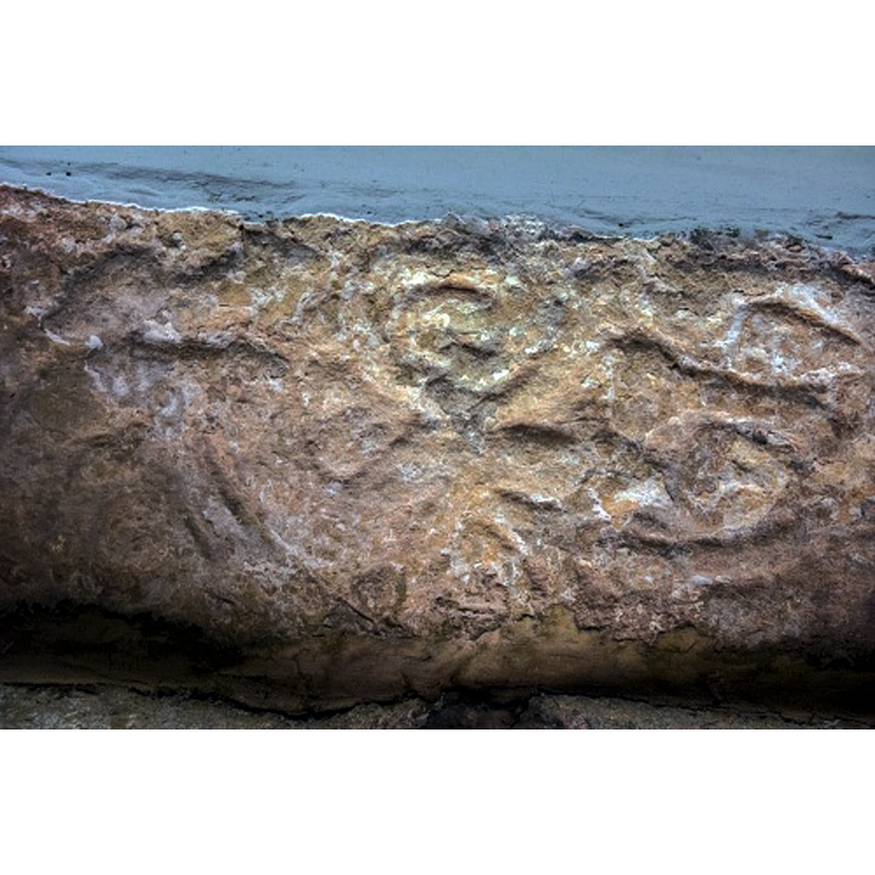
Scene Description: Source caption: "The highlight of Coverham church is the sandstone lintel over the south door. This is a reused section of a Saxon cross shaft and may date to the 9th century. Its presence might be an indication that there was a church on this site long before the current building was erected, but it is equally likely that the carved stone was brought to Coverham from elsewhere. If the stone is original then it is likely that the nave and chancel stand on the foundations of an earlier Saxon church. The lintel is carved with a pair of figures, perhaps forming part of a Crucifixion scene, though they are much worn and it is difficult to discern who or what they are intended to represent."
Copyright Statement: Image copyright © David Ross & Britain Express Ltd, 2019
Image Source: digital photograph by David Ross & Britain Express Ltd [www.britainexpress.com/attractions.htm?attraction=4226] [accessed 8 October 2019]
Copyright Instructions: Standing permission
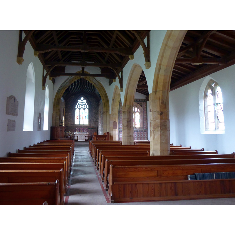
view of church interior - looking west
Scene Description: the modern font is partially visible at the far end, left side
Copyright Statement: Image copyright © Chris06, 2019
Image Source: digital photograph taken 15 August 2019 by Chris06 [https://commons.wikimedia.org/wiki/File:Holy_Trinity_Church,_Coverham_(11).jpg] [accessed 8 October 2019]
Copyright Instructions: CC-BY-SA-2.0
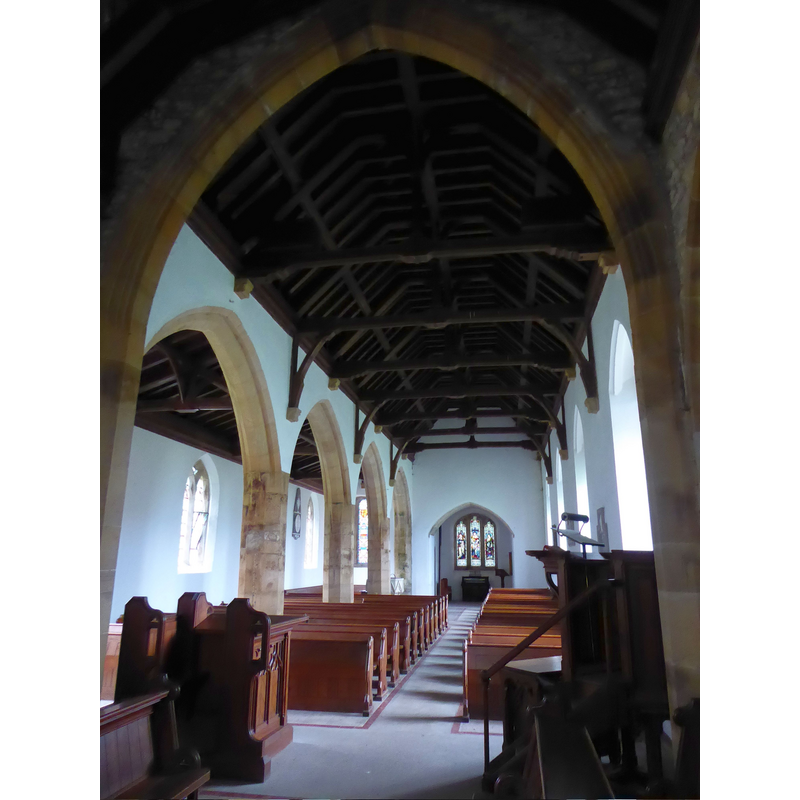
view of church interior - looking east
Copyright Statement: Image copyright © Chris06, 2019
Image Source: digital photograph taken 15 August 2019 by Chris06 [https://commons.wikimedia.org/wiki/File:Holy_Trinity_Church,_Coverham_(08).jpg] [accessed 8 October 2019]
Copyright Instructions: CC-BY-SA-2.0
INFORMATION
Font ID: 22392COV
Object Type: Baptismal Font1?
Font Century and Period/Style: 13th - 17th century, Medieval - Early Modern
Church / Chapel Name: Parish Church of the Holy Trinity [redundant]
Font Location in Church: [cf. FontNotes]
Church Patron Saint(s): The Holy Trinity
Church Notes: present church 13thC; redundant since 1985; now in the care of the Churches Conservation Trust
Church Address: Coverham Ln, Coverham, Leyburn DL8 4RN, UK
Site Location: North Yorkshire, Yorkshire and the Humber, England, United Kingdom
Directions to Site: Located 3-4 km SSW of Leyburn, 3 km W of Middleham, 18-20 km W of Bedale and the A1(M), at the NE edge of the Yorskshire Dales Natinal Park -- the church stands near the ruins of the Premonstratensian abbey and the Cover river
Ecclesiastic Region: Diocese of Leeds
Historical Region: Hundred of Land of Count Alan
Additional Comments: disused font? (a basin in the garden reported ca. 1914)
Font Notes:
Click to view
There is an entry for Coverham [variant spelling] in the Domesday survey [https://opendomesday.org/place/SE1086/coverham/] [accessed 8 October 2019] but it mentions neither cleric nor church in it. The entry for this parish in (York North Riding, vol. 1, 1914) notes: "The earliest details in the building are the 13th-century windows in the south wall of the chancel, to which date both this and the nave probably belong. [...] The font [...] is modern", but a footnote in the VCH entry adds: " In the garden of the vicarage is a plain octagonal bowl of large size, probably a font, which is said to have been brought from the church during its restoration." The entry for the Premonstratensian abbey here in the Victoria County History (York, vol. 3, 1974) notes that, after its original founding in Swainby, "Ralph the son of Robert, lord of Middleham, removed the canons to Coverham, [...] and granted them the church of Coverham, and many lands and tenements by fine in the king's court in 14 John (1212-13)", which means that the parish church already existed by then. The entry for this parish church in Historic England [Listing NGR: SE1039786369] notes: "Church. C13, C14, C15, late C16 - early C17. [...] Tower: C15. [...] Lintel to south doorway a reused Anglo-Saxon cross shaft"; no font mentioned.
Credit and Acknowledgements: We are grateful to David Ross & Britain Express Ltd for the photograph of the Anglo-Saxon cross fragment now used as lintel in the south doorway
COORDINATES
UTM: 30U 575420 6014504
Latitude & Longitude (Decimal): 54.2729, -1.8418
Latitude & Longitude (DMS): 54° 16′ 22.44″ N, 1° 50′ 30.48″ W
MEDIUM AND MEASUREMENTS
Material: stone
Font Shape: octagonal
Basin Interior Shape: round
Basin Exterior Shape: octagonal
REFERENCES
- Victoria County History [online], University of London, 1993-. URL: https://www.british-history.ac.uk.
- Victoria County History [online], University of London, 1993-. URL: https://www.british-history.ac.uk.