Guisborough No. 2 / Chigesborg / Chigesburg / Ghigesborc / Ghigesborg / Ghigesburg / Gigesburg / Gyghesborc / Gyseburne
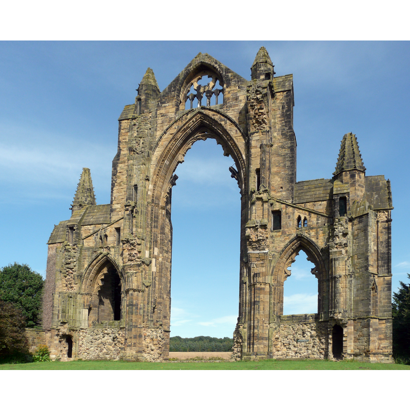
Image copyright © Admiralgary, 2016
CC-BY-SA-4.0
Results: 5 records
view of church exterior - east end
Copyright Statement: Image copyright © Admiralgary, 2016
Image Source: edited detail of a digital photograph taken 2 April 2016 by Admiralgary [https://commons.wikimedia.org/wiki/File:Gisborough_Priory_2.jpg] [accessed 30 September 2019]
Copyright Instructions: CC-BY-SA-4.0
view of church exterior in context - east view
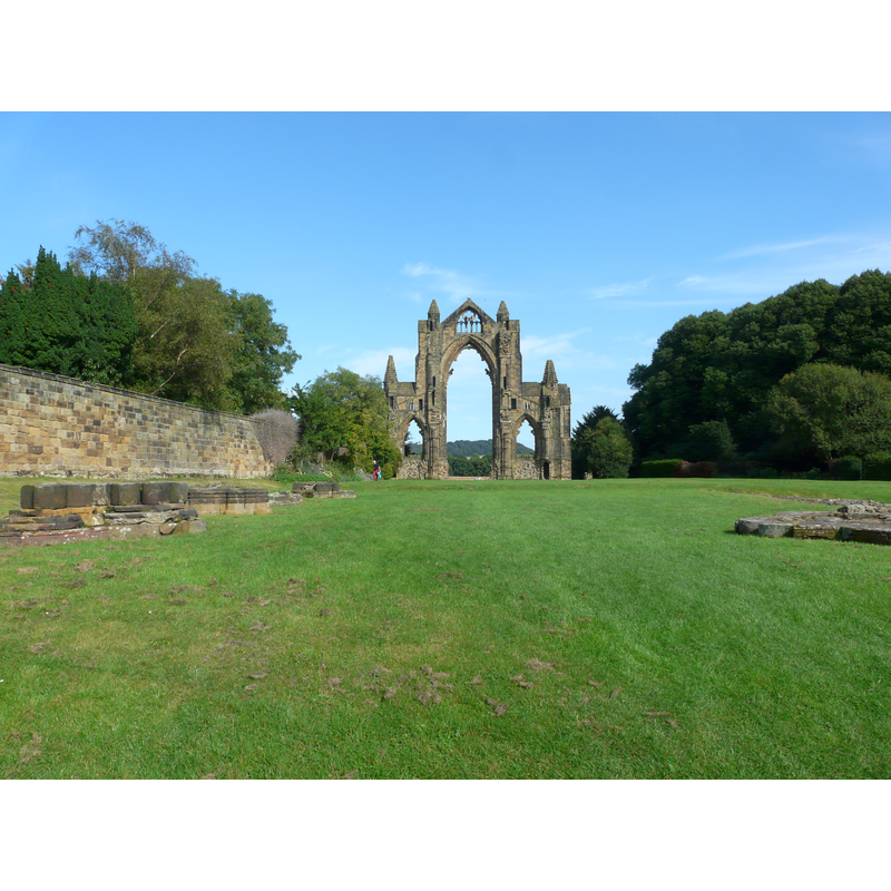
Copyright Statement: Image copyright © Admiralgary, 2016
Image Source: digital photograph taken 2 April 2016 by Admiralgary [https://commons.wikimedia.org/wiki/File:Gisborough_Priory_1.jpg] [accessed 30 September 2019]
Copyright Instructions: CC-BY-SA-4.0
view of church exterior in context
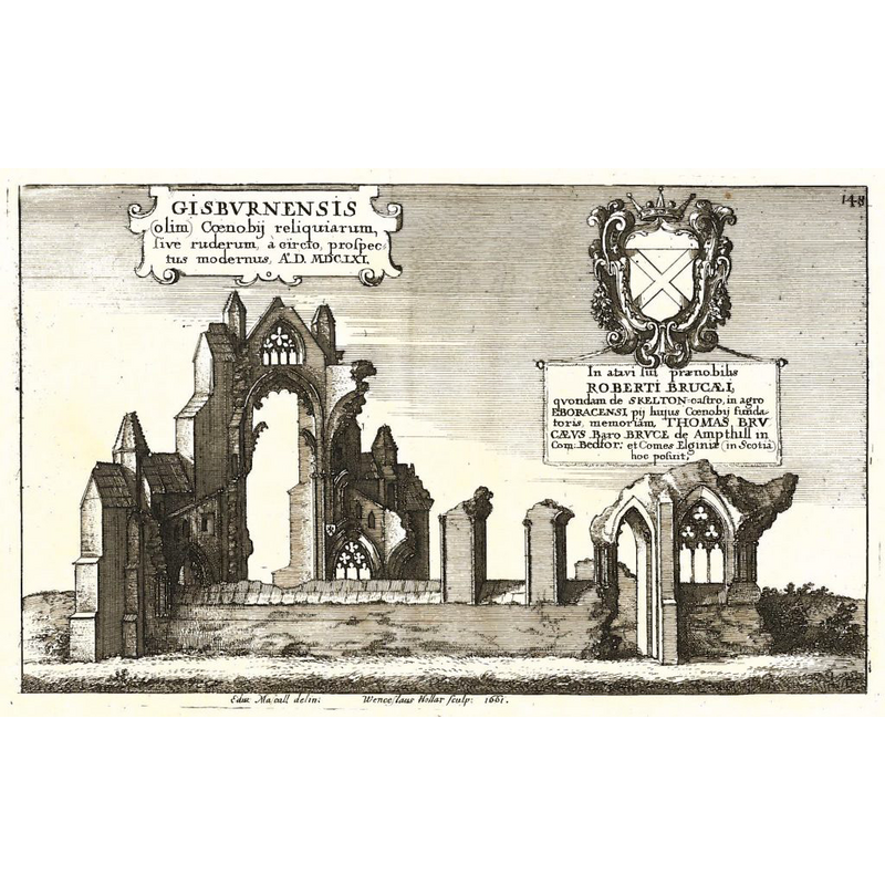
Scene Description: artist's view of the ruins ca. 1661
Copyright Statement: Image copyright © [in the public domain]
Image Source: digital image of an engraving by Wenceslaus Hollar, in Dugdale’s Monasticon (vol..2, part 1,1661) [https://gisboroughprioryproject.org.uk/history/] [accessed 30 September 2019]
Copyright Instructions: PD
view of church exterior - plan

view of church interior - plan
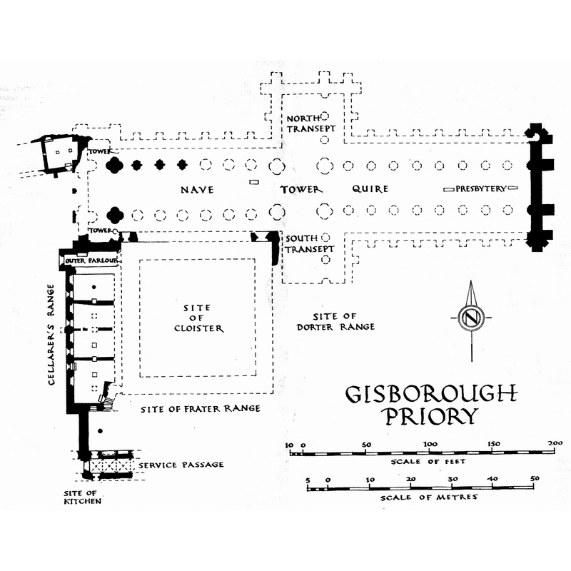
Copyright Statement: Image copyright © Ministry of Works/HMSO, 1955
Image Source: digital image of a 1955 site plan of Gisborough Priory. Ministry of Works/HMSO, by R. Gilyard-Beer [https://commons.wikimedia.org/wiki/File:Gisborough_Priory_site_plan.png] [accessed 30 September 2019]
Copyright Instructions: UK Government artistic works license
INFORMATION
Font ID: 22372GUI
Object Type: Baptismal Font1?
Font Century and Period/Style: 12th - 14th century, Medieval
Church / Chapel Name: Gisborough [sic] Priory Church [disappeared]
Font Location in Church: [disappeared]
Church Notes: mid-12thC priory church replaced by 1240 building that was destroyed in 1289 fire; re-built thereafter; demolished 1540s after Dissolution; only ruins remain
Church Address: Priory Grounds, Church St, Guisborough TS14 6HG, UK
Site Location: North Yorkshire, Yorkshire and the Humber, England, United Kingdom
Directions to Site: Located off (S) the A171, just N of Whitby Rd, 10-12 km SE of Middlesbrough
Additional Comments: the original font probably disappeared in/after the 1289 fire that destryod the Romanesque-period church; there may have been a second font when the priory was re-built in the Gothic period, but that one has also disappeared
Font Notes:
Click to view
[NB: we have no information on the baptimal font(s) of the medieval priory churc here].
COORDINATES
UTM: 30U 626290 6044942
Latitude & Longitude (Decimal): 54.536267, -1.048064
Latitude & Longitude (DMS): 54° 32′ 10.56″ N, 1° 2′ 53.03″ W