Esholt
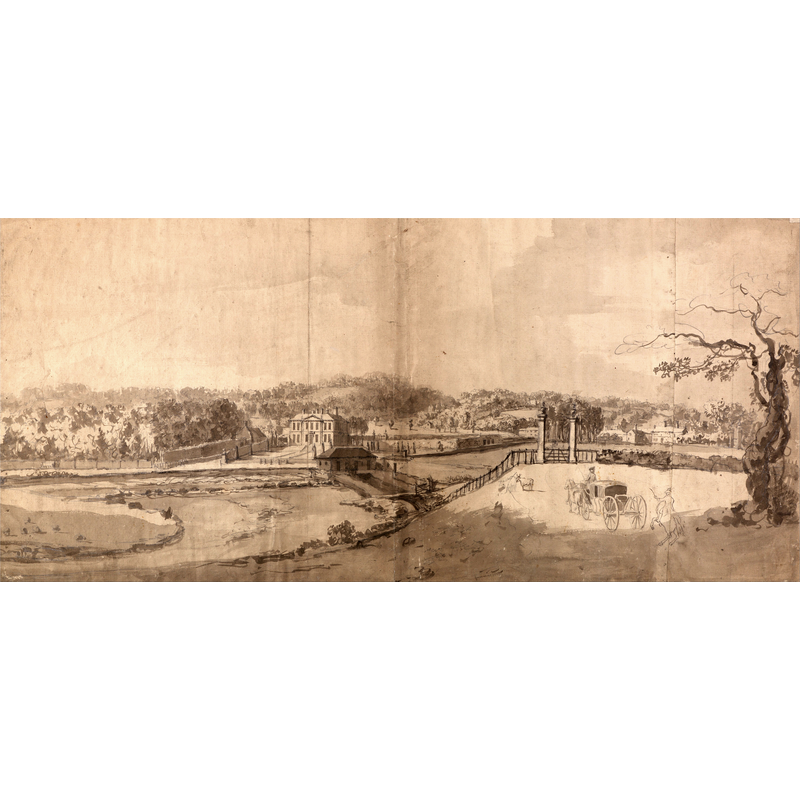
Image copyright © [in the public domain]
CC-PD-Mark / PD-old-100-expired / PD-Art (PD-old-100-expired)
Results: 1 records
view of context
Scene Description: Source caption: "Inscribed in artist's hand in pen and brown ink upper center: "A View of Esholt Yorkshire.._"; in artist's hand in pen and brown ink upper right: "No.13."
Copyright Statement: Image copyright © [in the public domain]
Image Source: digital image of an undated watercolour by Samuel Scott (1702-1772) BgG0-CLTTfgGbw at Google Cultural Institute [https://commons.wikimedia.org/wiki/File:Samuel_Scott_-_A_View_of_the_Estate_at_Esholt_Hall,_Yorkshire_-_Google_Art_Project.jpg] [accessed 19 September 2019]
Copyright Instructions: CC-PD-Mark / PD-old-100-expired / PD-Art (PD-old-100-expired)
INFORMATION
Font ID: 22353ESH
Object Type: Baptismal Font1?
Font Century and Period/Style: 12th century (late?), Late Norman? / Transitional?
Church / Chapel Name: Cistercian Priory Church [disappeared]
Font Location in Church: [disappeared]
Church Address: address and coordinates are for Esholt Hall, which now occupies the site of the former priory: Esholt Hall Estate, Esholt, Shipley BD17 7QU, UK
Site Location: West Yorkshire, Yorkshire and the Humber, England, United Kingdom
Directions to Site: Located on the E bank of the Aire river, W of the A658, 8 km NNE of Bradford, 19-20 NW of Leeds
Additional Comments: disappeared font? (the one from the late-12thC(?) priory church here)
Font Notes:
Click to view
No individual entry for Eshalt found in the Domesday survey. The entry for the Cistecian Priory at Esholt (York, vol. 3, 1974) notes: "The small Cistercian nunnery of St. Mary and St. Leonard at Esholt, in the parish of Guiseley, is said to have been founded at the latter part of the reign of Henry II or the beginning of that of Richard I [i.e., ca. 1189] [...] There is, however, much uncertainty both as to the real date of the foundation, and as to the original founder"; the VCH entry does mention a coventual church, "certain chambers where the sisters worked on the south side of the church"; the priory was suppressed in 1536. The entry for Esholt Hall in Historic England [Listing NGR: SE1885839670] notes: "Built on the site of the Medieval Esholt nunnery, by Sir Walter Calverley in 1706-07"; nothing remains of the old priory. The parish church of Esholt is modern, of 1839, and has a modern font in it.
COORDINATES
UTM: 30U 584535 5967926
Latitude & Longitude (Decimal): 53.852944, -1.714861
Latitude & Longitude (DMS): 53° 51′ 10.6″ N, 1° 42′ 53.5″ W
REFERENCES
- Victoria County History [online], University of London, 1993-. URL: https://www.british-history.ac.uk.