East Witton / Estwitton / Estwyton / Witun
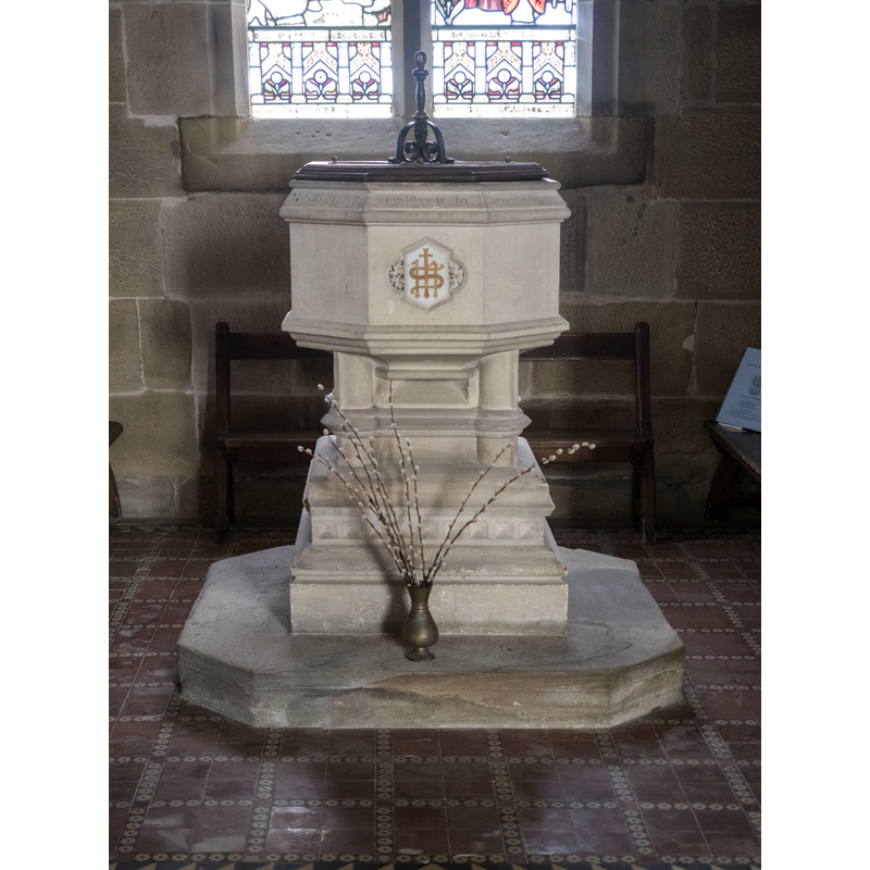
Image copyright © John Salmon, 2018
CC-BY-SA-2.0
Results: 4 records
view of font and cover
Scene Description: the font is probably, like the modern church, 19thC
Copyright Statement: Image copyright © John Salmon, 2018
Image Source: digital photograph taken 9 August 2018 by John Salmon [www.geograph.org.uk/photo/5961787] [accessed 13 September 2019]
Copyright Instructions: CC-BY-SA-2.0
view of church exterior - southeast view
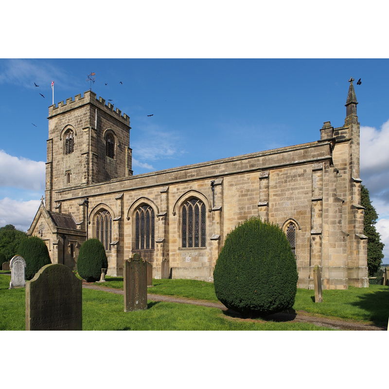
Scene Description: the modern church, dated 1809
Copyright Statement: Image copyright © Kreuzschnabel, 2014
Image Source: digital photograph taken 30 September 2014 by Kreuzschnabel [https://commons.wikimedia.org/wiki/File:2014-09_East_Witton_Parish_Church.jpg] [accessed 13 September 2019]
Copyright Instructions: GFDL / FAL / CC-BY-SA-3.0
view of church exterior - churchyard, cemetery
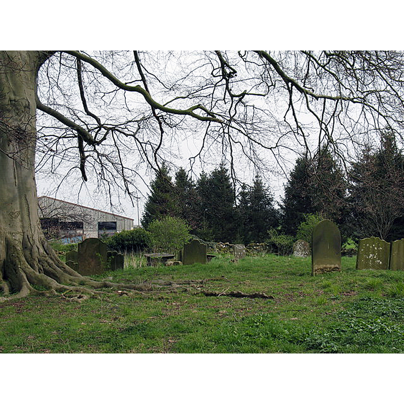
Scene Description: Source caption: "The original churchyard at East Witton is some 350m SSE of the 1809 church. When the Earl of Ailesbury had the new church built in 1809, he also rebuilt much of the village, setting the houses out in a long line either side of a large green. There is no sign of the earlier church in this graveyard, although there is a flat space large enough to accommodate a building."
Copyright Statement: Image copyright © Gordon Hatton, 2007
Image Source: digital photograph taken 21 April 2007 by Gordon Hatton [www.geograph.org.uk/photo/408819] [accessed 13 September 2019]
Copyright Instructions: CC-BY-SA-2.0
view of church interior - looking east
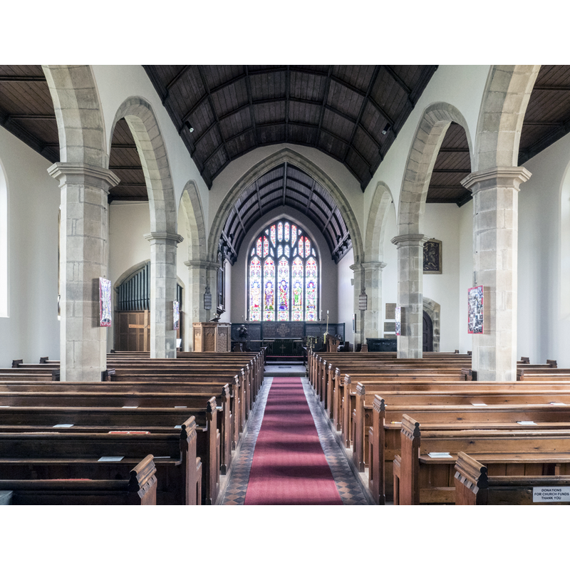
Scene Description: the modern church, dated 1809
Copyright Statement: Image copyright © John Salmon, 2018
Image Source: digital photograph taken 9 August 2018 by John Salmon [www.geograph.org.uk/photo/5961785] [accessed 13 September 2019]
Copyright Instructions: CC-BY-SA-2.0
INFORMATION
Font ID: 22333WIT
Object Type: Baptismal Font1
Font Century and Period/Style: 12th century, Late Norman
Church / Chapel Name: Parish Church of St. John the Evangelist [originally St. Ella's]
Font Location in Church: [disappeared]
Church Patron Saint(s): St. John the Evangelist [formerly dedicated to St. Ella
Church Address: East Witton, Leyburn DL8 4SN, UK -- Tel.: +44 1969 623753
Site Location: North Yorkshire, Yorkshire and the Humber, England, United Kingdom
Directions to Site: Located off (NE) the A6108, 3 km W of Jervaulx Abbey, 11-12 km W of Bedale
Ecclesiastic Region: Diocese of Leeds
Historical Region: Hundred of the Land of Count Alan
Additional Comments: disappeared font? (the one from the 12thC church later replaced by the present early-19thC building)
Font Notes:
Click to view
There is an entry for [East] Witton [variant spelling] in the Domesday survey [https://opendomesday.org/place/SE1486/east-witton/] [accessed 13 September 2019] but it mentions neither cleric nor church in it. T. Whellan's History and topography of the city of York; and the North riding of Yorkshire (vol. 2, 1859: 451) writes: "The existing Church (St. John the Evangelist) was erected in 1809 [...] A portion of the materials of the old Church of St Martin were used in the construction of this"; the old font of old St Martin's was probably not among the materials transferred to the new church, since the present font is modern]. The entry for East Witton in the Victoria County History (York North Riding, vol. 1, 1914) notes: "The church of ST. JOHN THE EVANGELIST [...] was built in 1809 [...] The registers date from 1670 [...] The church of St. Ella, the donation of which was valued at £20, was given by Earl Conan [ca. mid-12thC?], with the manor, to Reginald Boterel, and sold by Peter Boterel to the abbey of Jervaulx. [...] The church was appropriated in 1301, when a vicarage was ordained." The present font is, like the church itself, 19th-century.
COORDINATES
UTM: 30U 579711 6014209
Latitude & Longitude (Decimal): 54.269596, -1.776
Latitude & Longitude (DMS): 54° 16′ 10.55″ N, 1° 46′ 33.6″ W
REFERENCES
- Victoria County History [online], University of London, 1993-. URL: https://www.british-history.ac.uk.