Jervaulx Abbey / Jerovall / Jorevall / Jorvalle
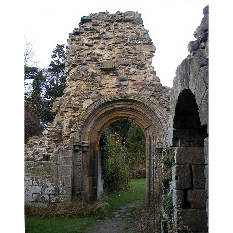
Image copyright © SMJ, 2008
CC-BY-SA-2.0
Results: 2 records
view of church exterior - detail
Scene Description: probably from the earlier time of the abbey, mid- to late-12thC?
Copyright Statement: Image copyright © SMJ, 2008
Image Source: digital photograph taken 16 November 2008 by SMJ [www.geograph.org.uk/photo/1047773] [accessed 13 September 2019]
Copyright Instructions: CC-BY-SA-2.0
view of church exterior
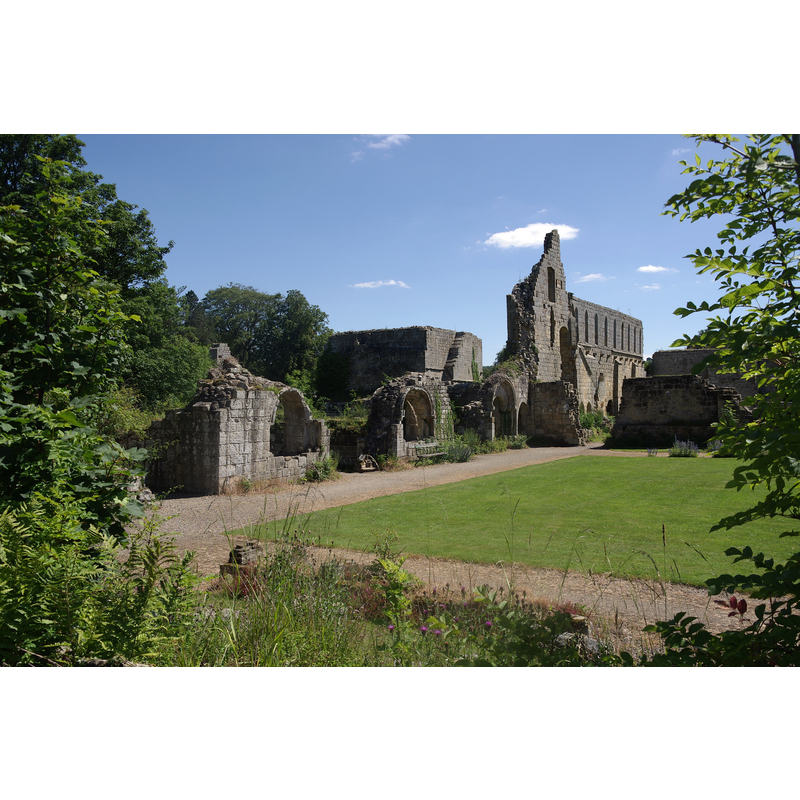
Copyright Statement: Image copyright © mattbuck [Matt Buck], 2011
Image Source: digital photograph taken 3 July 2011 by mattbuck [Matt Buck] [https://commons.wikimedia.org/wiki/File:Jervaulx_Abbey_MMB_15.jpg] [accessed 13 September 2019]
Copyright Instructions: CC-BY-SA-2.0 / CC-BY-SA-3.0
INFORMATION
Font ID: 22332JER
Object Type: Baptismal Font1?
Font Century and Period/Style: 12th century, Late Norman
Church / Chapel Name: Cistercian Abbey Church of St. Mary
Font Location in Church: [disappeared]
Church Patron Saint(s): St. Mary the Virgin
Church Address: Jervaulx, Ripon HG4 4PH, UK
Site Location: North Yorkshire, Yorkshire and the Humber, England, United Kingdom
Directions to Site: Located off (N) the A6108, on the S bank of the Ure river, 3 km E of East Witton, about 8-9 km WSW of Bedale
Historical Region: Richmondshire
Additional Comments: disappeared font? (the one from the abbey church here)
Font Notes:
Click to view
The entry for this abbey in the Victoria County History (York, vol. 3, 1974) notes that the original house "of wood was built in 1145", but this was in Fors, near Aysgarth, a place sixteen miles north of the final settlement, where, eventually, "the construction of the new abbey at Witton began" in 1156; "In 1268 [...] John, Duke of Britanny and Earl of Richmond, confirmed to the monks their abbey of Jervaulx, built in honour of the BIessed Mary [...] As a Cistercian house it was exempt from archiepiscopal visitation [...] The last abbot, Adam Sedbergh, joined the Pilgrimage of Grace, and suffered death by hanging at Tyburn in June 1537, [...]) when the-monastic property was forfeited to the king." The entry for the ruins of the abbey in Historic England [Listing NGR: SE1718385742] notes: "Ruins of Cistercian house moved to this site in 1156.Early English.Sandstone ashlar. Church of nave,transepts and choir,with cloister on south side of nave,flanked by chapter house to east,kitchen and dorter to south.Footings of church stand up to about one metre high,showing an aisled nave,transepts with eastern aisles and short choir with lady chapel".
COORDINATES
UTM: 30U 582188 6013957
Latitude & Longitude (Decimal): 54.266944, -1.738056
Latitude & Longitude (DMS): 54° 16′ 1″ N, 1° 44′ 17″ W
REFERENCES
- Victoria County History [online], University of London, 1993-. URL: https://www.british-history.ac.uk.