Hawnby / Halmebi / Haunneby
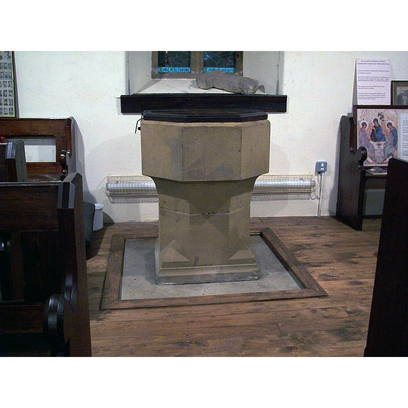
Image copyright © Maigheach-gheal, 2007
CC-BY-SA-2.0
Results: 3 records
view of font and cover
Scene Description: re-cut? / modern?
Copyright Statement: Image copyright © Maigheach-gheal, 2007
Image Source: digital photograph taken 12 July 2007 by Maigheach-gheal [www.geograph.org.uk/photo/495999] [accessed 5 September 2019]
Copyright Instructions: CC-BY-SA-2.0
view of church exterior - southeast view
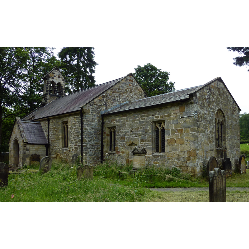
Copyright Statement: Image copyright © Wehha, 2012
Image Source: digital photograph taken 8 July 2012 by Wehha [https://commons.wikimedia.org/wiki/File:All_Saints_Church,_Hawnby,_Yorks..JPG] [accessed 5 September 2019]
Copyright Instructions: CC-BY-SA-3.0
view of church interior - looking east
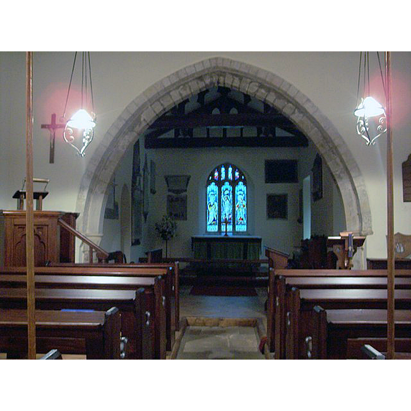
Scene Description: Source caption: "All Saints Church, Hawnby - Interior. All Saints has recently become a 'poetry shrine' - a place where poetry may be found and read, but also a place where poets may leave their work for others to see."
Copyright Statement: Image copyright © Maigheach-gheal, 2007
Image Source: digital photograph taken 12 July 2007 by Maigheach-gheal [www.geograph.org.uk/photo/496011] [accessed 5 September 2019]
Copyright Instructions: CC-BY-SA-2.0
INFORMATION
Font ID: 22321HAW
Object Type: Baptismal Font1
Font Century and Period/Style: Medieval? / Modern?
Church / Chapel Name: Parish Church of All Saints
Font Location in Church: Inside the church
Church Address: Front St, Hawnby, Ryedale, North Yorkshire, YO62, UK
Site Location: North Yorkshire, Yorkshire and the Humber, England, United Kingdom
Directions to Site: Located off (E) the A19, N of the A170, 11 km NW of Helmsley, 13-15 km NE of Thirsk
Ecclesiastic Region: Diocese of York
Historical Region: Hundred of Allerton
Additional Comments: altered font? / re-cut? [cf. FontNotes] or modern? / disappeared font? (the one from the 12thC church here, unless the present one is it but much altered?)
Font Notes:
Click to view
There are two entries for Hwnby [variant spelling] in the Domesday survey [https://opendomesday.org/place/SE5489/hawnby/] [accessed 5 September 2019] neither of which mentions cleric or church in it. The entry for this parish in the Victoria County History (York, vol. 2, 1923) notes: "The church was doubtless built in the 12th century, when it appears to have had a western tower and a narrower nave, as well as a small chancel. Probably the building suffered, like others in the neighbourhood, from the incursions of the Scots after Bannockburn and was left a ruin. In the rebuilding, which took place late in the 14th century, only the south walls of the nave and tower, which was not rebuilt, and perhaps part of the west wall of the latter, were retained on their old foundations, while the chancel was entirely reconstructed and the nave widened by moving the north wall outward. The church has continued in its present state since then, apart from the usual restorations, the most important of which was undertaken in 1874. [...] The font is octagonal, and from the staples in its top is apparently old but much recut." The entry for this church in Historic England [Listing NGR: SE5365189679] notes: "Church. Probably C12 fabric with C15 insertions and C19 restoration"; no font mentioned.
COORDINATES
UTM: 30U 618650 6018411
Latitude & Longitude (Decimal): 54.29979, -1.1767
Latitude & Longitude (DMS): 54° 17′ 59.24″ N, 1° 10′ 36.12″ W
REFERENCES
- Victoria County History [online], University of London, 1993-. URL: https://www.british-history.ac.uk.