Ada / Adá / Santa Baia de Adá
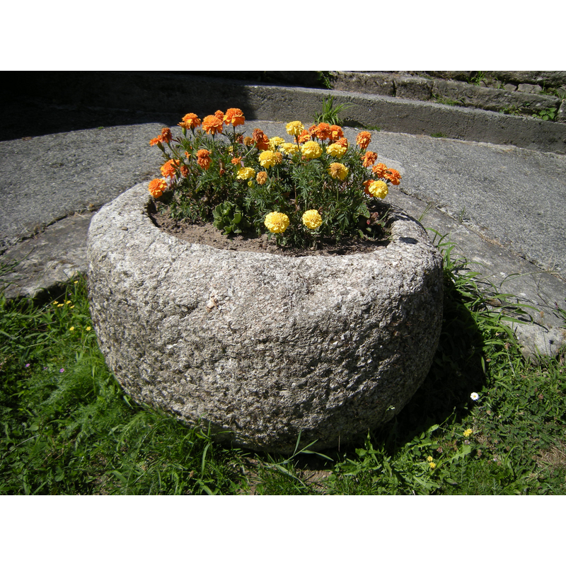
Image copyright © José Antonio Gil Martínez, 2010
CC-BY-2.0
Results: 2 records
view of basin
Scene Description: Source caption: "Iglesia de Santa Baia de Adá. Pila bautismal reutilizada como jardinera en el atrio de la iglesia."
Copyright Statement: Image copyright © José Antonio Gil Martínez, 2010
Image Source: digital photograph taken 7 August 2010 by José Antonio Gil Martínez [www.flickr.com/photos/freecat/5272977209/in/photostream/] [accessed 2 September 2019]
Copyright Instructions: CC-BY-2.0
view of church exterior in context - southwest view
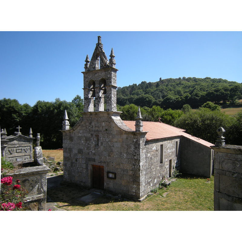
Scene Description: Source caption: "Iglesia de posible origen románico reedificada en el siglo XVI. Tan solo conserva de su primitiva fábrica dos canecillos en su cabecera."
Copyright Statement: Image copyright © José Antonio Gil Martínez, 2010
Image Source: digital photograph taken 7 August 2010 by José Antonio Gil Martínez [www.flickr.com/photos/freecat/5273585314/in/photostream/] [accessed 2 September 2019]
Copyright Instructions: CC-BY-2.0
INFORMATION
Font ID: 22313ADA
Object Type: Baptismal Font1, basin only?
Font Century and Period/Style: 12th - 13th century, Romanesque
Church / Chapel Name: Iglesia Parroquial de Santa Baia de Adá / Igrexa Parroquial de Santa Baia de Adá
Font Location in Church: Reported in the atrium of the church in 2010
Church Patron Saint(s): St. Baia
Church Address: Adá, 27511 Chantada, Lugo, Spain
Site Location: Lugo, Galicia, Spain, Europe
Directions to Site: Located off the LU-P- 6001, N of the CG-2-1, in the municipality and 10-12 km NW of Chantada
Historical Region: Comarca de Chantada
Additional Comments: disused font / re-cycled font (now used as planter in the atrium of the church)
Font Notes:
Click to view
A round basin said to be the baptismal font of the original Romanesque church here; the church was re-built in the 16th century. It is now located in the atrium of the church serving as planter.
COORDINATES
UTM: 29T 594264 4724201
Latitude & Longitude (Decimal): 42.664509, -7.849752
Latitude & Longitude (DMS): 42° 39′ 52.23″ N, 7° 50′ 59.11″ W
MEDIUM AND MEASUREMENTS
Material: stone, granite?
Font Shape: round
Basin Interior Shape: round
Basin Exterior Shape: round