Holme Cultram / Abbeytown / Holmcultram
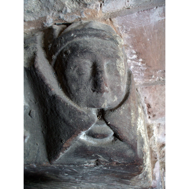
Image copyright © Matthew Hatton, 2014
CC-BY-SA-2.0
Results: 7 records
view of church exterior - porch - detail
Scene Description: Source caption: "Monastic carved head in Holme Cultram Abbey. A few fine pieces of carving are to be found inside the porch of St.Mary's Church in Abbeytown, the medieval remains of the Cistercian house of Holme Cultram Abbey."
Copyright Statement: Image copyright © Matthew Hatton, 2014
Image Source: digital photograph taken 23 May 2014 by Matthew Hatton [www.geograph.org.uk/photo/4004041] [accessed 16 August 2019]
Copyright Instructions: CC-BY-SA-2.0
view of church exterior - west portal
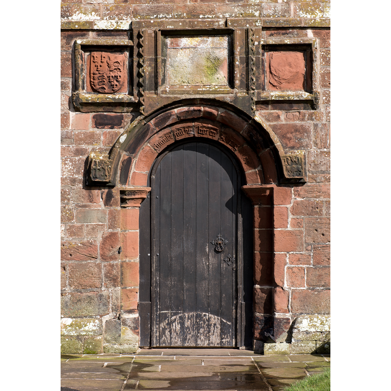
Copyright Statement: Image copyright © The Carlisle Kid, 2016
Image Source: digital photograph taken 27 March 2016 by The Carlisle Kid [www.geograph.org.uk/photo/4887805] [accessed 16 August 2019]
Copyright Instructions: CC-BY-SA-2.0
view of church exterior - northwest view
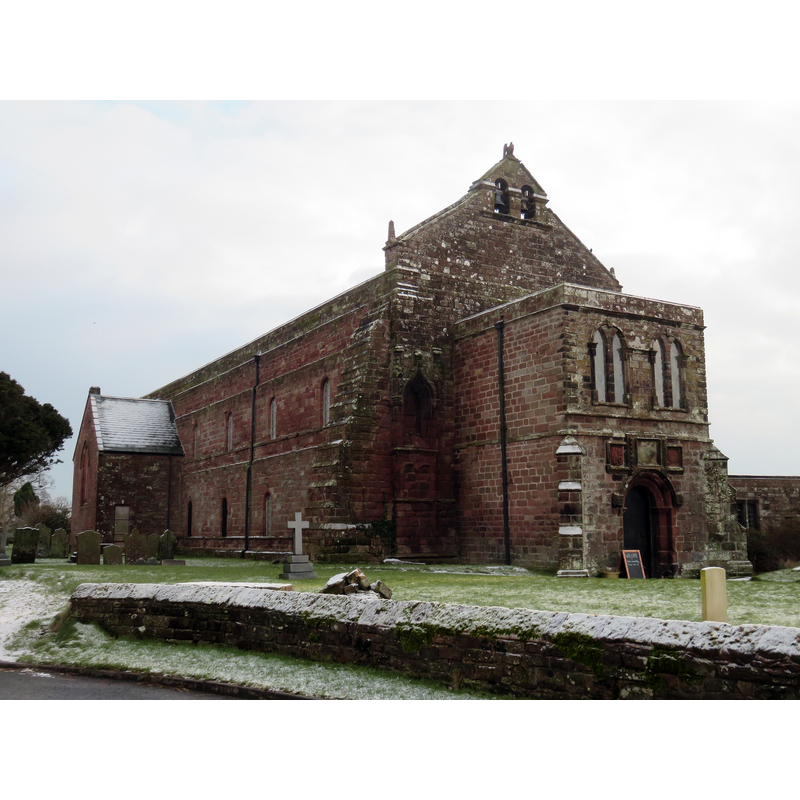
Scene Description: Source caption: "St Mary's Church, Abbeytown. The nave of the church of the former Cistercian Holmcultram Abbey now serves as the local parish church - a wonderful building now mainly restored after the church was set alight in an arson attack which totally devastated the roof of the building, parts of which had been in situ since it was erected 900 years ago."
Copyright Statement: Image copyright © Roger Rogerson, 2015
Image Source: digital photograph taken 21 January 2015 by Roger Rogerson [www.geograph.org.uk/photo/4363088] [accessed 16 August 2019]
Copyright Instructions: CC-BY-SA-2.0
view of church exterior - southwest view
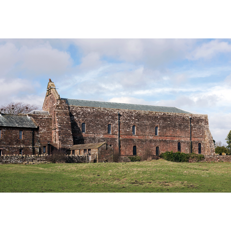
Copyright Statement: Image copyright © The Carlisle Kid, 2016
Image Source: digital photograph taken 27 March 2016 by The Carlisle Kid [www.geograph.org.uk/photo/4887874] [accessed 16 August 2019]
Copyright Instructions: CC-BY-SA-2.0
view of church exterior in context - south view
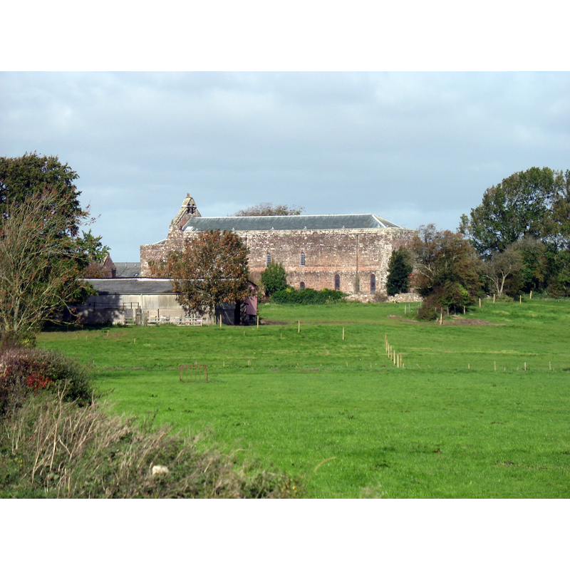
Scene Description: Source caption: "Holme Cultram Abbey/Parish Church of St Mary the Virgin. Built of stone from north of the Solway Firth, Holme Cultram Abbey was founded in 1150 by Cistercian Monks from Melrose."
Copyright Statement: Image copyright © David Purchase, 2018
Image Source: digital photograph taken 2 October 2018 by David Purchase [www.geograph.org.uk/photo/5937613] [accessed 16 August 2019]
Copyright Instructions: CC-BY-SA-2.0
view of church interior - looking west
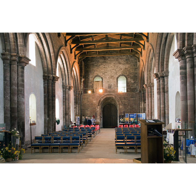
Copyright Statement: Image copyright © The Carlisle Kid, 2016
Image Source: digital photograph taken 27 March 2016 by The Carlisle Kid [www.geograph.org.uk/photo/4887831] [accessed 16 August 2019]
Copyright Instructions: CC-BY-SA-2.0
view of church interior - looking east
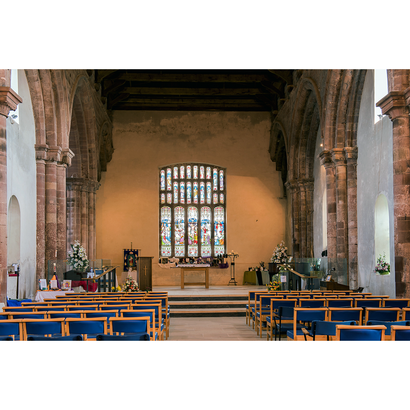
Copyright Statement: Image copyright © The Carlisle Kid, 2016
Image Source: digital photograph taken 27 March 2016 by The Carlisle Kid [www.geograph.org.uk/photo/4887866] [accessed 16 August 2019]
Copyright Instructions: CC-BY-SA-2.0
INFORMATION
Font ID: 22294HOL
Object Type: Baptismal Font1?
Font Date: ca. 1150?
Font Century and Period/Style: 12th century (mid?), Late Norman
Church / Chapel Name: Parish [former Cistercian Abbey] Church of St. Mary the Virgin
Font Location in Church: [cf. FontNotes]
Church Patron Saint(s): St. Mary the Virgin
Church Address: 68 Friars Garth, Holme Cultram, Abbeytown, Wigton CA7 4SD, UK
Site Location: Cumbria, North East, England, United Kingdom
Directions to Site: Located off the B5307, just E of the A5302 crossroads, 5-6 km SW of Newton Arlosh, 7-8 WNW of Wigton
Ecclesiastic Region: Diocese of Carlisle
Additional Comments: disappeared font? (the one from the original mid-12thC church here)
Font Notes:
Click to view
No individual entry found for either Holme Cultram of Abbeytown in the Domesday survey. A 14th-century(?) font from the abbey church here is said to have been transferred to Newton Arlosh [cf. BSI entry for the latter]. [NB: we have no information on the font of the original mid-12th century abbey church here.]
COORDINATES
UTM: 30U 481717 6077603
Latitude & Longitude (Decimal): 54.845201, -3.284722
Latitude & Longitude (DMS): 54° 50′ 42.73″ N, 3° 17′ 5″ W