Meole Brace / Brace Meole / Mela / Melam / Melesbracy / Meole / Mill / Mole
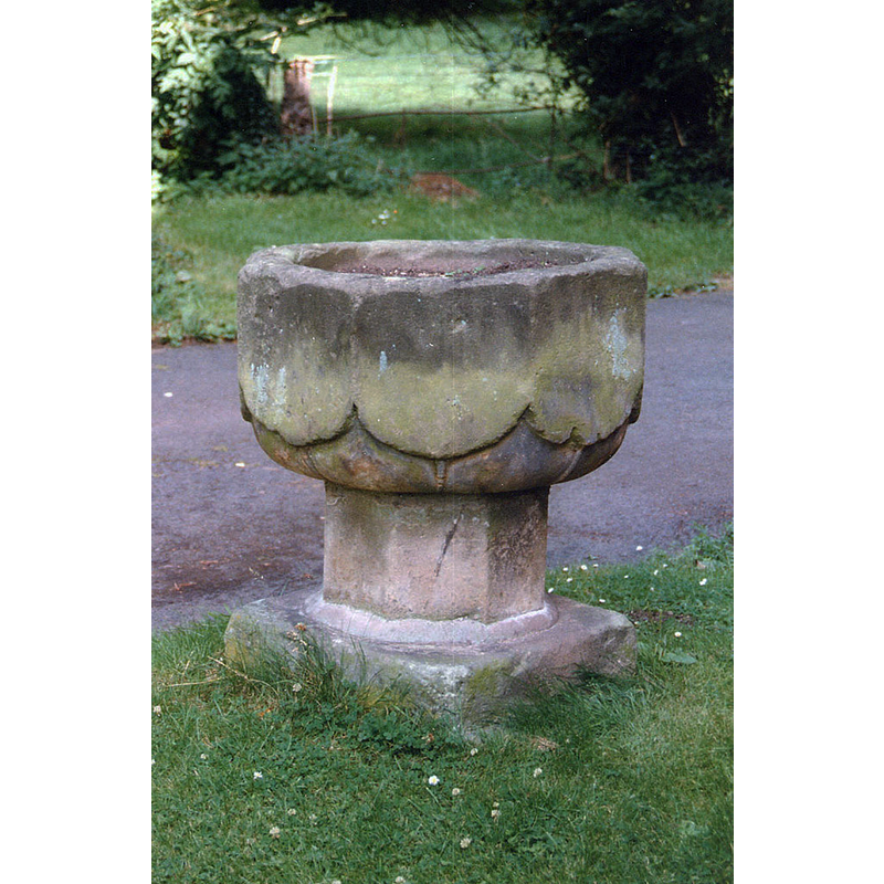
Image copyright © John Salmon, 2011
CC-BY-SA-2.0
Results: 5 records
view of font in context
Scene Description: Source caption: "Redundant font in churchyard"
Copyright Statement: Image copyright © John Salmon, 2011
Image Source: digital image of a photograph taken in August 1997 by John Salmon [www.geograph.org.uk/photo/2269912] [accessed 30 July 2019]
Copyright Instructions: CC-BY-SA-2.0
view of font and cover
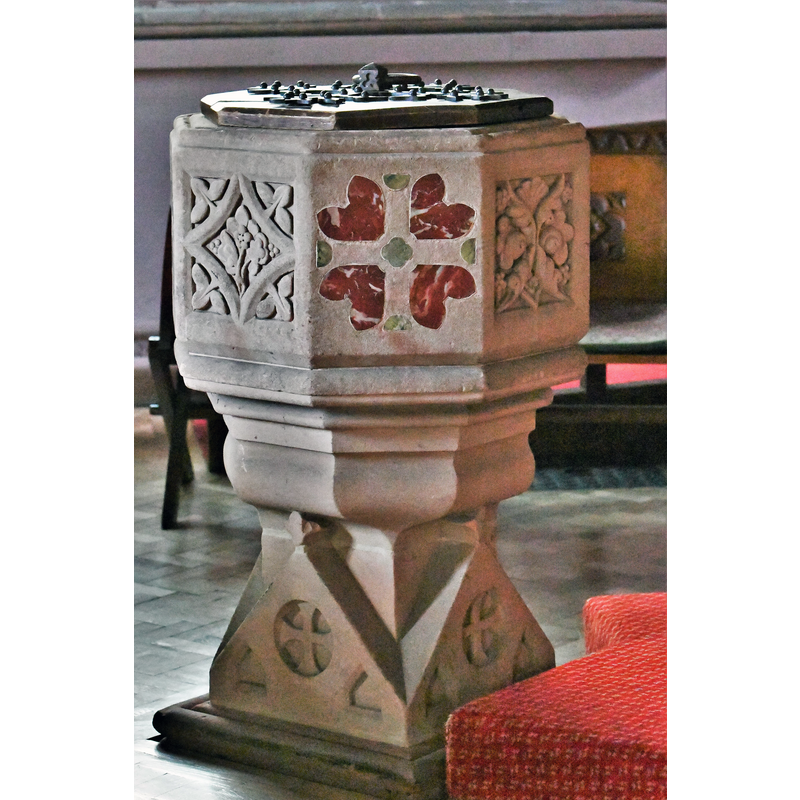
Scene Description: the modern font of the 19thC re-building
Copyright Statement: Image copyright © Michael Garlick, 2019
Image Source: digital photograph taken 30 April 2019 by Michael Garlick [www.geograph.org.uk/photo/6174826] [accessed 30 July 2019]
Copyright Instructions: CC-BY-SA-2.0
design element - motifs - panel - 8
Scene Description: shield-like
Copyright Statement: Image copyright © John Salmon, 2011
Image Source: digital image of a photograph taken in August 1997 by John Salmon [www.geograph.org.uk/photo/2269912] [accessed 30 July 2019]
Copyright Instructions: CC-BY-SA-2.0
view of church exterior - south view
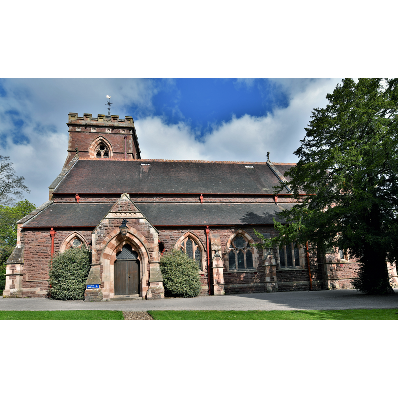
Copyright Statement: Image copyright © Michael Garlick, 2019
Image Source: digital photograph taken 30 April 2019 by Michael Garlick [www.geograph.org.uk/photo/6172808] [accessed 30 July 2019]
Copyright Instructions: CC-BY-SA-2.0
view of church interior - looking east
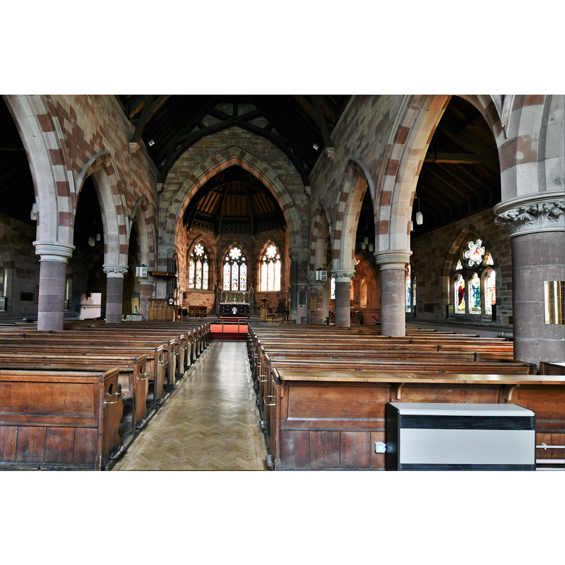
Copyright Statement: Image copyright © Michael Garlick, 2019
Image Source: digital photograph taken 30 April 2019 by Michael Garlick [www.geograph.org.uk/photo/6172817] [accessed 30 July 2019]
Copyright Instructions: CC-BY-SA-2.0
INFORMATION
Font ID: 22269MEO
Object Type: Baptismal Font1
Font Century and Period/Style: Late Medieval? / Modern?
Church / Chapel Name: Parish Church of the Holy Trinity
Font Location in Church: In the churchyard
Church Patron Saint(s): The Holy Trinity
Church Notes: present church is a 19thC re-building with exceptional William Morris and Burne-Jones stained glass
Church Address: Church Rd, Meole Brace, Shrewsbury SY3 9HF, UK -- Tel.: +44 743 242660 / +44 743 362399
Site Location: Shropshire, West Midlands, England, United Kingdom
Directions to Site: Located off the A5112-A5191-B4380 crossroads, now a SW suburb of Shrewsbury, about 3-4 km from the town centre
Ecclesiastic Region: Diocese of Lichfield [formerly in the Diocese of Hereford]
Historical Region: Hundred of Shrewsbury
Additional Comments: disused font? (the one in the churchyard) -- disappeared font? (the one from the 13thC church here)
Font Notes:
Click to view
There are two entries for Meole [Brace] [variant spelling] in the Domesday survey [https://opendomesday.org/place/SJ4810/meole-brace/] [accessed 30 July 2019] neither of which mentions cleric or church in it. The entry for the modern Holy Trinity Church at Meole Brace [Listing NGR: SJ4862010555] reports an "Octagonal font with alternate panels of marble inlay and raised foliate decoration" in it. The entry for this church in Trinity Churches [www.trinitychurches.org/about-us/history/] [accessed 30 July 2019] notes: "The current church building, Holy Trinity, is the fourth we know of on the site [...] The present Holy Trinity Church is a fine Grade II listed Victorian building [...] The second church was a plain stone building with a half timbered tower built in the thirteenth century. [...] the church was demolished in 1799. [...] The third church was ‘an ugly red-brick structure’ and just one bell was deemed sufficient for the puny tower. [...] The third church was basically “cheap and nasty” and survived less than seventy years. On April 30th1867 the foundation stone of the latest church was laid on the site of the old vicarage." There is an earlier font of stone in the churchyard, now disused; it consists of an octagonal basin with the panels shaped like blank shields, each with a thin moulding along the underbowl towards the back; on a plain octagonal pedestal base and a square lower base; the font appears late-medieval, although it could probably be of much later date; it is used as a planter in the churchyard.
COORDINATES
UTM: 30U 516154 5837836
Latitude & Longitude (Decimal): 52.6902, -2.761
Latitude & Longitude (DMS): 52° 41′ 24.72″ N, 2° 45′ 39.6″ W