Kirmington / Kermington
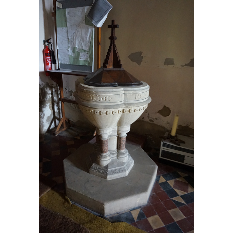
Image copyright © Ian S, 2017
CC-BY-SA-2.0
Results: 3 records
view of font and cover
Scene Description: the modern font in use
Copyright Statement: Image copyright © Ian S, 2017
Image Source: digital photograph taken 8 March 2017 by Ian S [www.geograph.org.uk/photo/5311413] [accessed 27 July 2019]
Copyright Instructions: CC-BY-SA-2.0
view of church exterior - southeast view
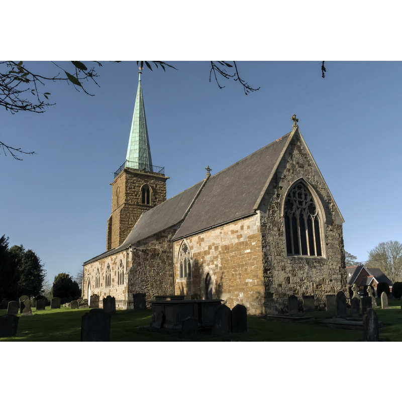
Scene Description: Source caption: "The church dates from the thirteenth century onwards with restorations and partial rebuilding in the nineteenth century. The church is built in ironstone and ashlar,(which is very weathered on the tower), as well as limestone and a slate roof. There is a western tower, four bay nave with north and south aisles, chancel, and vestry. The tower is of three stages and dates from the thirteenth century. At the top there are parapet railings and a hexagonal copper-covered spire which was added in 1838."
Copyright Statement: Image copyright © Julian P Guffogg, 2017
Image Source: digital photograph taken 23 November 2017 by Julian P Guffogg [www.geograph.org.uk/photo/5611484] [accessed 27 July 2019]
Copyright Instructions: CC-BY-SA-2.0
view of church interior - looking east
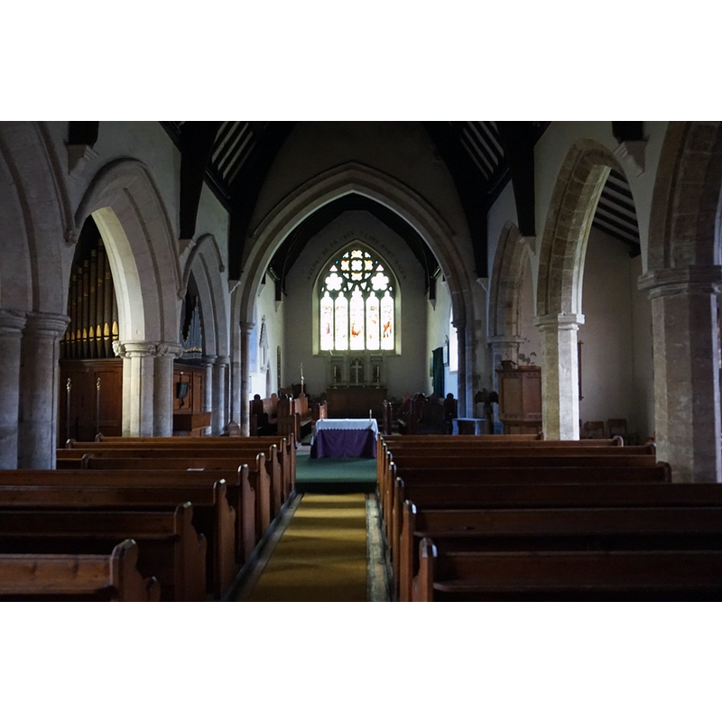
Copyright Statement: Image copyright © Ian S, 2017
Image Source: digital photograph taken 8 March 2017 by Ian S [www.geograph.org.uk/photo/5311416] [accessed 27 July 2019]
Copyright Instructions: CC-BY-SA-2.0
INFORMATION
Font ID: 22264KIR
Object Type: Baptismal Font1?
Font Century and Period/Style: 13th century, Early English
Church / Chapel Name: Parish Church of St. Helena [aka St. Helen's]
Font Location in Church: [disappeared]
Church Patron Saint(s): St. Helena
Church Address: Main St, Kirmington, Ulceby DN39 6YB, UK -- Tel.: +44 652 680414
Site Location: Lincolnshire, East Midlands, England, United Kingdom
Directions to Site: Located off (N) the A18, 2-3 km S of Ulceby, 8km W of Immingham 11-12 km N of Caistor, 19-20 km W of Grimsby
Ecclesiastic Region: Diocese of Lincoln
Historical Region: Wapentake of Yarborough
Additional Comments: disappeared font? (the one from the 13thC church here)
Font Notes:
Click to view
No individual entry found for Kirmington in the Domesday survey. The entry for this church in Historic England [Listing NGR: TA1061411296] notes: "Parish church. C13 tower, early C14 north arcade, later C14 south arcade. Spire erected 1838. Restorations of 1859-60 by S S Teulon [...] Ornate ashlar and marble font dated 1860."
COORDINATES
UTM: 30U 676663 5940796
Latitude & Longitude (Decimal): 53.5862, -0.331
Latitude & Longitude (DMS): 53° 35′ 10.32″ N, 0° 19′ 51.6″ W