Dunston nr. Stafford / Dunestone
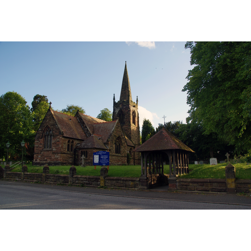
Image copyright © Bill Boaden, 2011
CC-BY-SA-2.0
Results: 1 records
view of church exterior in context
Copyright Statement: Image copyright © Bill Boaden, 2011
Image Source: digital photograph taken 22 May 2011 by Bill Boaden [www.geograph.org.uk/photo/2440779] [accessed 25 July 2019]
Copyright Instructions: CC-BY-SA-2.0
INFORMATION
Font ID: 22261DUN
Object Type: Baptismal Font1?
Font Century and Period/Style: 15th century (early?), Perpendicular
Church / Chapel Name: Parish Church of St. Leonard
Font Location in Church: [disappeared]
Church Patron Saint(s): St. Leonard
Church Address: Dunston, Stafford ST18 9AG, UK -- Tel.: +44 1785 715605
Site Location: Staffordshire, West Midlands, England, United Kingdom
Directions to Site: Located off (W) the A449, by junction 13 of the M6
Ecclesiastic Region: Diocese of Lichfield
Historical Region: Hundred of [East] Cuttlestone
Font Notes:
Click to view
There is an entry for this Dunston [variant spelling] in the Domesday survey [https://opendomesday.org/place/SJ9217/dunston/] [accessed 25 July 2019] but it mentions neither cleric nor church in it. The entry for this parish in the Victoria County History (Stafford, vol. 5, 1959) botes: "The chapel of St. Leonard at Dunston existed, evidently as a dependency of Penkridge church, by 1445 [...] The former chapel of ST. LEONARD was probably of early-15th-century date, rebuilt, except for the tower, in the 18th century. [...] Between 1876 and 1878 the chapel was demolished and a new church erected on the same site"; no font mentioned].
COORDINATES
UTM: 30U 560065 5845388
Latitude & Longitude (Decimal): 52.755, -2.11
Latitude & Longitude (DMS): 52° 45′ 18″ N, 2° 6′ 36″ W
REFERENCES
- Victoria County History [online], University of London, 1993-. URL: https://www.british-history.ac.uk.