West Keal / Cale / Westrecale
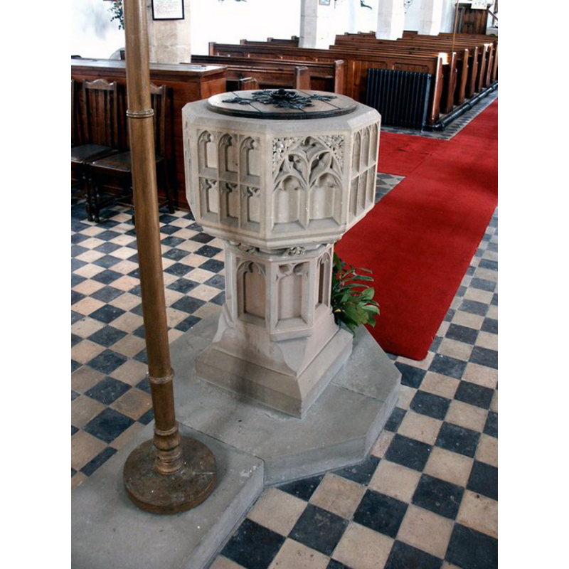
Image copyright © Dave Hitchborne, 2004
CC-BY-SA-2.0
Results: 5 records
view of font and cover
Scene Description: the modern font, probably installed in the G.E. Street renovation of the church
Copyright Statement: Image copyright © Dave Hitchborne, 2004
Image Source: digital photograph taken 9 April 2004 by Dave Hitchborne [www.geograph.org.uk/photo/567322] [accessed 23 July 2019]
Copyright Instructions: CC-BY-SA-2.0
view of church exterior in context - southwest view
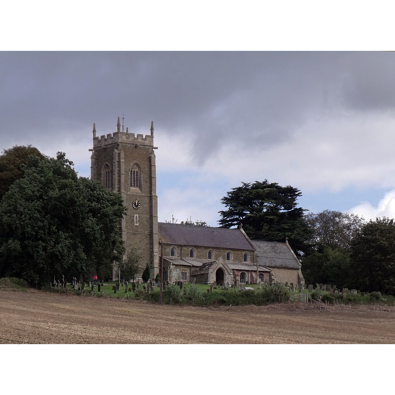
Scene Description: Source caption: "St Helen's Church, West Keal. 13th C onwards, chancel by G. E. Street 1867 and tower rebuilt 1881-4."
Copyright Statement: Image copyright © J. Hannan-Briggs, 2011
Image Source: digital photograph taken 11 September 2011 by J. Hannan-Briggs [www.geograph.org.uk/photo/2597565] [accessed 23 July 2019]
Copyright Instructions: CC-BY-SA-2.0
view of church interior - looking west
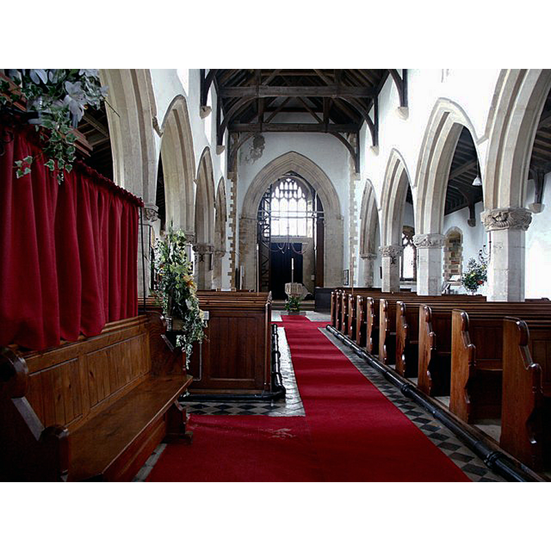
Scene Description: with the modern font at the far end, by the church tower
Copyright Statement: Image copyright © Dave Hitchborne, 2004
Image Source: digital photograph taken 9 April 2004 by Dave Hitchborne [www.geograph.org.uk/photo/567314] [accessed 23 July 2019]
Copyright Instructions: CC-BY-SA-2.0
view of church interior - looking east
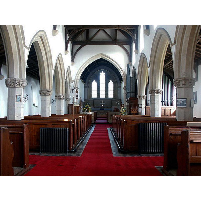
Copyright Statement: Image copyright © Dave Hitchborne, 2004
Image Source: digital photograph taken 9 April 2004 by Dave Hitchborne [www.geograph.org.uk/photo/567303] [accessed 23 July 2019]
Copyright Instructions: CC-BY-SA-2.0
view of object
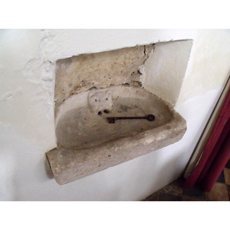
Scene Description: although captioned "Stoup, St Helen's Church. With animal's head in basin", it must be or have been a lavabo because it has a drain in the mouth of the beast
Copyright Statement: Image copyright © J. Hannan-Briggs, 2011
Image Source: digital photograph taken 11 September 2011 by J. Hannan-Briggs [www.geograph.org.uk/photo/2597583] [accessed 23 July 2019]
Copyright Instructions: CC-BY-SA-2.0
INFORMATION
Font ID: 22257KEA
Object Type: Baptismal Font1?
Font Century and Period/Style: 11th century, Pre-Conquest? / Norman
Church / Chapel Name: Parish Church of St. Helen
Font Location in Church: [disappeared]
Church Patron Saint(s): St. Helena
Church Address: Hall Ln, West Keal, Spilsby PE23 4BJ , UK -- Tel.: 01790 752526
Site Location: Lincolnshire, East Midlands, England, United Kingdom
Directions to Site: Located off (W) the A16 [aka Kill Hill]-A155 [aka Main Rd] crossroads, 5-6 km SW of Spilsby
Ecclesiastic Region: Diocese of Lincoln
Historical Region: Hundred of Bolingbroke
Additional Comments: disappeared font? (the one from the Domesday-time church here)
Font Notes:
Click to view
There are three entries for West Keal [variant spellings] in the Domesday survey [https://opendomesday.org/place/TF3663/west-keal/] [accessed 23 July 2019] one of which mentions a church in it. The entry for this church in Historic England [Listing NGR: TF3674963754] notes: "Parish church. C13, C14, C15, chancel by G. E. Street 1867, tower rebuilt 1881-4 [...] C19 octagonal font with traceried side panels."
COORDINATES
UTM: 31U 302317 5893416
Latitude & Longitude (Decimal): 53.15338, 0.0435
Latitude & Longitude (DMS): 53° 9′ 12.17″ N, 0° 2′ 36.6″ E