Pillaton nr. Penkridge
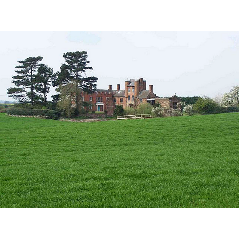
Image copyright © Geoff Pick, 2007
CC-BY-SA-2.0
Results: 1 records
view of context
Scene Description: Source caption: "View of Pillaton Old Hall, home of the Littleton family, near Penkridge, Staffordshire. The moated manor eventually became a ruin, but the gatehouse and chapel were restored in the 1880s by Lord Hatherton."
Copyright Statement: Image copyright © Geoff Pick, 2007
Image Source: digital photograph taken 12 April 2007 by Geoff Pick [www.geograph.org.uk/photo/398695] [accessed 18 July 2019]
Copyright Instructions: CC-BY-SA-2.0
INFORMATION
Font ID: 22251PIL
Object Type: Baptismal Font1
Font Century and Period/Style: 16th century(early?), Late Perpendicular
Church / Chapel Name: Pillaton Hall Chapel of St. Modwenna
Font Location in Church: Inside the chapel, W wall
Church Patron Saint(s): St. Modwenna [aka Modwen]
Church Address: Pillaton Hall, Penkridge, Stafford ST19 5RZ, UK
Site Location: Staffordshire, West Midlands, England, United Kingdom
Directions to Site: Pillaton is located off the B5012, about 1 km E of the M6, 2-3 km ESE of Penkridge. The chapel is located near Pillaton Hall Farm
Ecclesiastic Region: [Diocese of Lichfield]
Historical Region: Hundred of East Cuttlestone
Font Notes:
Click to view
No individual entry found for this Pillaton in the Domesday survey. The entry for the parish of Penkridge in the Victoria County History (Stafford, vol. 5, 1959) notes: "The small chapel of ST. MODWENA occupies the east end of the existing range of buildings at Pillaton Hall. Before the greater part of the Hall was demolished in the 18th century it formed the northeast corner of the quadrangular plan, abutting on the moat on two sides. The present building dates from the earlier 16th century, being contemporary with the rebuilding of the Hall at that period. [...] In 1888 it was thoroughly restored and reinstated for use as a chapel. [...] The stone font forms a projection in the middle of the west wall, its faces carved with trefoil-headed panels." The entry for Pillaton Old Hall, a scheduled monument in Historic England [List Entry Number: 1011061} reports: "East of the gatehouse is the stone-built chapel dedicated to St Modwena which was built c.1480. The chapel was restored in the 19th century. It remains in ecclesiastical use and is not included in the scheduling."
COORDINATES
UTM: 30U 561866 5840799
Latitude & Longitude (Decimal): 52.71355, -2.084184
Latitude & Longitude (DMS): 52° 42′ 48.78″ N, 2° 5′ 3.06″ W
REFERENCES
- Victoria County History [online], University of London, 1993-. URL: https://www.british-history.ac.uk.