Newcastle-under-Lyme No. 1 / Newcastle under Lyme
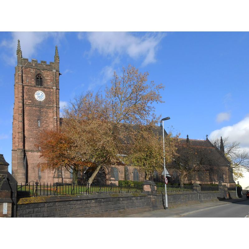
Image copyright © Rept0n1x, 2014
CC-BY-SA-2.0
Results: 1 records
view of church exterior - south view
Copyright Statement: Image copyright © Rept0n1x, 2014
Image Source: edited detail of a digital photograph taken 3 November 2014 by Rept0n1x [www.flickr.com/photos/121958154@N04/15517209639/] [accessed 16 July 2019]
Copyright Instructions: CC-BY-SA-2.0
INFORMATION
Font ID: 22245NEW
Object Type: Baptismal Font1
Font Century and Period/Style: 12th century (late?), Late Norman
Church / Chapel Name: Parish Church of St. Giles
Font Location in Church: [cf. FontNotes]
Church Patron Saint(s): St. Giles [aka Aegidus, Egidus, Gilles]
Church Address: Church St, Newcastle-under-Lyme ST5 1RA, UK
Site Location: Staffordshire, West Midlands, England, United Kingdom
Directions to Site: Newcastle-under-Lyme is located at the A34-A52-A525-A527 confluence, 4 km WNW of Stoke-on-Trent
[The Westlands is a SW suburb of Newcastle-under-Lyme, WNW of Stoke-on-Trent]
Ecclesiastic Region: Diocese of Lichfield
Historical Region: Hundred of Pirehill
Additional Comments: disappeared font? (the one from the late-12thC chapel here) -- moved font? (the font moved to nearby Westlands St Andrew's is probably the 18thC donation font reported in the VCH entry [cf. FontNotes])
Font Notes:
Click to view
No individual entry found for Newcastle-under-Lyme in the Domesday survey. The entry for this parish in the Victoria County History (Stafford, vol. 8, 1963) notes: "A chapel at Newcastle is first mentioned in an agreement made between 1175 and 1182 which terminated a long-standing dispute. [...] Newcastle remained a chapelry dependent on the church of Stoke until 1807 when a separate parish was constituted and a rectory established. [...] By 1872 [...] the church was dilapidated and no doubt inadequate to the needs of an enlarged population. It was, therefore, demolished except for the tower, and a new church, designed by Sir Gilbert Scott, was completed in 1876. [...] The marble font, surmounted by a detachable moulded and heraldic cover, and given to the old church in 1733 by Samuel Bagnall, has been superseded by a more elaborate modern one (fn. 142) presented by Joseph Griffith in 1899." The whereabouts of the old font is disclosed in a footnote in the VCH reference above: "Pape, Story of Parish Ch. of St. Giles, 12, 14. The cover of the old font is now (1959) in the Boro. Mus. The font itself is in St. Andrew's Church, Westlands: ex. inf. the rector".
COORDINATES
UTM: 30U 551701 5873856
Latitude & Longitude (Decimal): 53.01176, -2.2294
Latitude & Longitude (DMS): 53° 0′ 42.34″ N, 2° 13′ 45.84″ W
REFERENCES
- Victoria County History [online], University of London, 1993-. URL: https://www.british-history.ac.uk.