Crowle nr. Tetley / Caule
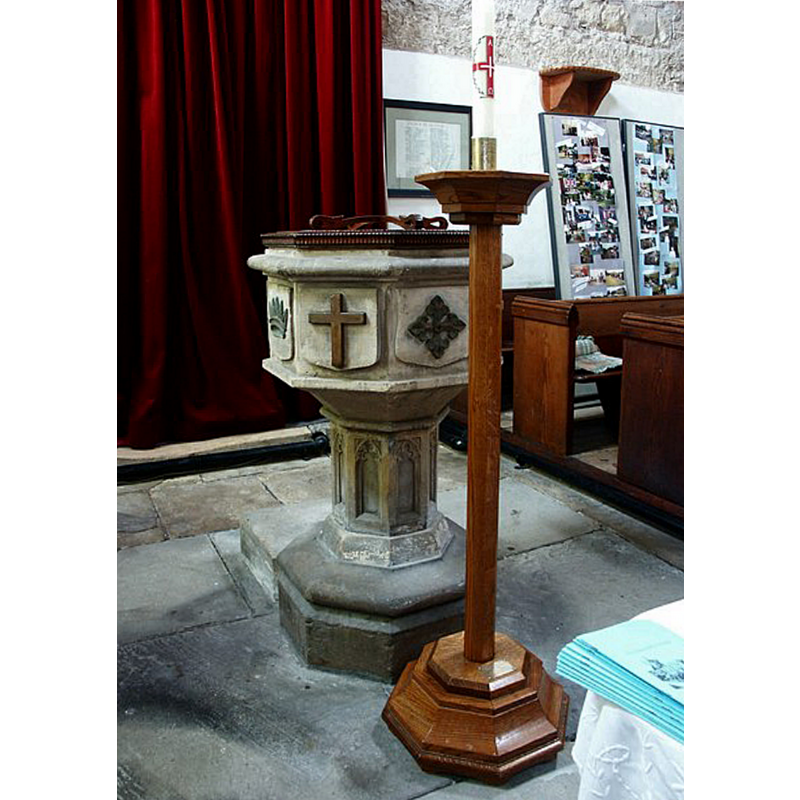
Image copyright © Dave Hitchborne, 2007
CC-BY-SA-2.0
Results: 8 records
view of font and cover
Scene Description: the modern font in use in this church
Copyright Statement: Image copyright © Dave Hitchborne, 2007
Image Source: digital photograph taken 23 July 2004 by Dave Hitchborne [www.geograph.org.uk/photo/430411] [accessed 14 July 2019]
Copyright Instructions: CC-BY-SA-2.0
view of church exterior - south portal - detail
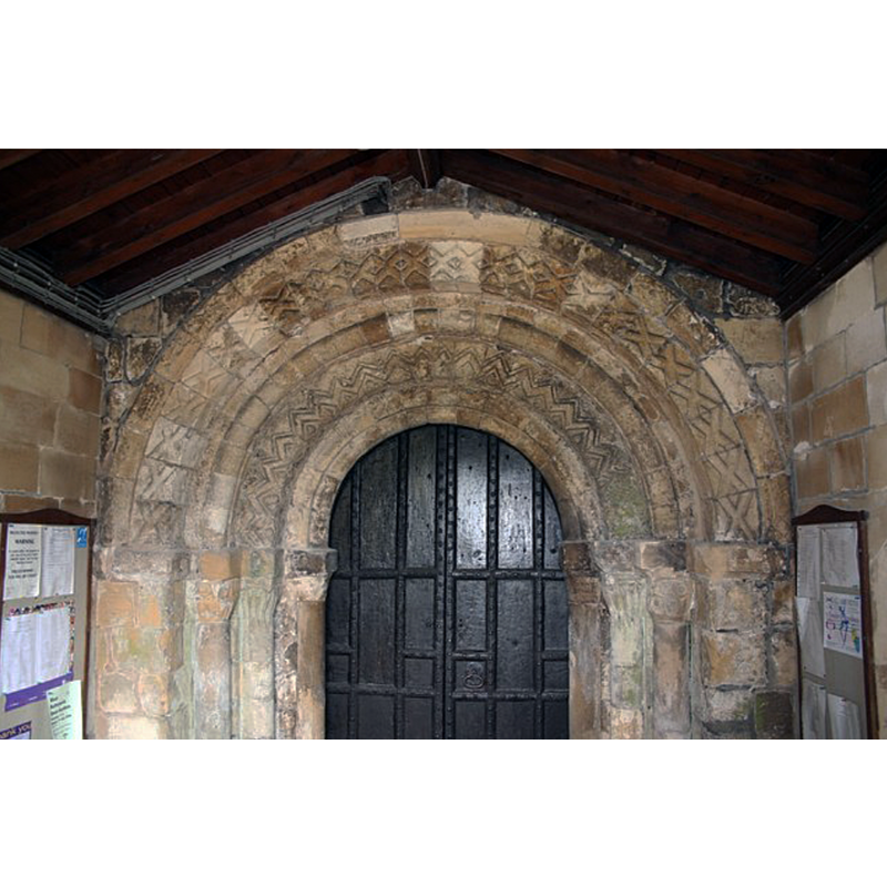
Scene Description: Source caption: "Norman doorway to St.Oswald's church"
Copyright Statement: Image copyright © Richard Croft, 2006
Image Source: digital photograph taken 13 June 2006 by Richard Croft [www.geograph.org.uk/photo/185915] [accessed 14 July 2019]
Copyright Instructions: CC-BY-SA-2.0
view of church exterior - south portal
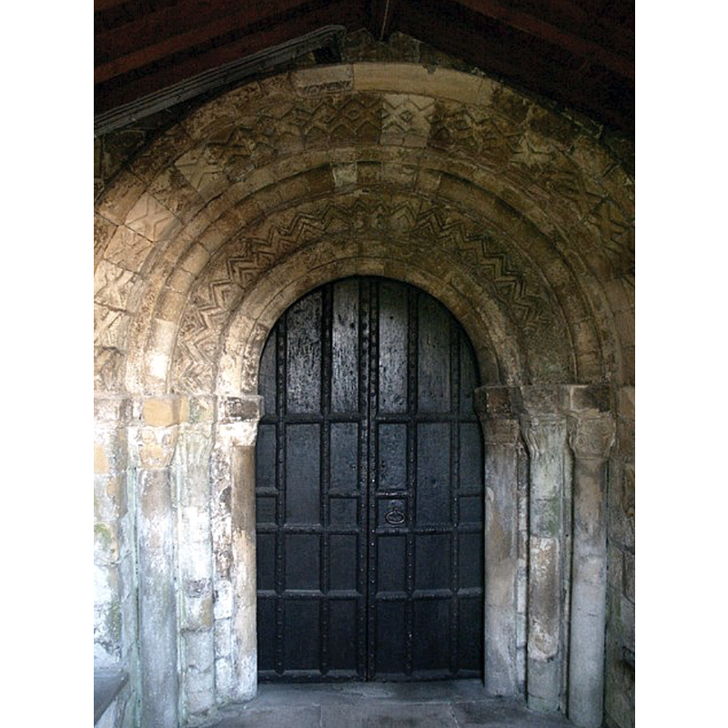
Copyright Statement: Image copyright © Dave Hitchborne, 2007
Image Source: digital photograph taken 23 July 2004 by Dave Hitchborne [www.geograph.org.uk/photo/430408] [accessed 14 July 2019]
Copyright Instructions: CC-BY-SA-2.0
view of church exterior - southeast view
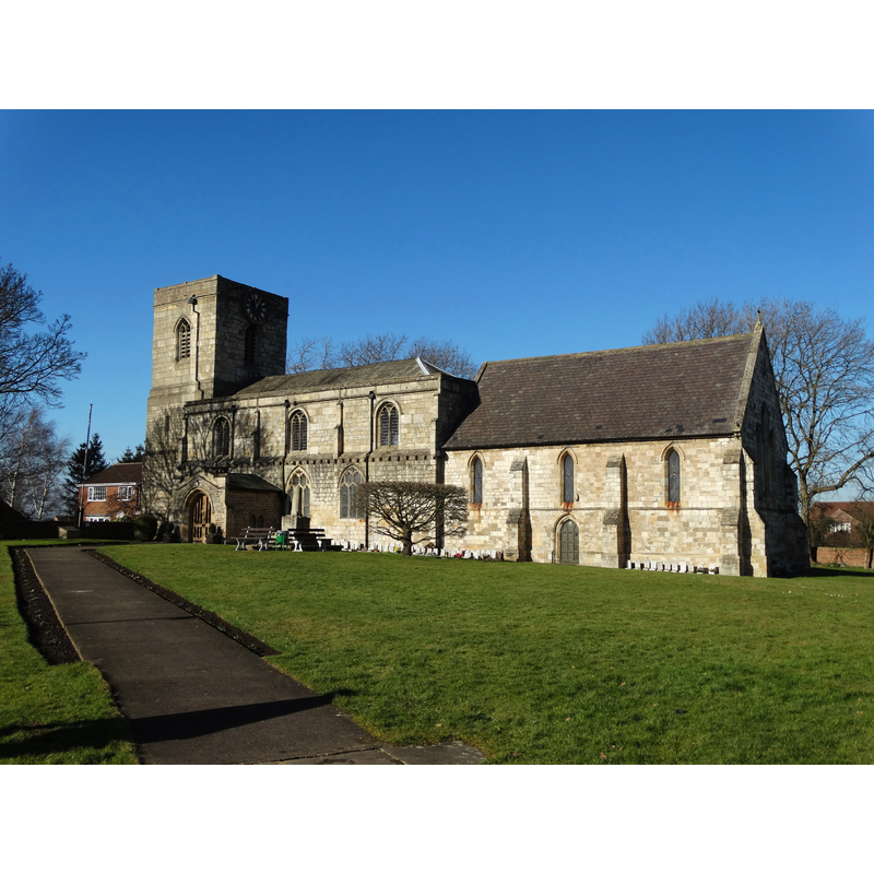
Scene Description: Source caption: "St Oswald's grew and changed with the passing centuries but at its heart there are distinct Saxo-Norman elements."
Copyright Statement: Image copyright © Neil Theasby, 2015
Image Source: digital photograph taken 17 February 2015 by Neil Theasby [www.geograph.org.uk/photo/4352793] [accessed 14 July 2019]
Copyright Instructions: CC-BY-SA-2.0
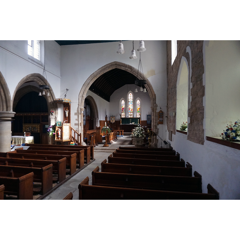
view of church interior - west end
Copyright Statement: Image copyright © Ian S, 2018
Image Source: digital photograph taken 3 October 2018 by Ian S [www.geograph.org.uk/photo/5945500] [accessed 14 July 2019]
Copyright Instructions: CC-BY-SA-2.0
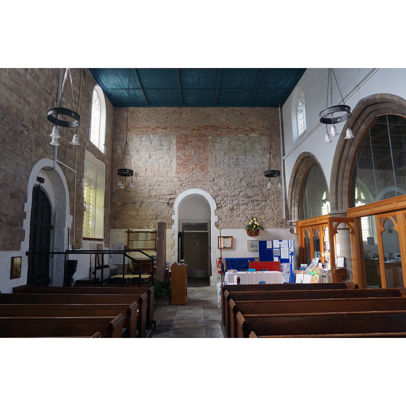
view of church interior - looking west
Scene Description: Source caption: "Interior of St Oswald, Crowle. The nave, looking from the chancel. The north arcade and aisle, to the right."
Copyright Statement: Image copyright © Dave Hitchborne, 2007
Image Source: digital photograph taken 23 July 2004 by Dave Hitchborne [www.geograph.org.uk/photo/430444] [accessed 14 July 2019]
Copyright Instructions: CC-BY-SA-2.0
view of church interior - tower arch
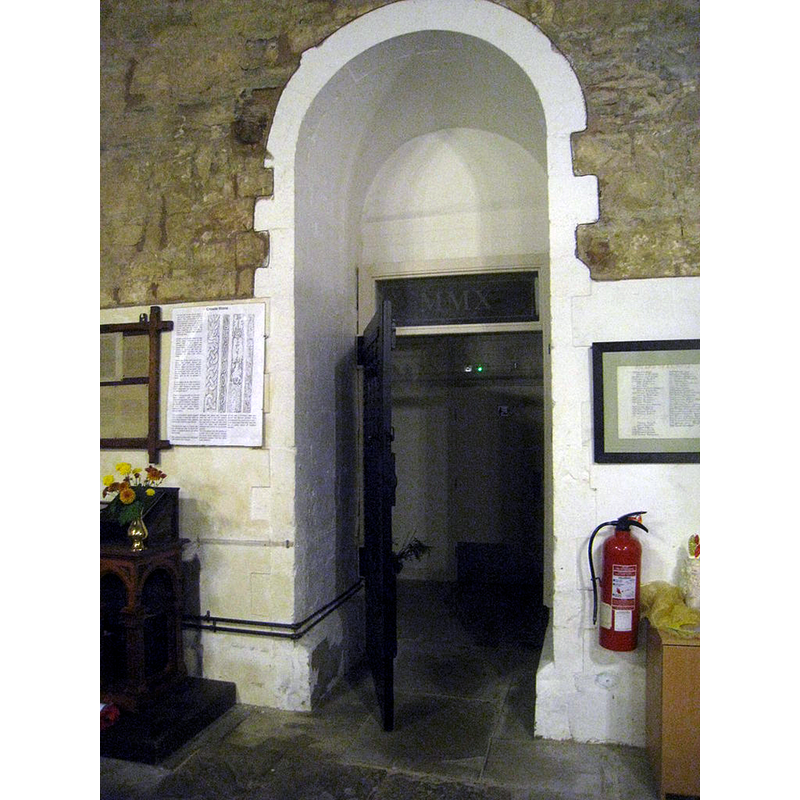
Scene Description: Source caption: "St. Oswald, Crowle - tower arch. Dates from the early Norman period."
Copyright Statement: Image copyright © Jonathan Thacker, 2013
Image Source: digital photograph taken 16 October 2013 by Jonathan Thacker [www.geograph.org.uk/photo/3702845] [accessed 14 July 2019]
Copyright Instructions: CC-BY-SA-2.0
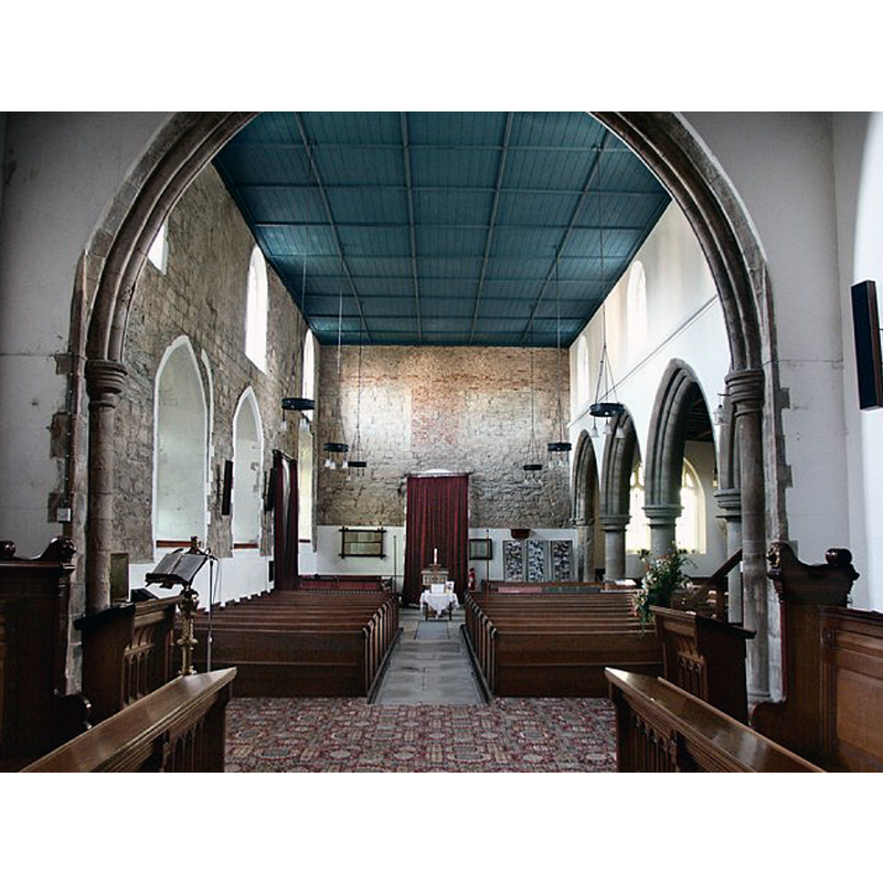
view of church interior - looking east
Scene Description: the modern font is visible at the southeast end of the nave, by the east side of the chancel arch
Copyright Statement: Image copyright © Ian S, 2018
Image Source: digital photograph taken 3 October 2018 by Ian S [www.geograph.org.uk/photo/5944684] [accessed 14 July 2019]
Copyright Instructions: CC-BY-SA-2.0
INFORMATION
Font ID: 22241CRO
Object Type: Baptismal Font1?
Font Century and Period/Style: 11th century, Pre-Conquest? / Norman
Church / Chapel Name: Parish Church of St. Oswald
Font Location in Church: [disappeared]
Church Patron Saint(s): St. Oswald of Nothumbria
Church Address: 3 Church St, Crowle, Scunthorpe DN17 4LF, UK -- Tel.: +44 1724 710900
Site Location: Lincolnshire, East Midlands, England, United Kingdom
Directions to Site: Located off (W) the A161 [aka Wharf Rd], 2 km NNW of Tetley, 7-8 km WNW of Scunthorpe
Ecclesiastic Region: Diocese of Lincoln
Historical Region: Hundred of Epworth
Additional Comments: disappeared font? (the one from the Domesday-time church here)
Font Notes:
Click to view
There is an entry for this Crowle [variant spelling] in the Domesday survey [https://opendomesday.org/place/SE7713/crowle/] [accessed 14 July 2019]; it reports a church in it. The entry for this church in Historic England [Listing NGR: SE7715612984] notes: "Parish church. C12 nave south and west walls and doorway, chancel north wall; C13 chancel arch, lower section of tower, and responds and portions of outer arches of north arcade; C14-C15 nave south windows; C15 north aisle, clerestory and upper stage of tower; C15-C16 arch to north chapel. Nave re- roofed 1785, north aisle taken down 1792. Chancel partially rebuilt 1856; restorations of 1884 [...] C19 carved octagonal font".
COORDINATES
UTM: 30U 643203 5942039
Latitude & Longitude (Decimal): 53.60757, -0.8355
Latitude & Longitude (DMS): 53° 36′ 27.25″ N, 0° 50′ 7.8″ W