Ranton No. 2 / Rantone / Rantun
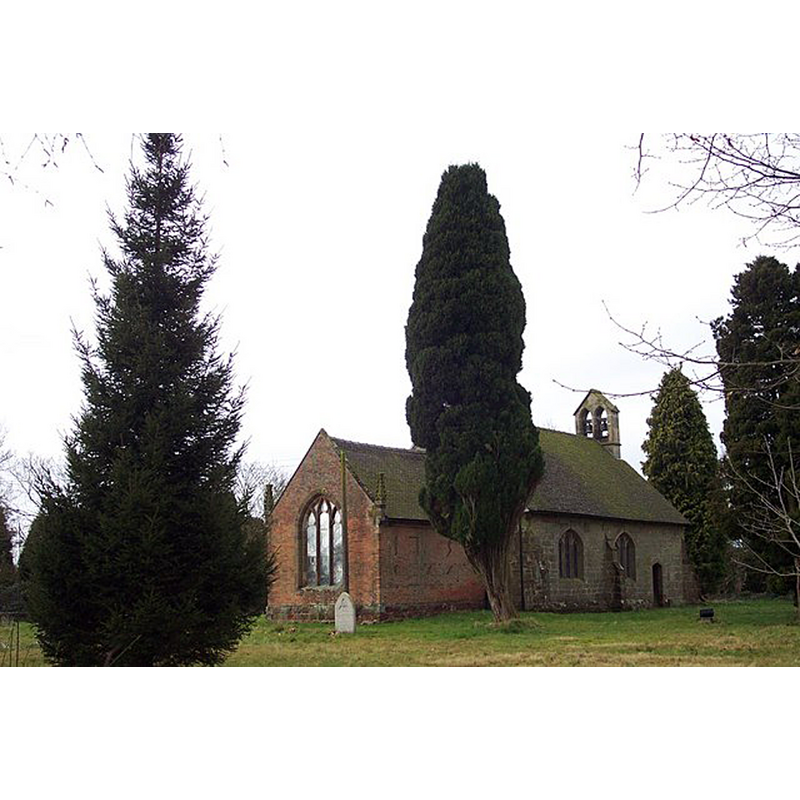
Image copyright © Geoff Pick, 2006
CC-BY-SA-2.0
Results: 2 records
view of church exterior - northeast view
Scene Description: Source caption: "All Saints, Ranton. The brick wall has the date 1753 laid out in darker brick."
Copyright Statement: Image copyright © Geoff Pick, 2006
Image Source: digital photograph taken 25 March 2006 by Geoff Pick [www.geograph.org.uk/photo/142244] [accessed 12 July 2019]
Copyright Instructions: CC-BY-SA-2.0
view of church exterior - southeast view
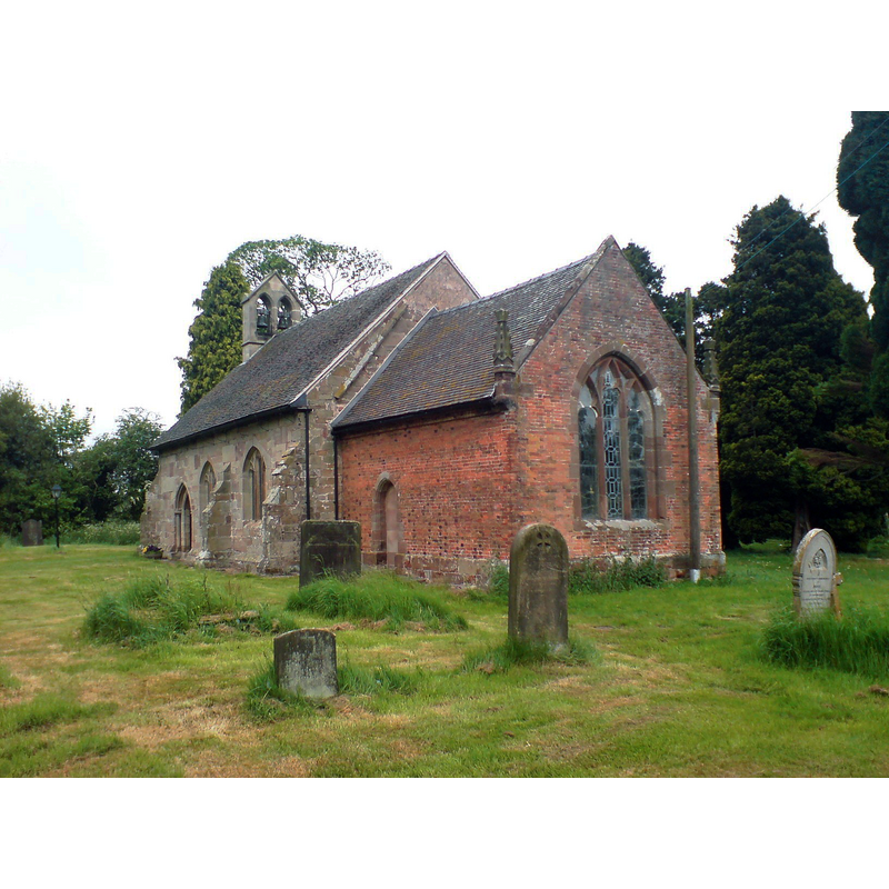
Copyright Statement: Image copyright © [in the public domain]
Image Source: digital photograph taken 20 May 2008 by Peter Morrell [https://commons.wikimedia.org/wiki/File:Ranton_church.JPG] [accessed 12 July 2019]
Copyright Instructions: PD-user
INFORMATION
Font ID: 22234RAN
Object Type: Baptismal Font1
Font Century and Period/Style: 13th century [basin only] [composite font], Medieval [composite]
Church / Chapel Name: Parish Church of All Saints
Font Location in Church: Inside the church
Church Patron Saint(s): All Saints
Church Notes: 13thC church; modified mid-18thC
Church Address: Brook Ln, Ranton, Stafford ST18 9PQ, UK -- Tel.: (01785) 282829
Site Location: Staffordshire, West Midlands, England, United Kingdom
Directions to Site: Located off (S) the B5405, 6-7 km WNW of Stafford
Ecclesiastic Region: Diocese of Lichfield
Historical Region: Hundred of Pirehill
Additional Comments: altered font (only the basin is original of the 13thC church here)
Font Notes:
Click to view
There is an entry for Ranton [variant spelling] in the Domesday survey [https://opendomesday.org/place/SJ8524/ranton/] [accessed 12 July 2019] but it mentions neither cleric nor church in it. The entry for this church in Historic England [Listing NGR: SJ8550324250] notes: "A small towerless C15 fabric. Restored 1841 and the chancel encased in brick. East window and lateral windows of nave C15 Interior scraped and roofs modern. Font bowl C13."
COORDINATES
UTM: 30U 552566 5852310
Latitude & Longitude (Decimal): 52.818, -2.22
Latitude & Longitude (DMS): 52° 49′ 4.8″ N, 2° 13′ 12″ W
MEDIUM AND MEASUREMENTS
Material: stone